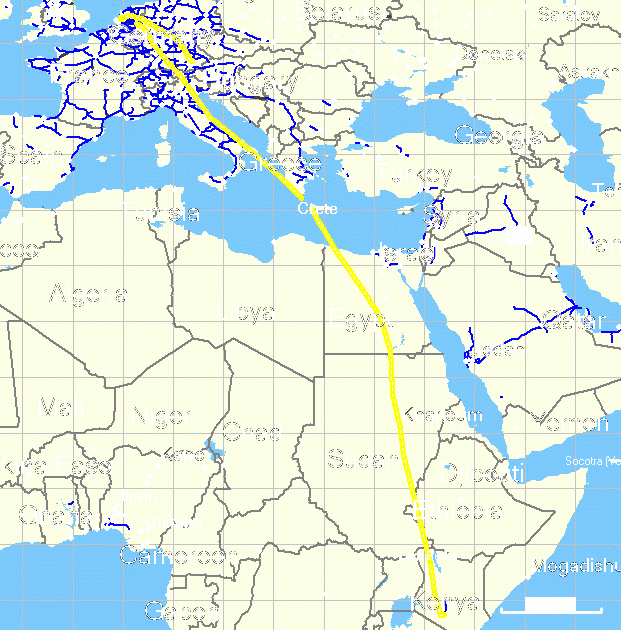
Flight Munich - Amsterdam - Nairobi
Private homepage – Hans-Georg Michna
Kenya travel reports: 1999, 2000, 2002, 2003, 2004, 2005, 2006, 2007, 2008, 2009, 2010, 2011, 2012, 2013-Goma, 2013, 2014, 2015, 2016, 2017, 2018, 2019
Kenya Safari Travel Plan, Kenya 1980-2000 photos
Kenya 2008
A personal travel report from Kenya in May 2008
Last change 2008-07-20 Copyright 2008-2023 Hans-Georg Michna
Click on the small pictures to see them enlarged, usually to 800 x 600 pixels.
Times are given in local Kenyan time in 24h format (without "am" or "pm"), i.e. 0:00 to 23:59 o'clock.
A few readers had the problem that after clicking on a picture, then going back to the main page, all thumbnail pictures were reloaded. This is typically caused by Internet Explorer cache corruption. It can often be repaired by going to the Internet options and deleting the temporary Internet files.
All photos are subject to copyright . If you want to reuse any photo, send me an email asking for permission, and I can send you the full-size photo, usually 1,600 x 1,200 pixels. Photos bear the copyright 2008-2023 Hans-Georg Michna.
EXIF times in the pictures are UTC; add 3 hours to get Kenya time.
[Still the same cameramy Panasonic Lumix DMC-FZ1-2 digital camera. Most photographs in this travel report are reduced to 800 x 600 pixels and JPEG-compressed with medium strength to make them more palatable for the web.]
| Departure | Arrival | Flight | Status |
|---|---|---|---|
| 06:50 Sun 11 May, Munich | 08:25 Sun 11 May, Amsterdam | KL 1790 | Flown |
| 10:15 Sun 11 May, Amsterdam | 19:35 Sun 11 May, Nairobi | KQ 0119 | Flown |
| 08:15 Sun 31 May, Nairobi | 16:20 Sun 31 May, Amsterdam | KQ 0116 | Flown |
| 21:00 Sun 31 May, Amsterdam | 22:25 Sun 31 May, Munich | KL 1801 | Flown |
My travelling checklist in michna.com/kenya.htm#Preparations (German version michna.com/kenia.htm#Reisevorbereitungen) is, as always, my means of packing without fear of forgetting anything important.
I used to have a fairly large travel bag, but last year it didn't withstand the load, and the shoulder strap attachment more or less tore off. KLM nicely let me choose a new bag from one of the big mail order shops, but there was none as big as my old one. I decided to use two smaller ones instead, which may be a better choice for more than one reason. I later found that, with my new, more spacious computer bag that I take as hand luggage, I could get everything else into the one new travel bag, mainly because I didn't take camping gear with me this time. There's just not enough time and opportunity to camp out, and it isn't worth the trouble to carry camping gear for just one or two nights out.
I just had it confirmed that KLM and Kenya Airways on their flights to Nairobi currently allow two pieces of baggage of up to 23 kg each, which allowed me to put my travel bag and at least one plastic bag with clothes and other gifts into a large sea bag and take a fairly big suitcase with used clothes along as well.
This time I will get my little off-road vehicle, the Suzuki Maruti Gypsy, only on Monday morning, so I'll have to take a taxi to the Aero Club of East Africa, my home in Nairobi. This makes no difference in time, so it may be a good solution anyway, except for the cost of the taxi, but the Nairobi taxis aren't as expensive as those in, say, Zurich, so it's not too bad. I miss the feeling a bit of climbing into the car at the airport at night and driving to the club while taking in the first impressions. But I'll have enough driving to do later. And I hope that chatting with the taxi driver will make up for it.
The flight via Amsterdam with KLM and Kenya Airways was perfect. I watched three movies on their on-board entertainment system (two of which were rather bad, and one, "Jumper", at least bearable). The food was fine, and I had the GPS on all the time at the window to record the flight path.
Flight Munich - Amsterdam - Nairobi
This time I also had the visa application form already prepared, I knew the non-obvious way to another visa counter, so the procedure took only minutes. Although I was the last to leave the plane, I was among the first few at the luggage belt. It helps to know one's way.
My two pieces of luggage arrived quickly, the customs officer asked me whether I had anything to declare, to which I replied, "no", and he said "goodbye." The Barclays ATM at the bank counter just outside the customs area worked and provided me with KSh40,000 (sounds like a lot, but is only about 400) through my Maestro card, I hopped into the first taxi, and off we went into the night.
The taxi driver was nice, gave me some useful information on the situation in Kenya, and I had to give the standard explanations about how a GPS works. The taxi driver was technically conversant and asked good questions. He wanted to know who provides the signals (the American military through its GPS satellites), whether one has to pay for the service (no), whether the GPS device also sends out information (most don't), whether it can keep tracking while switched off (no), how many tracks it can store (a couple of days worth), etc.
Soon we arrived at the Aero Club of East Africa, where I immediately met and chatted with one of my flight instructors, had a drink at the bar, and collected my room key (no. 3 in the old wing).
The only thing that didn't work instantly was the Internet connection. There are two WiFi networks on the compound, but the operators sometimes change the key or the settings, and the night receptionist didn't know. This is why you couldn't read this on the same evening.
The morning passed with collecting the car, planning a checkout flight for tomorrow, and trying to fix the WiFi problem, which turned out to be a Windows problem after all. I have fixed it now and have uploaded this page through the WiFi connection at the Aero Club.
Sajid Rasul in person, Rasul's junior boss, collected me from the Aero Club and took me to Rasul's office to hand over the off-road car, the usual Suzuki Maruti Gypsy, the same one I have already driven several times. Road traffic rules in Kenya have been tightened and now require a fire extinguisher and a warning sign.
I learned a new route across southern Nairobi that avoids the central Uhuru Highway traffic and uses a bridge that crosses over the Mombasa Road. Have already put the bridge into the GPS, because it can be a big time saver when driving from the west of Nairobi (like Wilson Airport) out to the south (like Mombasa or Namanga Amboseli), even when not crossing that bridge.
In the late afternoon I had a technical success that will probably take this web page a big step closer to real-time. I bought a local (Safaricom) SIM card for my Nokia 6230 do-everything smartphone and set up the computer to dial a GPRS/EDGE Internet connection through it.
This worked very easily, after a bit of searching for the settings. I didn't even have to ask Safaricom; it just worked. Now I imagine myself sitting on one of the hills somewhere beyond the faraway Samburu River in the sunset, looking at the wild animals and writing this travel report onto the web server.
Settings for Safaricom GPRS/EDGE
Number to dial: *99#
Username: saf
Password: data
Dial-in server protocol: PPP
I sent an empty SMS to 4777, as one web page recommended, but am not sure whether that was necessary or had any effect. If you get an Internet connection without this, please let me know.
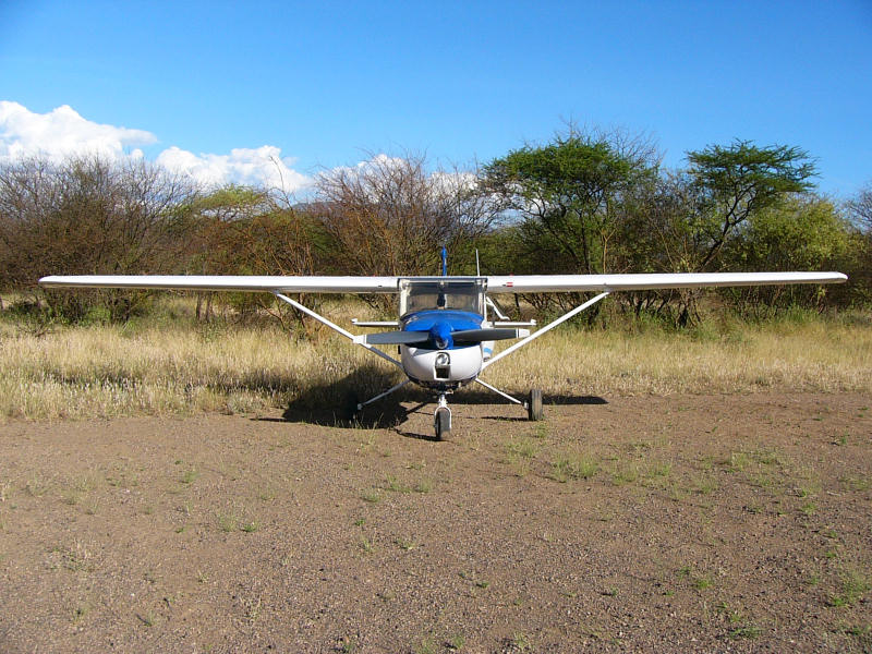
Today I did a test flight with a flying instructor, a routine procedure when flying a type of aircraft that one hasn't flown in a while, in this case the light two-seater Cessna 150 Aerobat, an aerobatics plane, as the name says. It is an elegant, light, beautiful, dragonfly-like plane that can barely carry two people when the tanks are not full.
We promptly did simulated stall-spin-accidents, and the full belt safety harness became useful. In these training episodes I take the plane into a situation where it cannot fly, like climbing up steeply until it stalls. Aeroplanes behave strangely, when that happens. Usually one wing drops very suddenly, and if I don't take corrective action, which is a partly counter-intuitive control input combination, the plane can go into a spin, from which recovery can be more difficult.
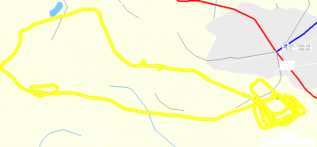
Training flight
In the GPS recording of the flight path you can see two steep turns, one left, one right, and one simulated emergency landing. After that I flew six circuits at Wilson Airport, some on the other runway for crosswind landings. They also included a simulated engine-out landing, a flapless landing, a short-field landing, and a low-level (simulated low cloud) circuit. The end result was that I was signed off on the aircraft type and can now fly it on my own, which I plan to do tomorrow.
After the flight I drove to the small Langata Link business park to visit the Amboseli Trust for Elephants office to look at certain computer problems and also to have lunch in their nice little open-air restaurant. They offered, among other nice things, big glasses of pure, fresh mango juice for a price unheard of back home in Germany.
Today I flew into and along the Rift Valley and took some photos. I also wanted to visit a new lodge, named Shompole. These are the GPS records:
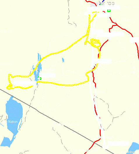
Flight to Namanga (black on white); flight to Shompole (black on yellow)
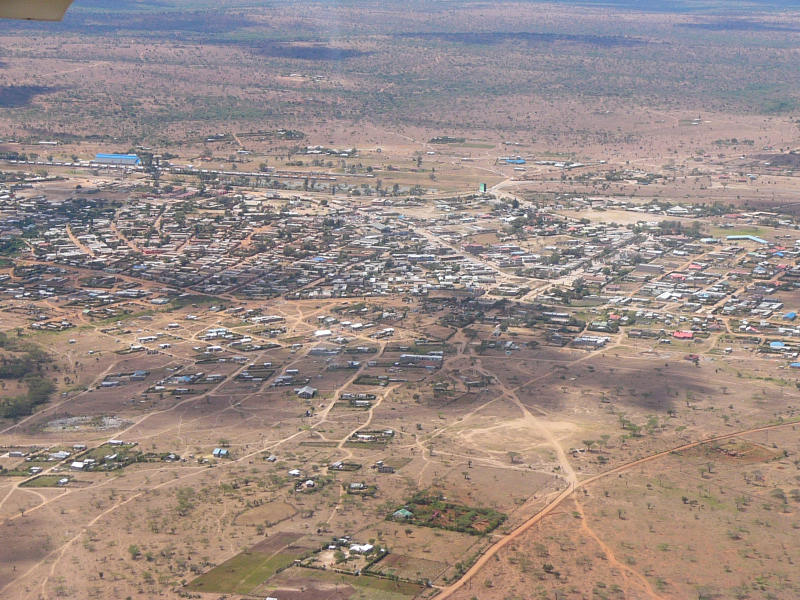
Selected aerial photos:
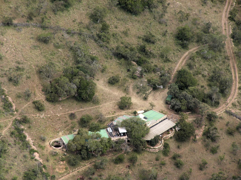
The house of a friend
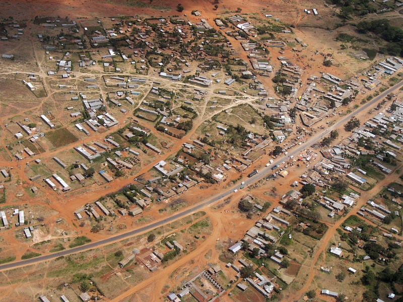
Bissil
Bissil, or Ilbissil, is a Maasai town at the road to Namanga.
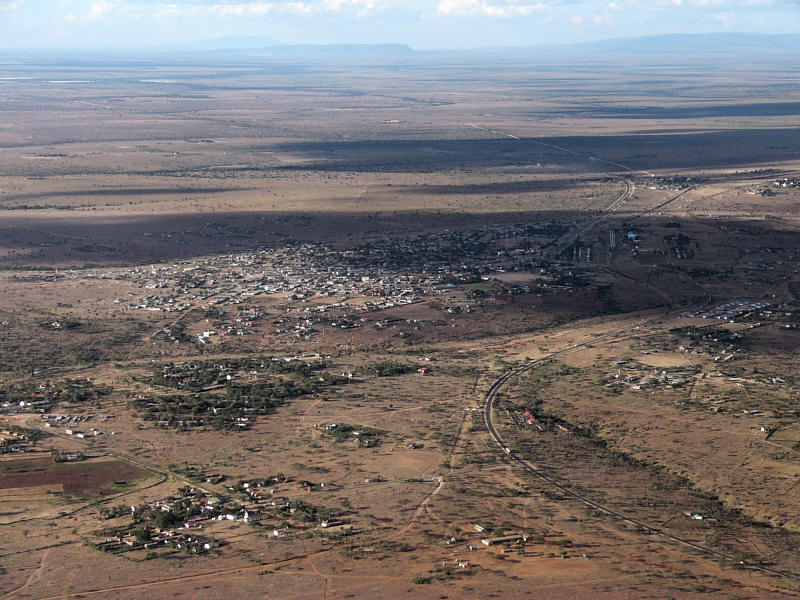
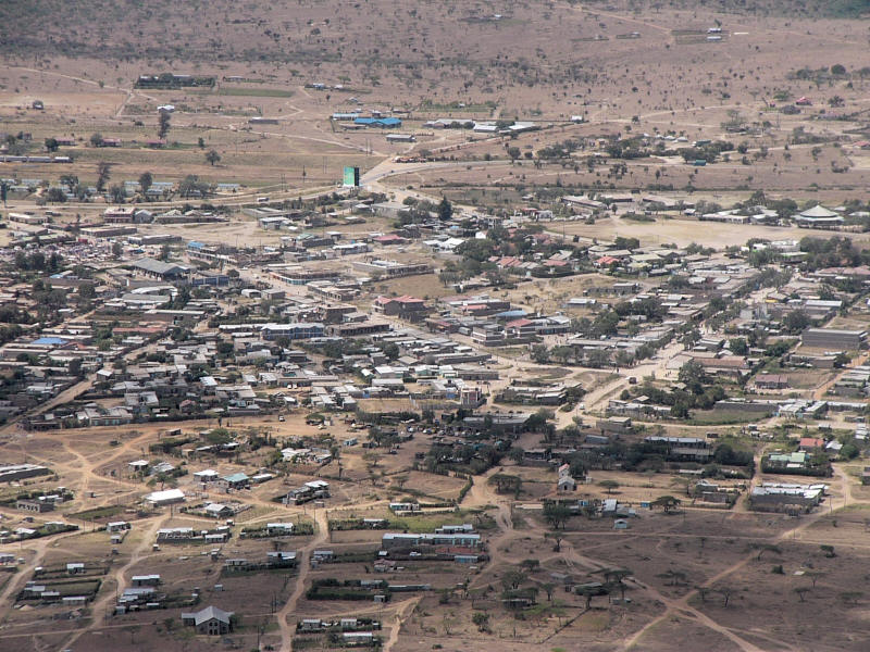
Kajiado
Kajiado is the biggest town in the area, about half way from Nairobi to Namanga on the Tanzanian border.
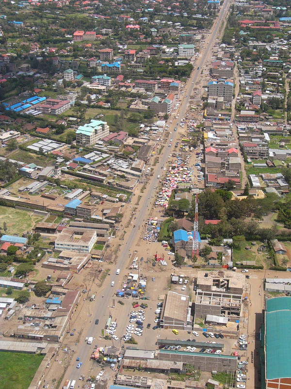
Outskirts of Nairobi

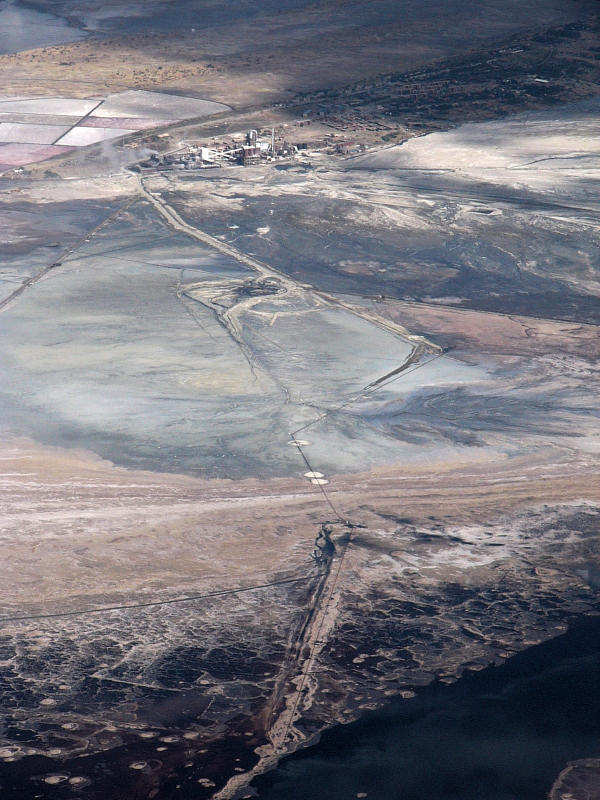
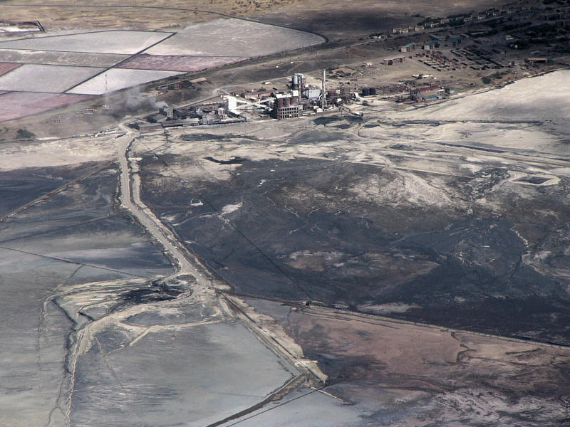
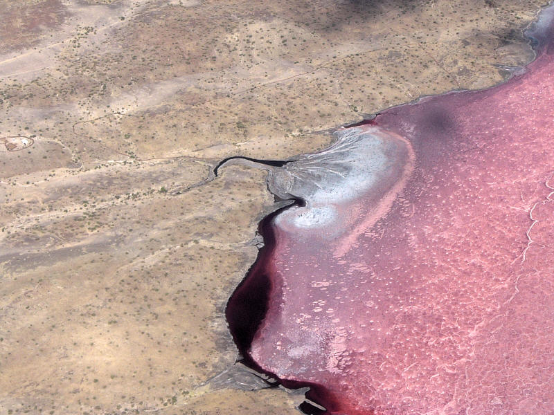
Lake Magadi
Lake Magadi is a salt lake. In the photos you can see how the salt is harvested.
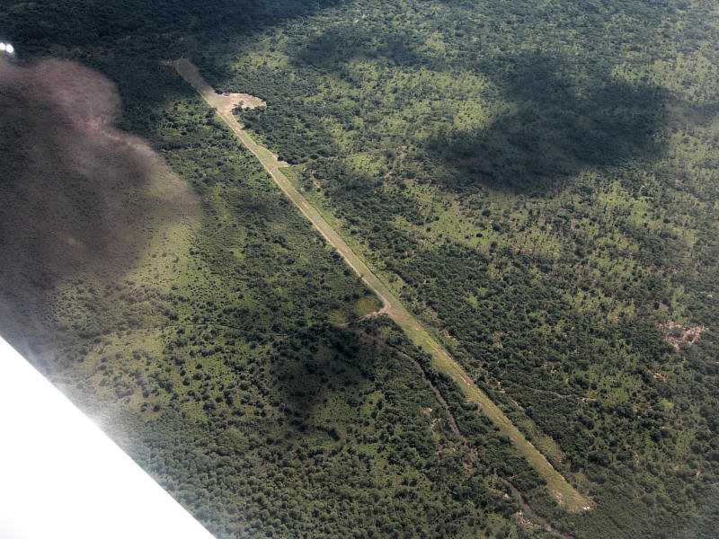
Unknown airfield near Shompole
One of my destination was Shompole Lodge, about which I kept hearing good things.

Shompole airfield and the lodge in the upper right background
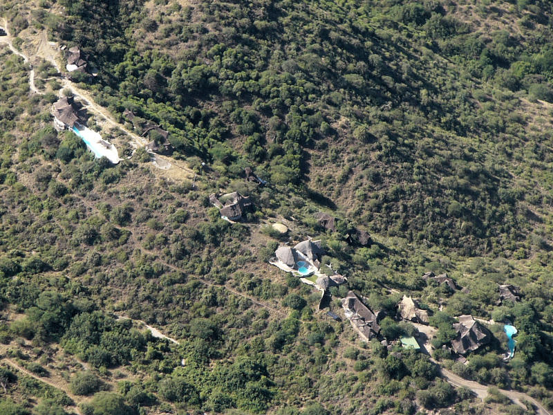
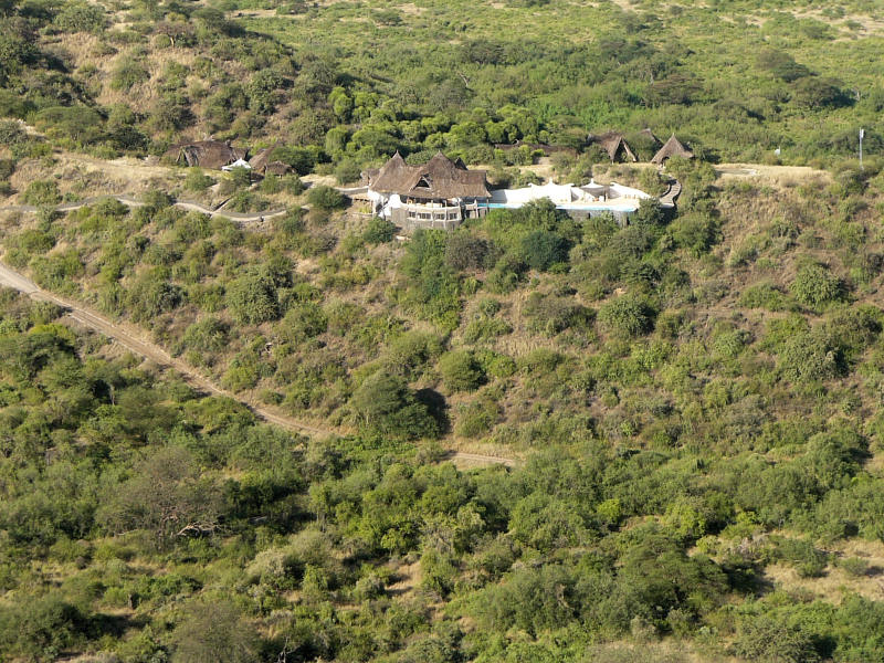
Shompole Lodge looks nice, although I'm not sure whether its position in one of the hottest areas in Kenya is a good idea. I also don't know how much wildlife there is in the area.
The airfield is a killer. It is probably the most dangerous airfield I have ever seen, and I have seen several quite dangerous ones already. In one of the photos you can see the 50+m wide ravine at the end of the airfield. What you cannot see here is that the airfield has a strong undulation at the ravine end. If you don't lift off and climb before that, you lift off anyway, because the undulation is too deep for the airplane to follow, so you would then hit the ground again. If you are lucky, that second ground contact helps you to actually lift off and climb. If you are unlucky, you hit the ground unfavorably, causing uncontrollable movement of the aeroplane or a bent propeller.
But that's not all. If you don't lift off and fly with that second chance, you fall into the ravine. In the worst case, which is, unfortunately, also the most likely one, you hit the other side of the ravine, meaning certain death to all people in the plane, not to mention total destruction of the plane.
And the usable part of the runway is short. Add the thin air, due to altitude and the high temperature, and you get an idea what I mean when I say killer airfield. In my little Cessna 150, aware of the situation, I taxied to the very end of the airfield and began rolling with full power. Even so I just barely lifted off before the undulation and didn't touch the ground again. But the margin was small. And I had a little bit of wind. Without wind it would have been even more difficult. I wouldn't send a student pilot there.
Shompole lodge

Shompole airfield as seen from the ground
Nairobi Orly
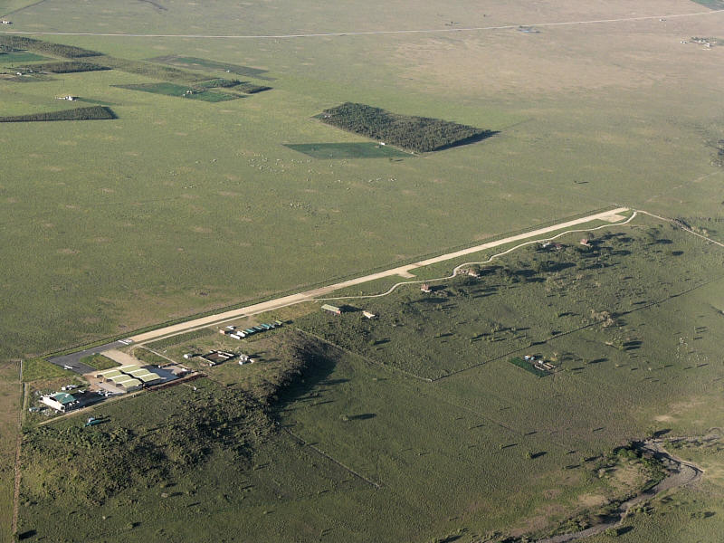
Nairobi has its fourth airport now. A group of people from the Aero Club of East Africa is trying to establish Nairobi Orly as a center for private aviation. I think the airfield looks good, and it will look even better when it is paved.

Don't ask, I don't know what this is. But it looks interesting.
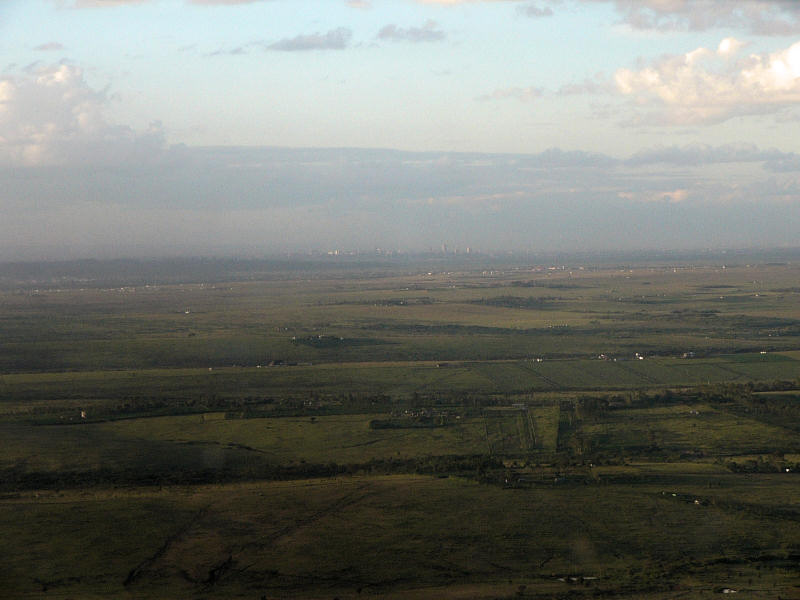
Approaching Nairobi from the south
You can see the city of Nairobi at the horizon. The distance is about 15 to 20 km.
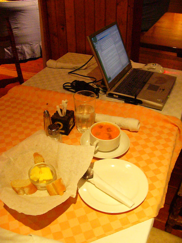
My dinner table
I still like the Aero Club's WiFi Internet connection. It is wonderful to be able to write this travel report while waiting for the soup to cool to an edible temperature.
Finally I made it out of Nairobi!
I had to do several things in the morning and drove off, first to the Kenya Civil Aviation Authority at the international airport, then all across Nairobi to visit a friend, then on to Nakuru.
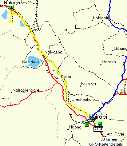
Nairobi Nakuru
The road to Nakuru has been redone and is now in excellent condition, apart from a stretch between Gilgil and Lake Elmenteita that is apparently there to remind you how bad African roads can be. I reached Lake Nakuru National Park in the late afternoon, drove in through the south gate (Nderit Gate), continued to Lake Nakuru Lodge, which is not far from the gate, and checked into my room. I got a free upgrade, i.e. a nicer room that is normally more expensive, and of these I apparently got the most beautiful one with a wonderful view over the lake.

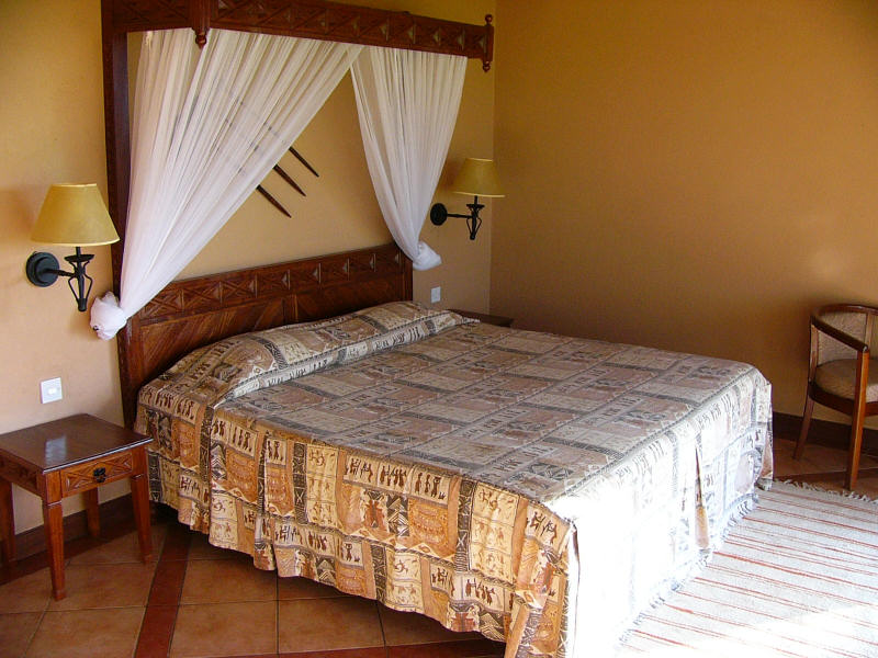
A room with a viewLake Nakuru Lodge
The stripes on the window panes are there to prevent birds from crashing into them.
Then I drove out again to use the last hour of daylight for an evening game drive. Even on this short game drive I saw several rhinos and several groups of eland, one of which was large enough to be called a herd. It was too dark to take photos, but it was a wonderful impression.
The lodge is more or less empty. There was a German family of four, an Indian family of three, and me.
After dinner I sat at the computer, writing this and uploading it through my new mobile phone Internet connection. I had to learn how to position the phone, because GPRS connections should deliver more bandwidth than just speaking, so even a seemingly maximal connection (7 bars on my phone) is not always enough. In this case leaning it against the wall did the trick, with the back side, where the antenna is, facing outward.
Then I went to bed. There were lions in the vicinity. I heard them roar every 20 minutes, a nice wildlife lullaby.
I woke up when it was still dark and got up when I saw the first trace of light on the horizon. I drove out in the first light of dawn, just enough to see where I was going.
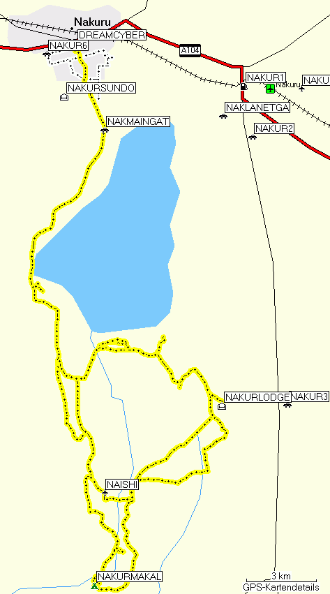
Lake Nakuru 2008-05-15 and 2008-05-16 (white: 2008-05-16 afternoon in Nakuru)
I looked for the lions. Although I had not heard them in the morning, and the watchman at the gate had also heard them only in the last evening, I still looked for them. Somehow you always look for lions. Even though you often just see them sleep, they are so magnificent, iconic, and inspiring that you still look for them.
I didn't find them. Most likely they had moved on, otherwise I would have heard them in the morning. I drove with both windows open, so I could hear and see better and the mist would not condense on the windows, and it was cold, but beautiful. The first conspicuous animals I saw was a herd of eland, the same I had already spotted last evening. They blocked my way and didn't want to flee out into the open, so they didn't really know where to go and could only circle my car. I did take a photo, even though there was no suitable light.
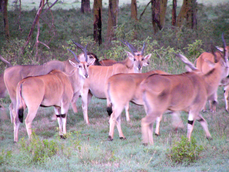
Eland
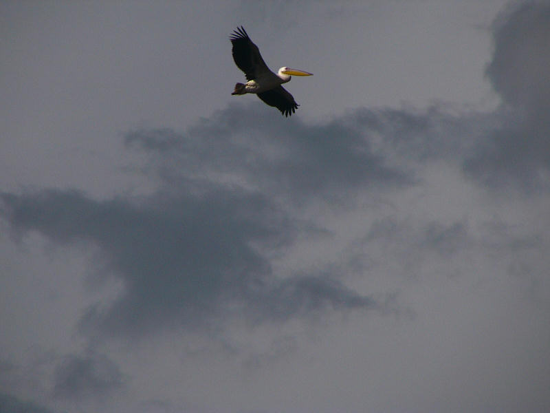
I saw a lot of interesting animals, including baboons, rhinos basking in the morning sun to warm up, large numbers of pelicans at the lake shore and some flamingos, a marabu stork, from which the flamingos kept fleeing (for good reason), two European white storks, many buffalos and several giraffes.
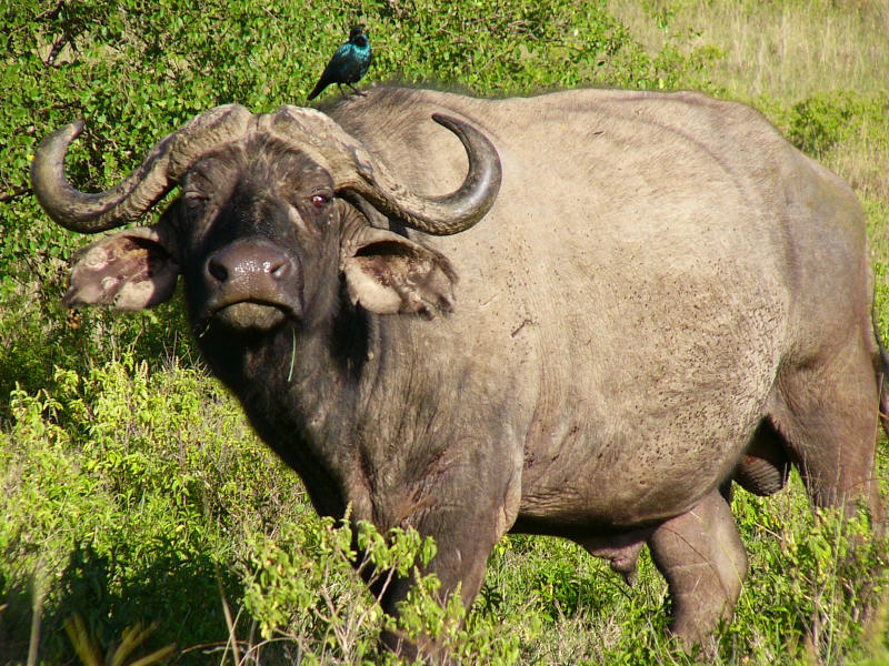
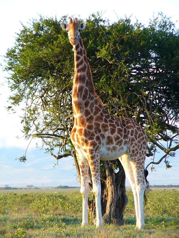
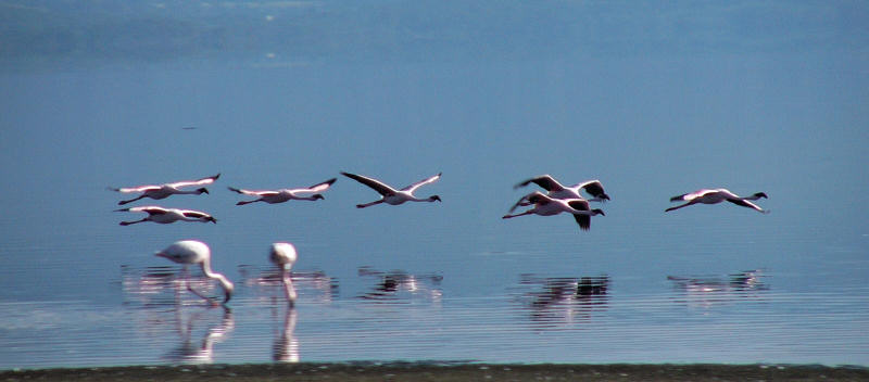
Buffalo; Rothschild giraffe; flamingos
After lunch I packed and left the lodge for a last game drive. I drove south to Makalia Falls.
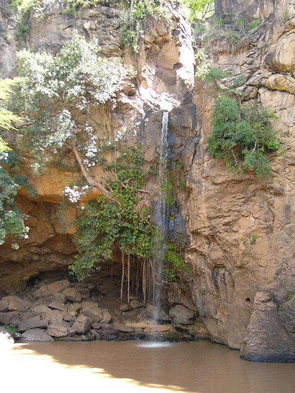
Makalia Falls
On the adjacent camp site I met three ladies who were camping. I thought, these can only be Kenyans, because normal tourists never dare to camp out in lion country, so I asked them about the area and any exit I might not know. But they turned out to be Swiss.
After a short chat I left and slowly drove through antelope, gazelle, and ostrich country.

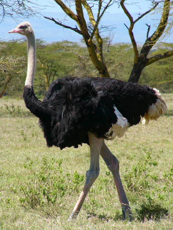
Somali ostrich female and male
The three Swiss ladies had broken off their camp and soon overtook me. That may have been a mistake, because only a few minutes later I spotted a buffalo carcass that they had missed. Its cause of death was unclear. I suspected disease or a car collision, because it didn't look as if it had been eaten.
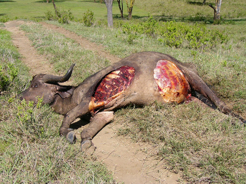
Dead buffalo
A fair number of vultures had gathered on the surrounding trees, and I waited patiently for them to start eating the buffalo. However, they didn't come, which mystified me as much as the cause of death.
So I continued past the buffalo carcass to map the track. Suddenly both the cause of death and the cause of the vultures' hesitation became clear.
The cause - three lions
My time in the nature reserve ran out, so I slowly moved towards the main Nakuru exit. Along the way I took some pelican photos.
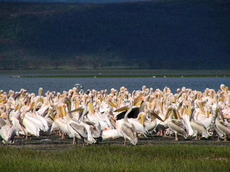
Pelicans
In Nakuru I met friends and was invited to a very nice dinner. Eventually I ended up in the Waterbuck Hotel.
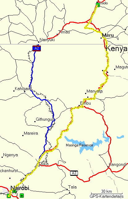
I had to find an entirely new route, because this time I wouldn't make it to Baringo. I tried to find a northerly route to the Samburu West Gate, but if that would turn out to be too difficult or too time-consuming, I'd try to find a way via Nanyuki and Isiolo.
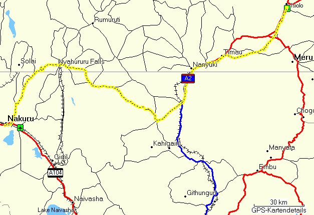
Nakuru Isiolo

Subukia
It did turn out to be too time-consuming. I drove the fastest way, or so I believed, to Nanyuki via Subukia, Nyahururu (Thomson Falls), Naro Moru, Nanyuki to Isiolo. On this trip I learned once more that Kenya does not have a complete road network. The roads between Nyahururu and Nyeri that I intended to take were unpaved tracks that would have taken a lot of time. So I asked matatu drivers, who know all the roads and shortcuts, and they sent me on towards Mweiga and Nyeri, which involved driving away from my next waypoint, Nanyuki. When I noticed, I asked another matatu driver, and he said, yes, that's the way. There is a shortcut, but he was worried that I would get lost trying to find it.
So I drove on, but soon realized that I actually knew that shortcut, because I had used it to get from Nanyuki via Naro Moru on the foothills of Mt. Kenya to The Ark, a forest night lodge near Mweiga. I even had the route in my GPS receiver, so I reversed it and drove the shortcut. It was, and still is, a bone-shaking, stone-based single track of some 20 km. On the GPS map above the shortcut is the straight bit that eventually hits the A2 highway.
In Isiolo I spent a very nice evening with one of our Somali Network members, Sarah Mohamed, and some of her family members.
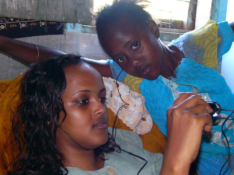
Sarah and Najma are trying the music I brought.
I spent the night in the Bomen Hotel in Isiolo and got a quite nice room, a lot nicer than the one last year.
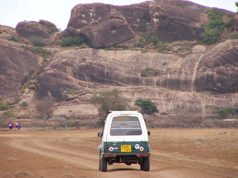
The next morning I finally set out to Samburu, the farthest point of this trip and a beautiful nature reserve, one of the finest in Kenya. Remarkably, the formerly horrible Isiolo Road was being redone. Both the substituting side lane and those bits of the unfinished road that I could already drive on were a lot better than the old Isiolo Road had ever been. So I soon reached the southeastern gate, paid my dues, and entered Buffalo Springs National Reserve, one of the two adjacent reserves that are commonly called Samburu. In truth Samburu is the name of the local tribe and area. The Samburu are close relatives of the Maasai, look quite similar and speak the same language.
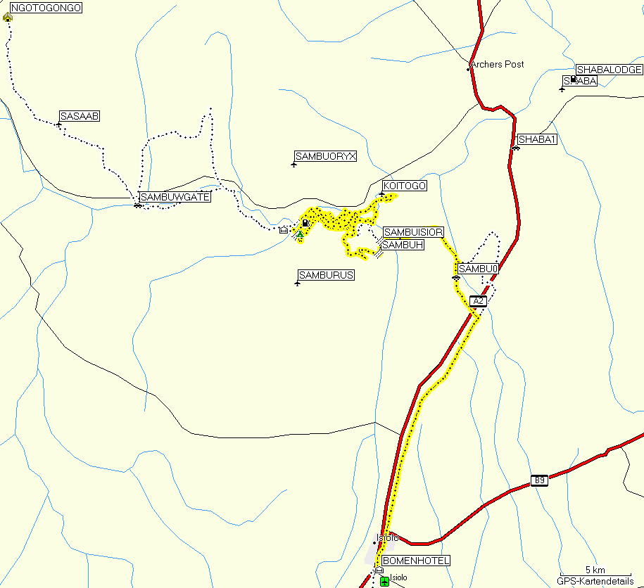
Samburu (white: tree-planting competition schools)
Not long after passing the gate I encountered a large group of elephants crossing my way. I had to stop and stay there for a while, until I could drive through the groups on the left and right side of the track. The elephants here are a bit more shy than those in Amboseli. They tend to move away from my car at a distance of 50 to 100 m, and I see the occasional sign of disapproval, a head shaking in my direction.
I moved on, making this an extended morning game drive and moving along smaller tracks in the direction of Samburu River.
Soon I met five cheetahs. This is a rare occasion, and I considered myself very lucky. I believe I had never seen five cheetahs together before.
When you see two or more cheetahs in a group, it is almost certainly one mother and her offspring. The only other possibility is a few siblings, usually brothers, that already live without their mother. But in a group of five, one will invariably be the mother. In this case the offspring was already pretty much grown up, so I could not even make out for certain who the mother was.
The cheetahs were hunting. More precisely, they were walking through their territory in search of prey. After watching them pass, I marked their position on the GPS map, memorized their direction, and drove around to meet them further on. I couldn't follow them directly, because it is too risky (acacia thorns, holes in the ground) and it is also forbidden to drive straight into the bush. But I could not find them again. Either I had misjudged their speed or they had changed their movement. So I drove down to the river and then along it, towards the bridge.
Samburu River had low water. I was later told that it had already been completely dry and that Samburu hasn't had any rain recently.
Along the river I met many more elephants, so many in fact that I later abandoned driving along the shore of the river, because it was impossible to get through all the elephants. I saw other species as well, like a pair of secretary birds, a gerenuk, dikdiks, a very large eagle, several other birds of prey, lots of impalas, two waterbucks from far, and many more.
However, there was not a single photo opportunity. The first elephants were badly lit (choice between black, shaded elephant fronts or nicely sunlit elephant behinds, cheetah bodies without legs floating through the high grass, elephants not very visible in the river shore bushes, a gerenuk looking the other way, etc. So, sorry, no morning photos.
Eventually I reached the bridge, crossed it, and drove to the nearby Samburu Game Lodge, also simply called Samburu Lodge. As expected, the lodge was nearly empty, except for two elderly ladies and a BBC camera team.
All lodges seem to offer some kind of discount these days. Either I get an outright discount or I get a better room for the price of a cheaper one, or both. Here they gave me, although I didn't ask for it, a 10% discount and also gave me a large, comfortable hut with three beds.
I had a wonderful lunch. I particularly liked the soup, then ate far too much of the tasteful lamb, one of the three main course choices.
Samburu is quite warm. The thermomenter in my GPS shows 32C. The relatively dry air makes this bearable, but I delayed my afternoon game drive until 16 o'clock.
The game drive was uneventful. Along the way I stopped some way up a hill, from where I could establish an Internet connection, uploaded this page and checked my email. Then I drove on to see many more elephants, most of them at or in the river.
In the evening Shivani Bhalla, the lion researcher, came over to the lodge. The idea came up to form one big dinner table together with the BBC film crew, and so it was done. Another very nice evening passed.
Early in the morning Shivani collected me from the lodge, and we looked at two lions that had shown up near the lodge. One of them walked so close to the car that I could almost have touched him, if I had dared. At that early time there was not enough light yet for good photos.
The low numbers of tourists had made the lodge monkeys rather desperate. They came very close and even performed raids on lunch tables while people were eating.
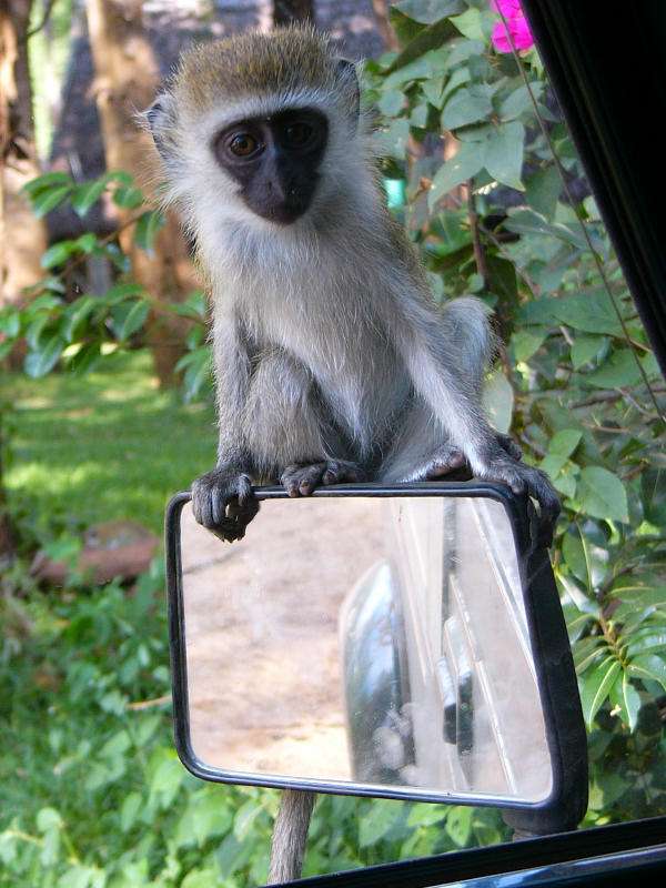
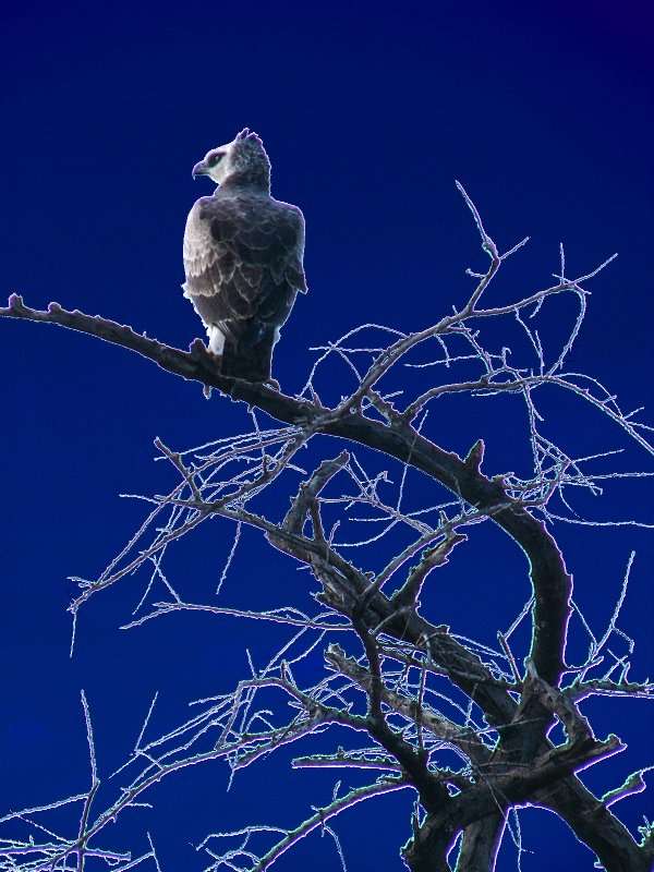
Young vervet monkey; eagle
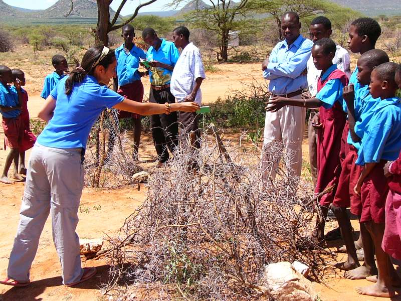
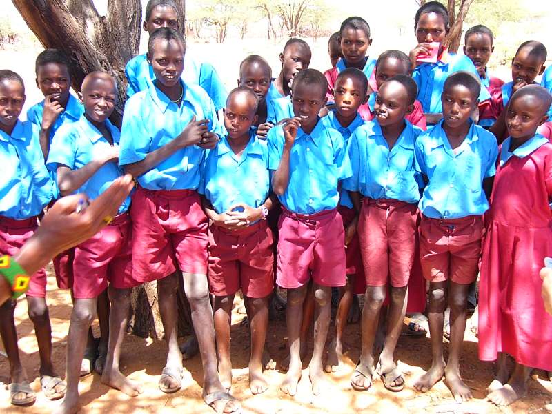
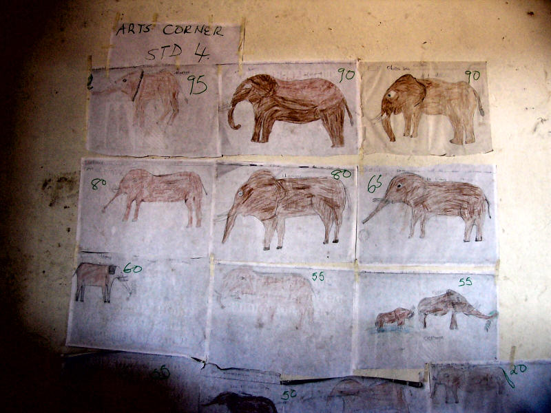
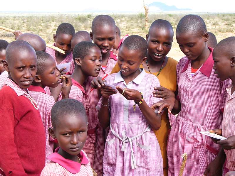
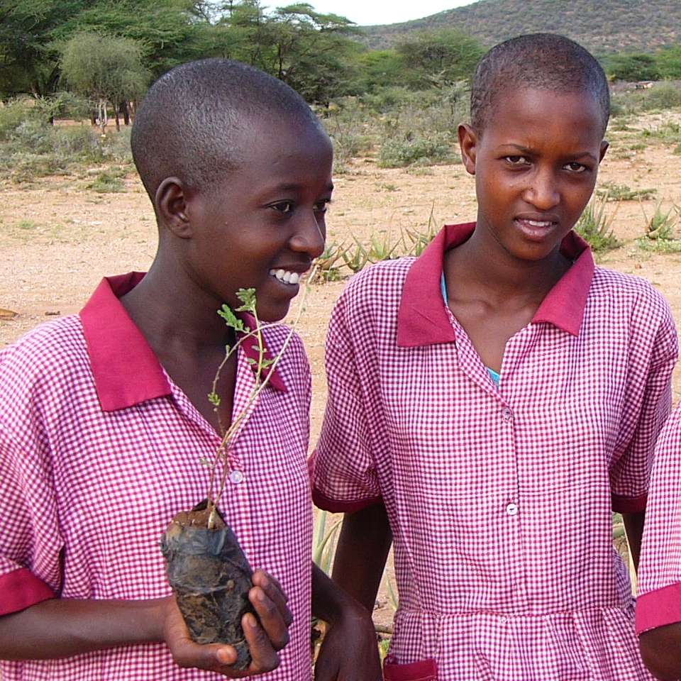
Shivani had started a tree planting competition between three schools in the Samburu area (see white track on the map above, the farthest school was Ngotogongoron past Sasaab airfield in the upper left corner of the map) and some schools in the Machakos district, closer to Nairobi. The idea is to let school kids form groups, each of which plants, waters, and protects a tree in the school compound. After a longer time the trees are compared and the tallest one wins. Another part of the plan is to bus children from Samburu to Machakos and vice versa to familiarize them with the different areas and lifestyles in Kenya. Some photos:
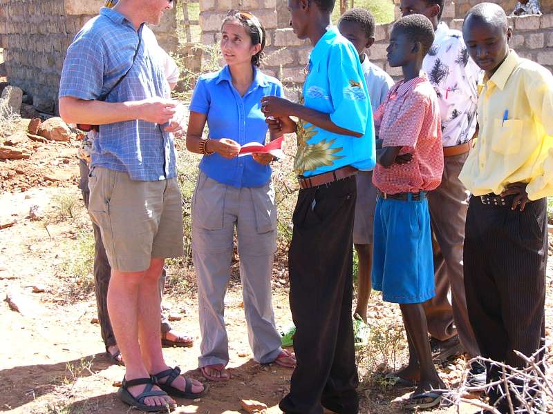
Preparations
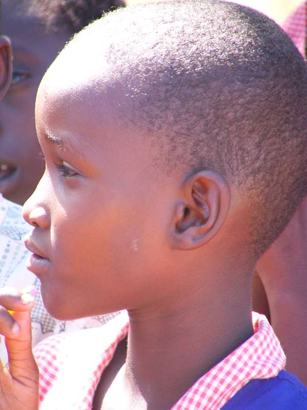
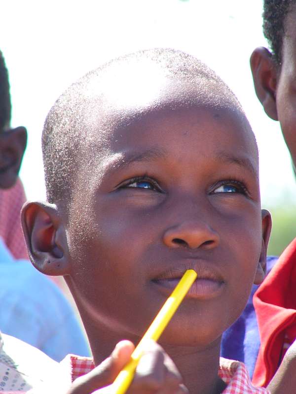
Samburu girl
Voluntary teacher who had come to teach for a year

Shivani reads the reports
School impressions
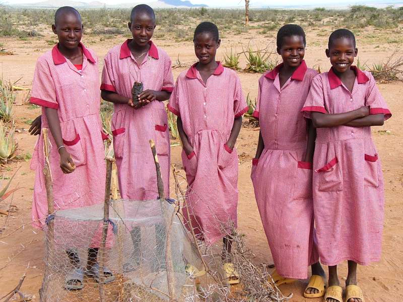
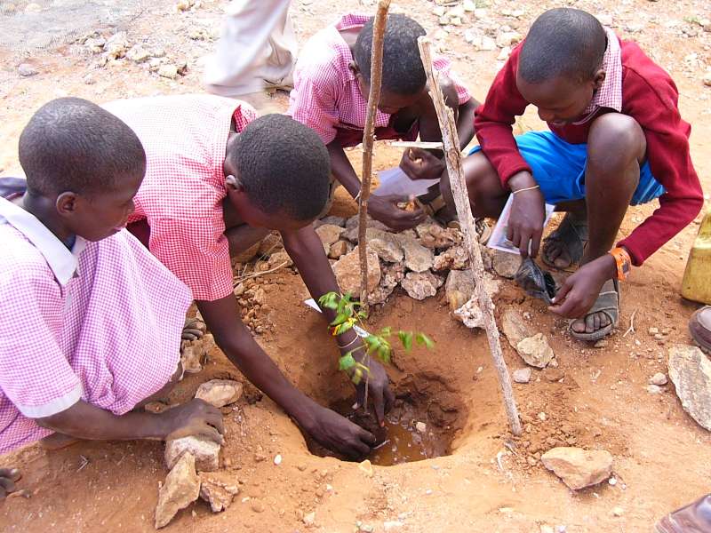

Planting trees

Students
I got the impression that the tree-planting project is a wonderful way to involve young students in conservation and make them think more about their environment.
This morning's game drive was once more dominated by elephants. Many of them were near the river, and I also had several encounters with big elephant bulls. In one situation I was standing near the river shore, watching a group of elephants playing in the water, when I noticed, almost accidentally, that a huge elephant bull came towards me from the other side. He was already quite close, less than 50 m, and walking straight towards me. I had to start the engine and quickly reverse out of the elephant pincer, because I had already been warned about several bulls in musth, particularly one who had already smashed one car (see last year's photos). Since I don't know the Samburu elephants, I had to be careful.
In another, similar situation another bull walked towards me, but rather than following the curved track on which I stood, he nicely took a shortcut and bypassed me at a few meters distance behind a thin row of bushes. In that situation I didn't start the engine, but assumed that the bull had no intention of clashing with my car.
Watching the elephants was fun. They kept going into the river, which had only very little water.
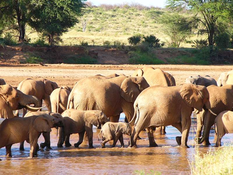
Elephants in Samburu River
I had several more elephant encounters. Since there were so many elephants in the bushes along the river, I kept meeting them, and often had to stop. In one case I was parking in the shade of a bush on a slope down to the river, when suddenly an elephant cow with a two-year-old calf came running down the slope. Elephants tend to run when the descend a slope. When my car came into sight, she braked and stopped very suddenly, because the car would be almost in her path. Since I believe in politeness towards elephants, I started the engine and reversed out of her way by moving some 15 m backwards. I wanted to let her know that at least some people respect elephants. She waited a few seconds, then proceeded, this time slowly, down to the river.
Later I drove to the ranger post at the bridge to pay for my remaining nights in the nature reserve. I had expected a ranger to show up at the lodge, but this time I hadn't seen one. The bridge is near though, so this was not a problem.
I have still been taking very few photos, partly because many situations didn't yield a good photo and I didn't want to take bad ones. Here is one from a dikdik. I apologize for my lack of photographic diligence. Perhaps I need a week in the wilderness until the desire reappears to do photographic work.
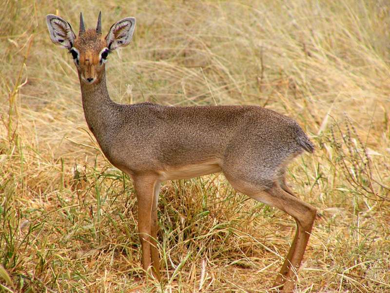
Dikdik
A few minutes before sunset, on my way back to the lodge, a leopard crossed my way. He apparently came from the river and walked away from it, while I was driving parallel to the river bank. I watched him, as he majestically walked through the grass. When he was about to disappear between two bushes, he looked back at me for a little while, then turned away and walked on. There was not enough light to take a good photo, so I just sat there and observed.
Early in the morning I left Samburu Lodge and drove slowly, at game drive speed, through the nature reserve.

Waterbuck in the morning sun
I continued back to Isiolo, where I had an Internet connection again through my mobile phone, and thus updated this page.
I decided to drive on the eastern side of Mt. Kenya this time, because I had already passed through Nanyuki, and I never liked to go the same way back. So I turned left towards Meru and drove through that town and later through Embu.
Isiolo Nairobi around the eastern side of Mt. Kenya
In the late afternoon I reached Nairobi. Unfortunately the Aero Club is at the exact opposite end, so I had to cross all of Nairobi City at the height of the rush hour.
After some time of adaptation, perhaps after driving enough terribly bad roads or tracks, driving on better roads or even through Nairobi can be fun. The driving style is so different from German driving that the impressions are quite intense. The open windows encourage chatting or making jokes with the people in the cars next to you, when you're in a traffic jam. Particularly funny are the matatu (minibus) conductors, which often hang outside the doors or jump in and out of their matatus. They certainly have a sense of humor when it comes to handling traffic jams.
In Nairobi I decided to drive a bit closer to the city, but where I wanted to turn right, it was no longer allowed, so I had no choice but to drive right through the center. The density of both people and cars in Nairobi is extreme. You can never drive fast or accelerate suddenly, because you'd run a high risk of bumping into a pedestrian walking between the cars.
I drove past my favorite Chinese restaurant and several other places I knew very well. Normally I avoid the city of Nairobi these days, because its nickname Nairobbery is not too far off the mark, but I see now that I should occasionally make an exception.
I finally made it through Nairobi and ended up in the Aero Club again, where I had a nice dinner and a good rest.
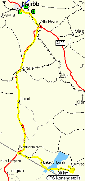
I got up at the first break of dawn, had a small breakfast in the Aero Club's restaurant, and set off for Amboseli. But first I visited those friends in the Kajiado area whose house I had earlier photographed from the air.
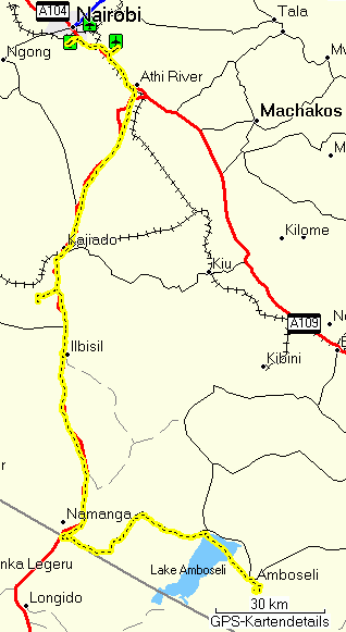
Nairobi Namanga Amboseli
After we had talked about various things for much longer than I had planned, they invited me to a very nice lunch, including self-made fresh cheese. Then I asked for the time, only to learn that it was already 2 pm, so I rushed off and drove through Bissil and Namanga at the Tanzanian border to Amboseli, whose entrance gate (Meshenani) I reached at about 5 pm.
Lake Amboseli was completely dry, so I could drive straight across it. Not far after leaving the lake I saw hyaenas running away from me and from an almost completely eaten gnu baby carcass. The gnu must have been only a few months old. A lot of vultures had gathered around it, and the most hungry or the most aggressive were still tearing off and eating little bits.
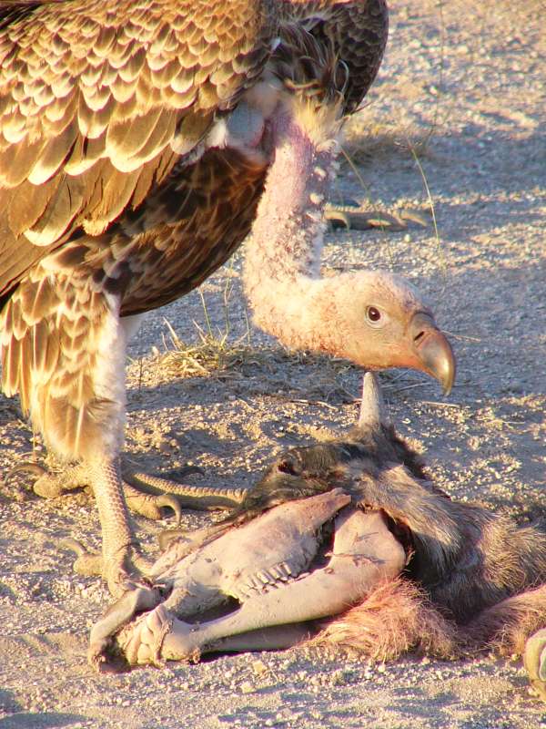
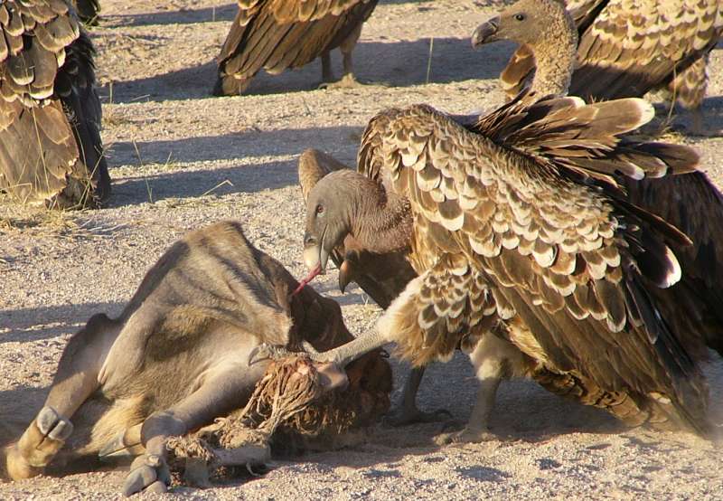
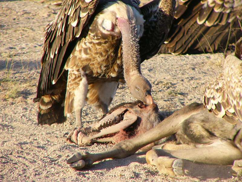
Vultures eating a wildebeest baby carcass
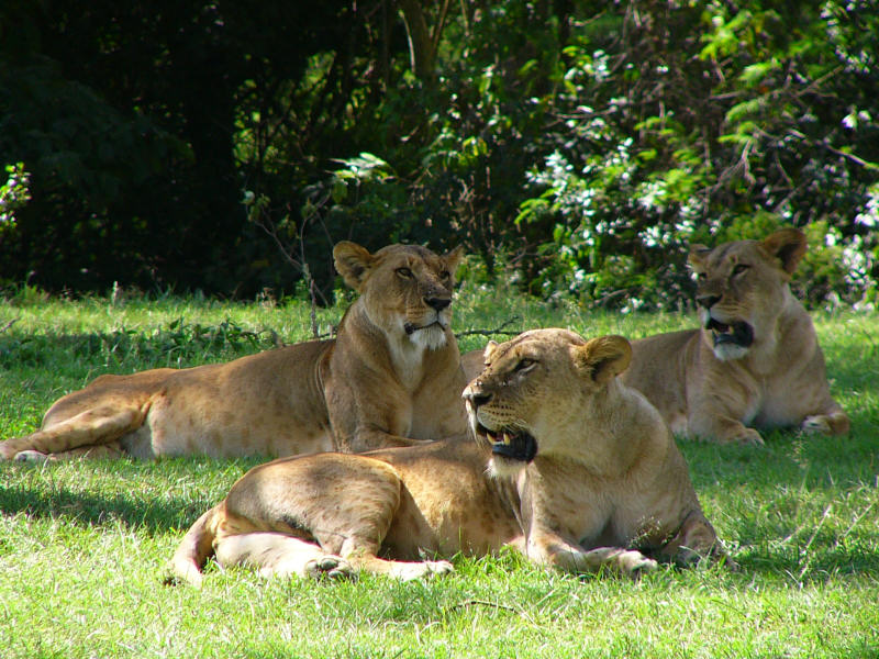
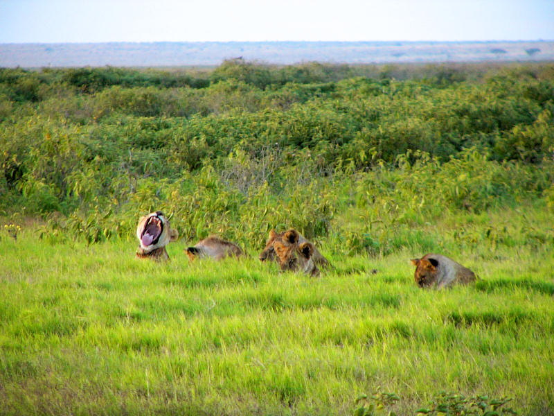
I watched the scene for a while, taking photographs, and then continued to drive deeper in to the nature reserve, when I saw two lions.
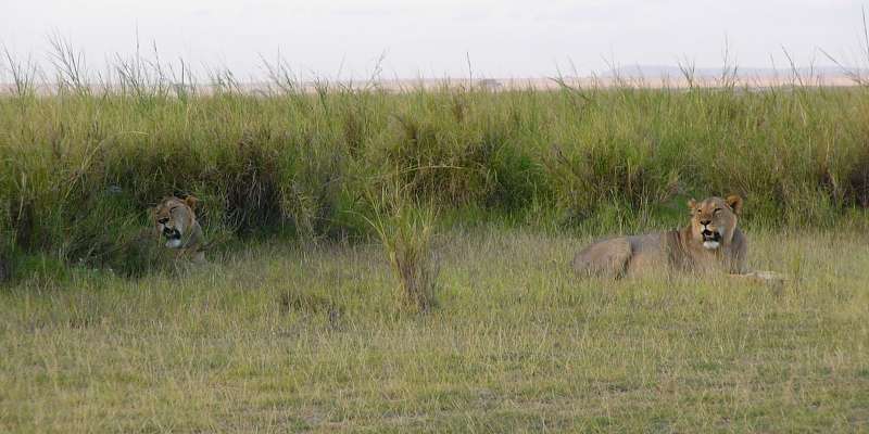
Two lions
Not bad for the first few minutes in Amboseli! I continued to the camp where I was going to stay and was welcomed by the camp assistant. I moved into my tent and then used the wonderful solar shower, for which I had also brought some spare parts.
A nice dinner followed, and soon I went to bed.
If I were superstitious, I would believe that some evil being is trying to prevent me from taking photos. The weather was grey on 2008-05-23, which had the advantage of being relatively cool and comfortable, but the disadvantage of not yielding any good photography light.
Game drives in Amboseli
On 2008-05-24 I went on a late morning game drive, and when I tried to take my first photo, prepared the camera, even mounted the polarizing filter, because there was a bit of sunshine, I suddenly noticed that my car was full of bees and many more were swarming around it. Knowing that African bees can be extremely aggressive, I very quickly put down the camera, started the engine, and backed out as speedily as I could while cranking up the windows. The bees followed the car and whenever I opened a window to let one bee out, two others came in.
I was lucky not to be stung and eventually managed to flee, but againno photo. So here is at least one I took later at the edge of the swamp.
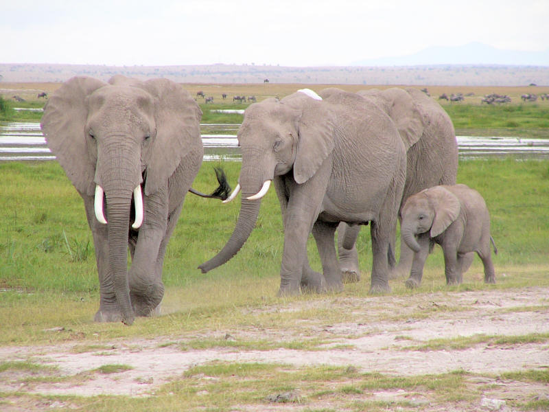
Elephants at the swamp
I made a long drive along the outer, western edge of the swamp and drove until I reached the dry Lake Amboseli. There were many animals in the swamp area, mainly wildebeest, buffalo, zebra, and many large birds.
I tried to drive around the swamp, but there was no visible track, and I didn't want to drive across uncharted territory, so I turned back and crossed the swamp at the Sinet Causeway, a dam across the swamp with openings to let the water pass underneath.
I drove out again in the evening and saw these fellows just before sunset, peeping at a large gathering of wildebeest and some zebra, one of which they certainly wanted for dinner.
Lions at sunset
In the evening there was a birthday party of one of the research assistants. Everybody important was there, like the senior warden of Amboseli National Park, the ticketing officer, and the manager of the Ol Tukai Lodge.
After a light breakfast I set out for Nairobi and this time wanted to drive the route near the Tanzanian border that leads through the Kitirua Gate. Along the way I met a hyaena family, more precisely a mother with two kids, who were not particularly shy.
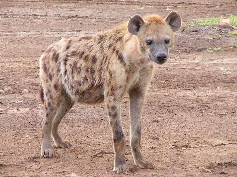
Hyaena mother with kids
This should be a foretaste of the next days, which I will devote mostly to hyaenas.
I drove on and rechecked the right rear tire, which had looked a bit flat to me the day before. My suspicion was that I had caught a bad acacia thorn when I drove the difficult Samburu exit track and had to drive over some young acacias.
I found the tire with clearly too low pressure, decided not to take any chances and drove a little way back to the Amboseli Serena Lodge, which has a petrol station and a workshop.
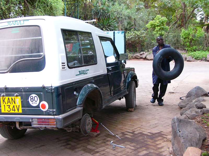
Tire repair
However, and this is the first time this has happened to me, we could neither find a leak, nor a thorn. So we put everything together again and put the right pressure (30 psi, a bit over 2 at) in all four tires.
Amboseli Nairobi
I drove off again, used a new way to Kitirua Gate, which led me unexpectedly to the Amboseli Tortillis Camp, one of the very classy lodges in the area. I briefly inspected the lodge. It looked very good to me. Then I drove on and found a big airfield next to the lodge, which I measured and put into my East Africa GPS waypoint list. Then I drove on through Maasai country.


Across the southwestern part of Lake Amboseli; Kori bustard and Thompson gazelle;
fascinating landscape
Later on the Namanga road several hitchhikers benefitted from my trip. The first was an extended preacher family that was more or less put into my car by a police officer at one of the frequent checkpoints. They wanted to go from a local church to another church in Kajiado. I could not refuse his strong request, but when I agreed, I was not yet fully aware how big the family was. Anyway, they all squeezed in, two ladies sat on the left front seat, god only knows how many on the back seat, and we drove on to Kajiado.
The next were a mother and daughter, part of a farmer family who lives in Sultan Hamud, some way down the Mombasa Road, who had visited friends near Kajiado. I took them along to Athi River, where the Namanga Road ends and feeds into the Mombasa Road. I turned left towards Nairobi, while they went to the bus stop to catch a matatu to Sultan Hamud.
They could both speak good English, so we could chat about various things, like how life is in Germany. Somehow it is a bit frustrating that I can usually only be the one who tells stories, because I'm the one who knows both countries, but I keep finding that many Kenyans do not really have an impression of what winter means, like walking on ice, which strains the imagination of somebody living on the equator, so there are always some interesting stories to tell.
This part of the travel report can be found at the special research web site http://resaf.org/node/88, which facilitates comments and discussions.
After a short, but extremely interesting week in the hyaena research camp I made it back to Nairobi over the roads that are worse than ever. Road works are in progress, but long stretches of the road have already been dismantled.
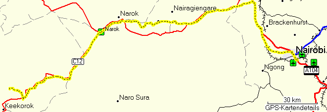
Masai Mara Nairobi
In Nairobi I met Shivani again, who also happened to have come there, and another friend, before visiting Rasul's office to arrange for the last-minute handover of the car the next morning, before I fly out. Then I drove to the Aero Club of East Africa for my last dinner and last night.
My mobile phone was set to wake me at 5:00 o'clock, but still being used to the early hyaena observations, I woke up around 4:30 and used the extra time to distribute my remaining prepaid mobile phone credit among friends. (Safaricom has a function with which you can send anybody a part of your credit.) Some of the thus enriched had their phones switched on and were woken up by this. I apologize, but I had not been able to do it earlier.
I loaded my luggage into the car, jumped in and wanted to drive to the airport. I was in for a little shock when the engine did not start. My diagnosis was that it was a starter relay problem, which I could not repair on the spot, particularly not in the dark. This was at 5:30, some time before dawn.
I could have called a taxi, but I didn't want to give up too soon, so I called the askari (nightwatchman), and we pushed the car back. The Aero Club's parking lot is slightly sloped, which greatly helped the operation. Both of us could push the car back and up, then I jumped in, the askari pushed forward, and I just barely managed to start the engine before crashing into the gate, which was still closed.
So I could drive off after all, and was now extremely careful not to stall the engine, which is very easy in this type of car.
Nairobi was still very quiet at this time of the day, and I reached the meeting point with the driver well in time, leaving me a couple of minutes to use my electric shaver and reply to a few thank-you messages I had received from the friends who had already discovered their unexpected mobile phone credit.
The driver showed up, jumped in, and we carried on towards the international airport. Not far, however, we hit a traffic jam, caused by a traffic accident that blocked the entire southeast-bound side of the highway. Here the advantage of an off-road car paid off again, as we simply drove off the road, bypassed the whole traffic jam, and arrived at the airport roughly in time.
Not very much buffer time remained, however, and I made a mental note to be sure to arrive somewhat more than two hours before departure the next time. This was less than two hours, and the buffer time shrank worryingly while I waited in the long line that had formed in front of the few open check-in counters.
But the time proved sufficient, and I reached the gate with a little time still to spare.
I had not been aware that Kenya Airways now also, like KLM, has an online check-in. This lack of information cost me the window seat, I could not see northern Kenya and the Nile from above, and I cannot show you a GPS track of the flight back home.
The plane, a Boeing 767-300ER (Extended Range) was comfortable, even comfortable enough to write this on my computer during the flight, but its other technical amenities left something to be desired. The entertainment system was severely defective, almost unusable (my volume control was defective, several channels had distorted video), the light in the toilet was defective, etc. I can only hope that the engines of the plane are serviced better than those other technical parts.
But the flight itself was smooth and uneventful, apart from the almost regular use of spoilers during the descent that seems to be typical for third world airlines. But their waste of fuel is not my immediate concern, so I will not complain.
In Amsterdam I had a four-hour layover. Unfortunately Amsterdam Schiphol airport still doesn't see the signs of the time and still does not offer free public WiFi, so uploading this page will have to wait until I'm at home. One network, run by KPN, a dutch telephone and communications company, fraudulently requires me to enter my name and email address before telling me that I have to pay some ridiculous amount of money up front by credit card for a few strictly limited minutes of Internet time without any bandwidth guarantee, i.e. an offer that no sane person on a budget can accept other than in an emergency. But at least I found an electricity socket and could recharge my battery, that I had run nearly empty during the flight, while writing this.
[Please skip this chapter for the time being, because there aren't any tracks yet.]
To experience a flight or drive for yourself, you can re-run it in Google Earth as follows.
Remarks: The virtual camera doesn't exactly follow the flight path for flights that you can see as a colored line. Instead it follows a point under that line a few miles ahead and 4,000 m above the ground. Hence the virtual aeroplane appears to climb and descend as the ground ahead rises and falls. This is one of the peculiarities of Google Earth. For this reason, if you set the altitude in Google Earth too low (somewhat lower than 4,000 m), you will fly into mountains and get stuck. No, even in Google Earth the aeroplane cannot turn into a mole and fly underground.
If in this text you find any typos, orthographic errors (even small ones), ungrammatical sentences, wrong or illogical information (like wrong names of birds), if you want me to write more details about something in particular, or if you want one of the photos in full resolution (usually 1,600 x 1,200 pixels), please click on the email sign below and write to me. Many thanks!
Copyright 2008-2023 Hans-Georg Michna.
Private homepage – Hans-Georg Michna
Kenya travel reports: 1999, 2000, 2002, 2003, 2004, 2005, 2006, 2007, 2008, 2009, 2010, 2011, 2012, 2013-Goma, 2013, 2014, 2015, 2016, 2017, 2018, 2019
Kenya Safari Travel Plan, Kenya 1980-2000 photos

hits since 2008-05-04
Free PHP scripts by PHPJunkYard.com