
Munich – Amsterdam – Nairobi
Private homepage – Hans-Georg Michna
Kenya travel reports: 1999, 2000, 2002, 2003, 2004, 2005, 2006, 2007, 2008, 2009, 2010, 2011, 2012, 2013-Goma, 2013, 2014, 2015, 2016, 2017, 2018, 2019
Kenya Safari Travel Plan, Kenya 1980-2000 photos
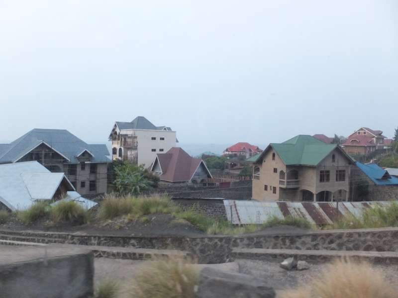
Goma 2013
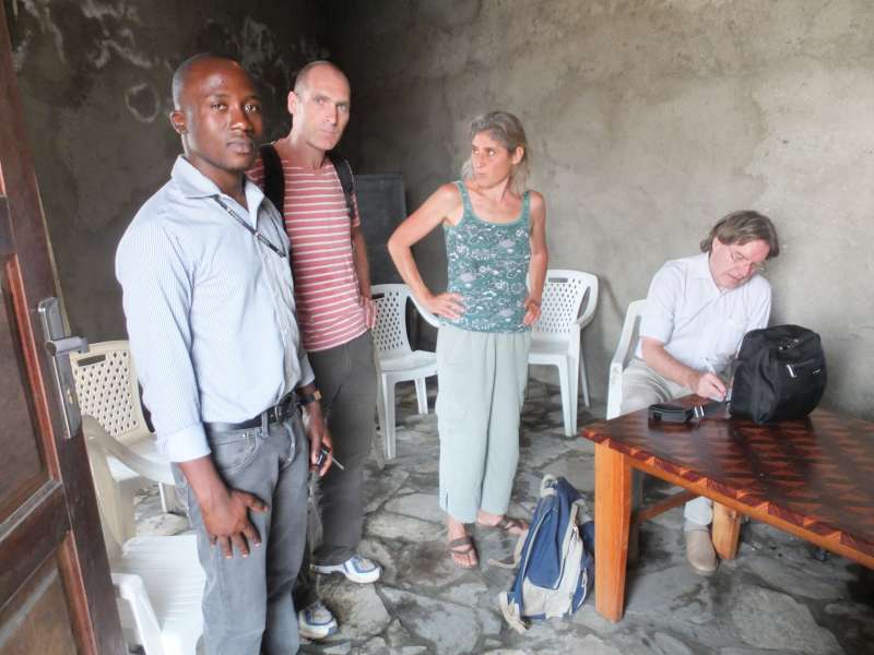
A personal travel report from the Congo (DRC) and Kenya in January and February 2013
Last change: 2013-03-01 – Copyright © 2013-2023 Hans-Georg Michna
Click on the small pictures to see them enlarged, usually to 800 x 600 pixels.
Times are given in local time in 24 h format (without "am" or "pm"), i.e. 0:00 to 23:59.
All photos are subject to copyright ©. If you want to reuse any photo, send me an email asking for permission, and I may send you the full-size photo, usually 1,600 x 1,200 pixels. Photos bear the copyright © 2013-2023 Hans-Georg Michna.
EXIF times in the pictures are UTC. Add 2 hours to get Rwanda and Congo time. Add 3 hours to get Kenya time.
[I still used the same camera—my Panasonic Lumix DMC-FZ1-2 digital camera, but most photos this time came from a new camera, a Fujifilm F770 EXR. Most photographs in this travel report are reduced to 800 x 600 pixels and JPEG-compressed with medium strength to make them more palatable for the web.]
2013-01-20 Munich – Nairobi
2013-01-25 Kigali – Gisenyi – Goma
2013-01-30 Kigali – Nairobi
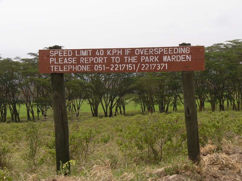
2013-01-31 Nakuru
2013-02-02 Nairobi
2013-02-03 Munich
My travelling checklist in michna.com/kenya.htm#Preparations (German version michna.com/kenia.htm#Reisevorbereitungen) is, as always, my means of packing without fear of forgetting anything important. As usual, the packing and other preparations take at least a full day of concentrated work, because they cover an immense number of small things and details. Without the checklist I'd be lost.
KLM, Air France, and Kenya Airways on their flights To Nairobi currently allow two pieces of baggage of up to 23 kg each in the economy class. KLM also has a pretty good and informative web site, allowing ticket purchase, online check-in, and often seat selection.
My experience on such international flights, particularly from Nairobi, is that a lot of stress can be taken out of the check-in procedure by being at the airport just 10 to 15 minutes earlier than needed. In Munich the rush seems to begin 90 minutes before departure, in Nairobi at least two hours. Be there before that rush and everything is a lot more relaxed.
This time there was no safari group. Only my wife accompanied me.
I had finished packing last night by 21:00 and went to bed not much later, so I could sleep a bit before our alarms woke us up in the early morning, not long after 3:00.
We were at Munich Airport well in time, and the flight to Amsterdam was uneventful.
The Amsterdam airport seemed quite busy. There was a seemingly endless line waiting at the gate, before a security check, where all passengers of this flight were checked. Most passengers had already boarded the Boeing 747-400, while the last ones were still being screened and could then walk leisurely into the plane.
Then, just when everything looked as if we could now depart, the pilot announced that an electric motor, controlling a luggage door, had failed. A while later he announced that some ice has been found and that the motor has to be replaced to be on the safe side. Outside temperatures were about -3°C, so any water outside the plane would be expected to freeze.
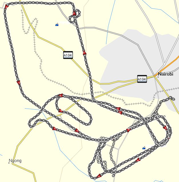
Munich – Amsterdam – Nairobi
Eventually we took off and flew exactly the same course back. We passed Munich between the airport and our home, so we could have seen it from our seats on the right side of the plane, if only we had looked.

Departure from Munich and
overflying Munich again 7 hours later
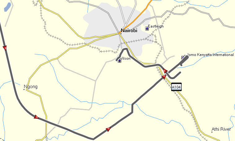
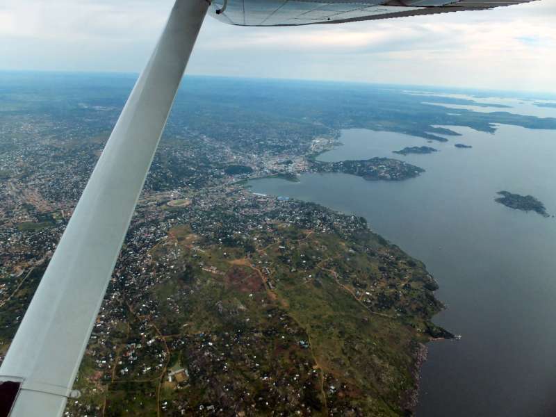
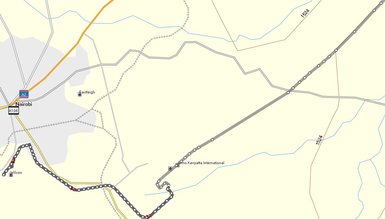
Arrival on Nairobi International Airport
and taxi ride to the Aero Club of East Africa
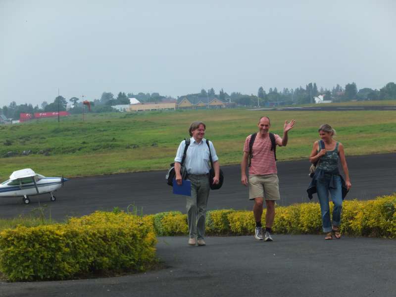
The delay did not matter all that much to us. It only meant that we would arrive at the Aero Club of East Africa later than planned, but even when the bar closes, they hand our room key over to the askari (guard), who forwards it to us when we arrive. In fact, we arrived 10 minutes before midnight, and the bar was still open, with one other guest about to finish his last beer.
That guest turned out to be a pilot and a technical expert on aerial photography from Berlin, so we chatted until long after midnight, when we finally went to bed.
The first two things we had to do were
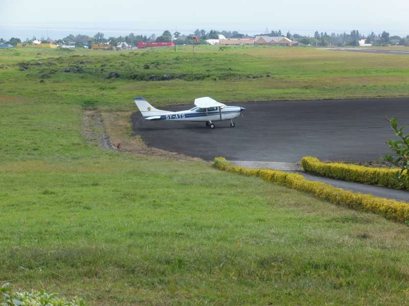
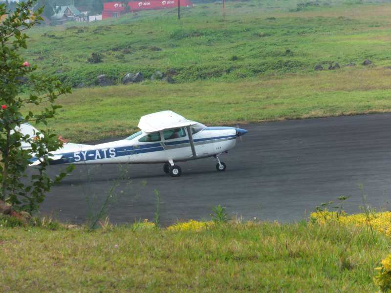
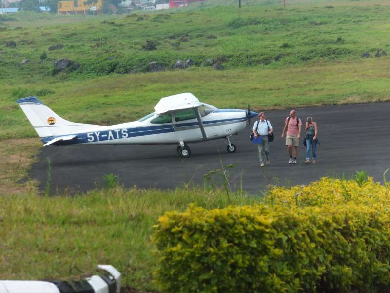
I did both, and then had a checkout flight with a flying instructor, which I passed successfully. The aeroplane, 5Y-ATS (Five Yankee – Alpha Tango Sierra) also turned out to be working fine, so I had a good feeling for our long flight to Rwanda and the Congo border town Gisenyi.
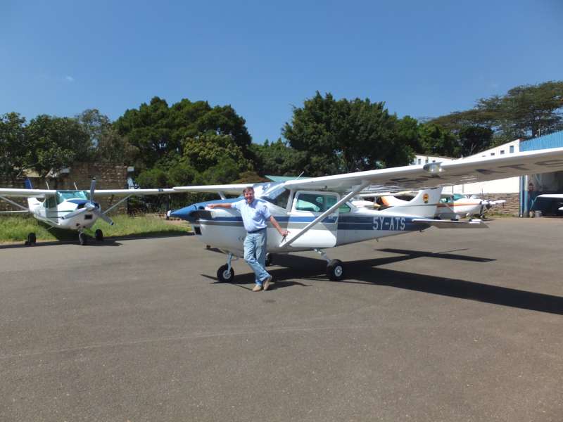

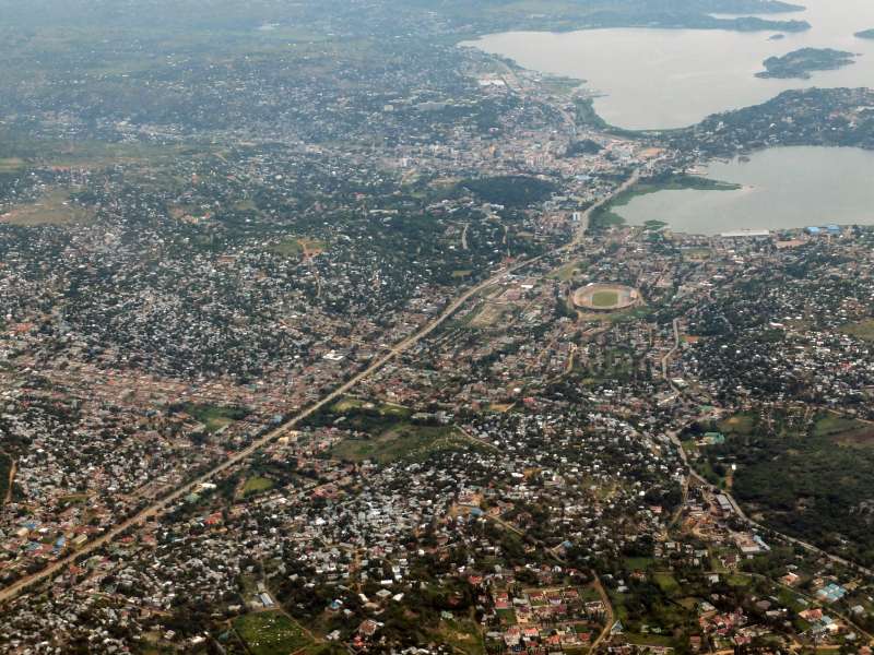
Checking 5Y-ATS; overflying the Kibera slum with the city of Nairobi visible in
the far right.
In the afternoon we began to make more precise plans, wrote some emails and this web page.
The following days were filled almost entirely with the preparations for our flight to Kigali, Rwanda. There is an incredible number of tasks to perform until one can actually take off. Some of these had already been done months ago from Germany, like obtaining the clearances to overfly Tanzania and land in Rwanda. But many more things can only be done here in Kenya. Still I could not do it alone. I needed the help of at least two persons with enough experience to do what I needed to do.
The only work-free exceptions were the evenings in the club, where we met very interesting people, like professional pilots or, for example, the already mentioned guy from Berlin, also a pilot, who installs aerial survey equipment in aeroplanes and then teaches the customers how to fly these planes. Usually these evenings were so interesting that I missed the times in which I could have continued this travel report. So now you know why I did not write earlier.
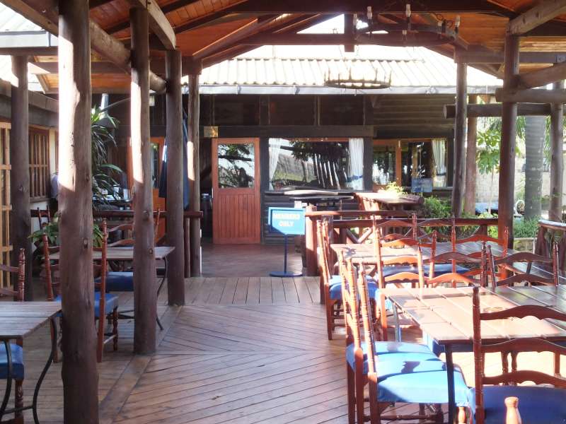
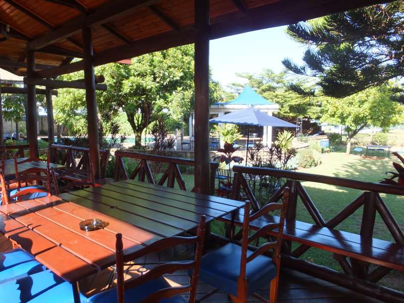
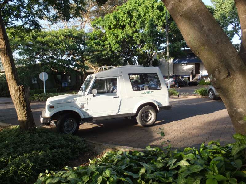
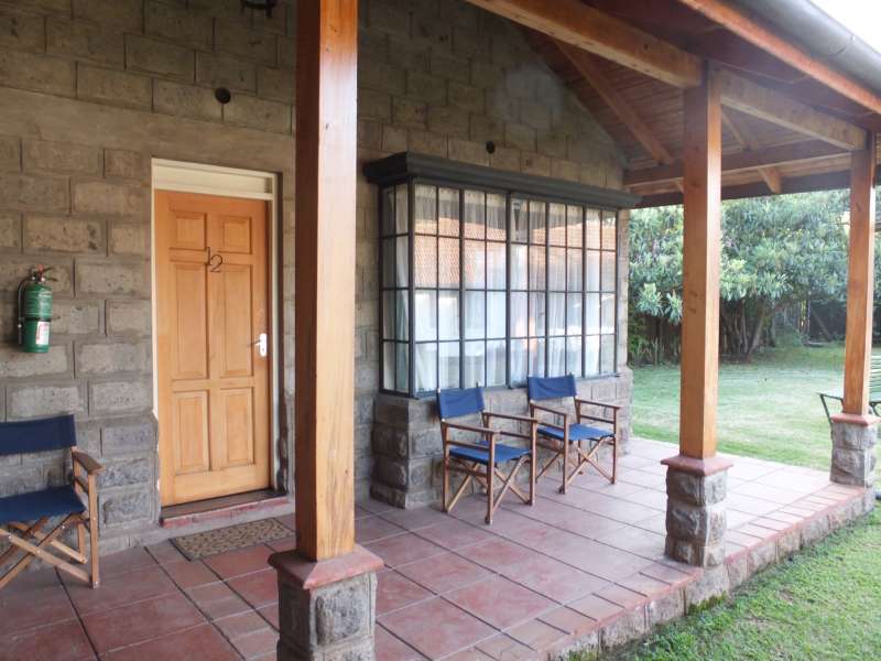
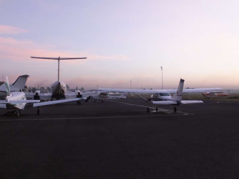
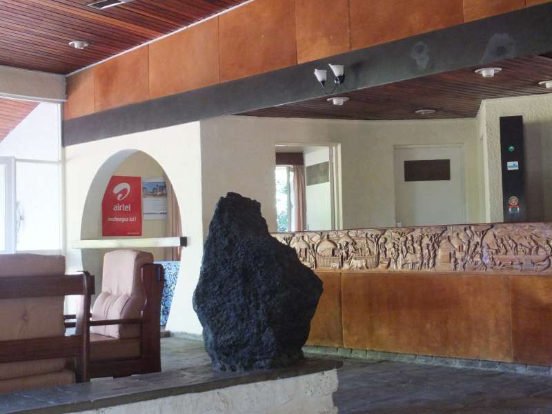
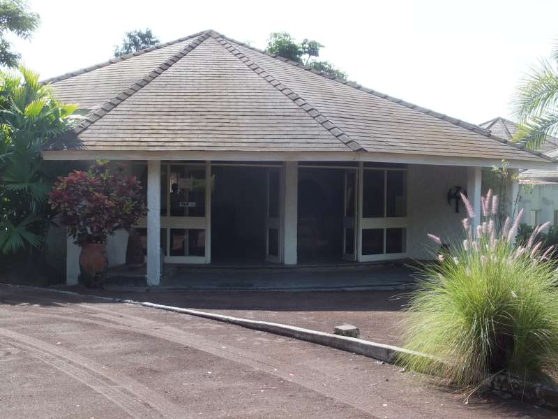
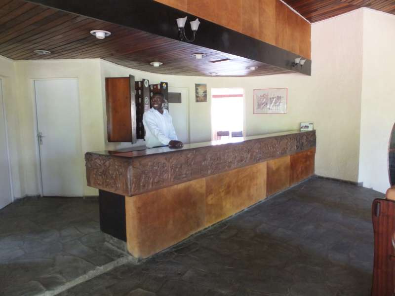
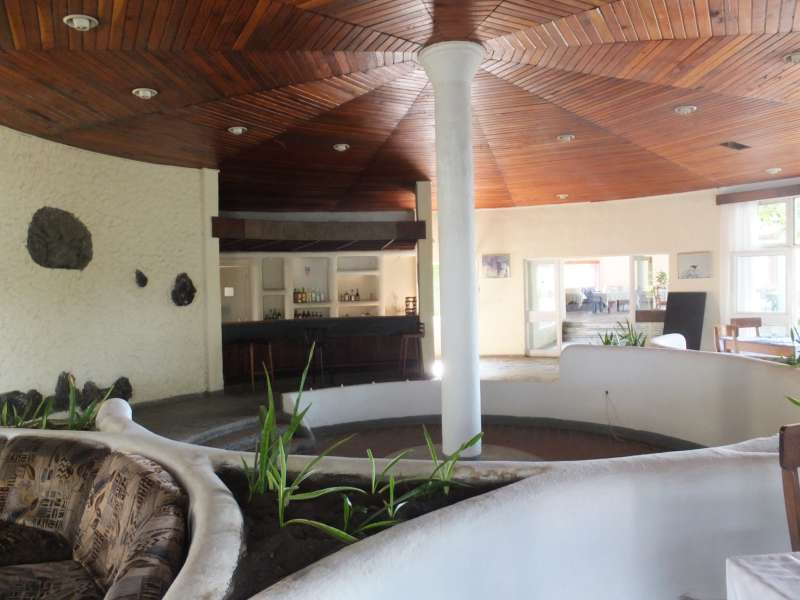
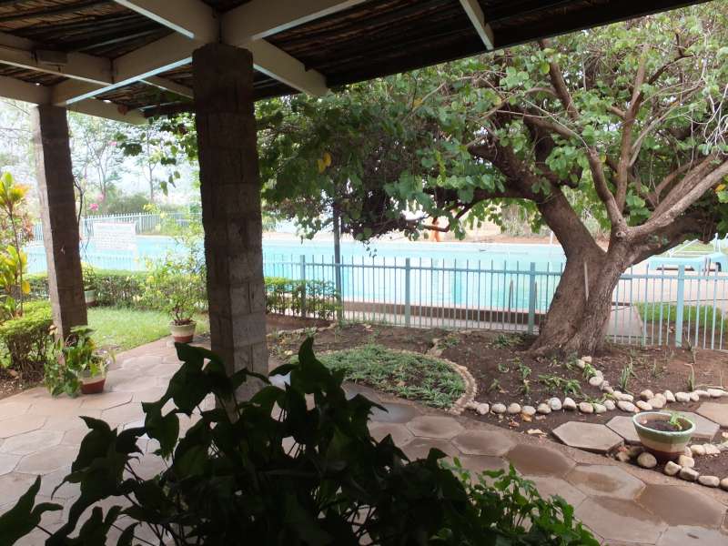
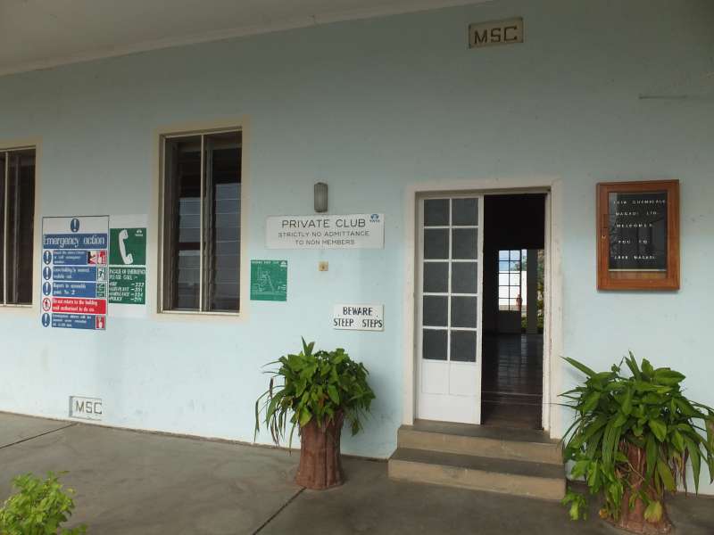
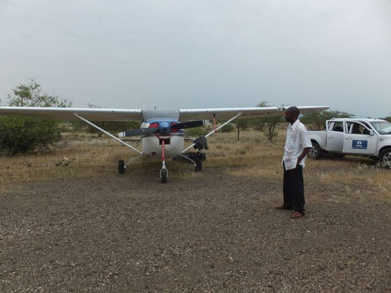
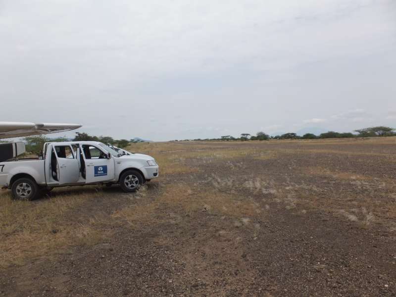
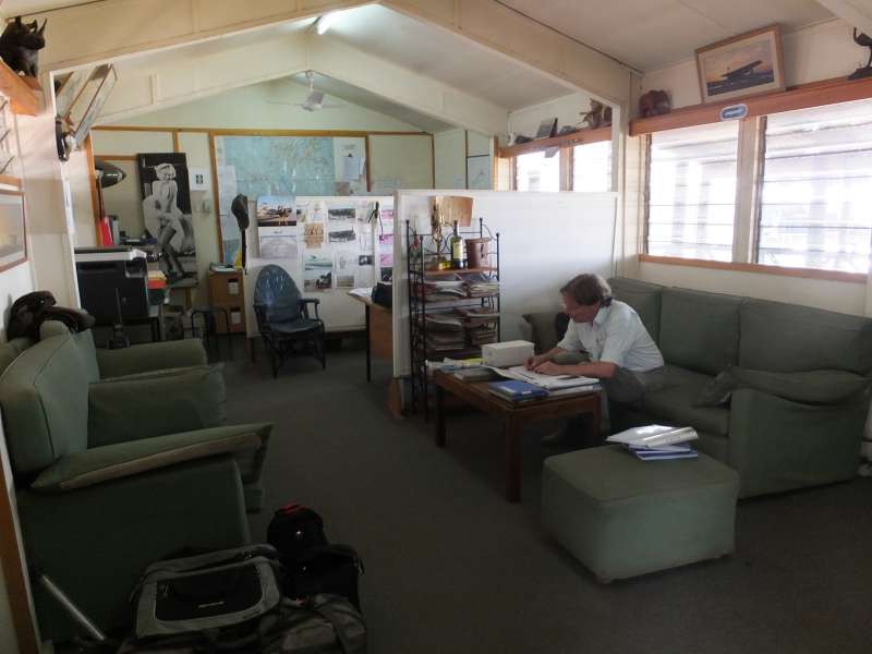
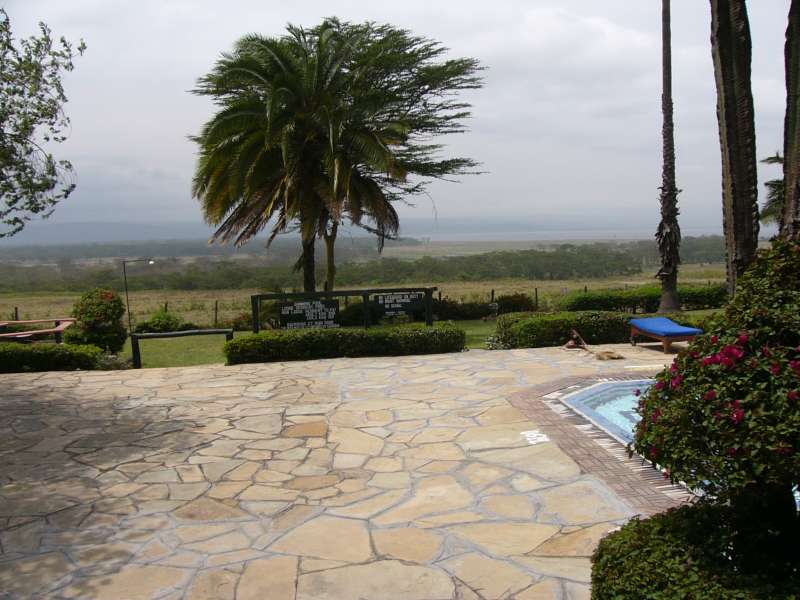
Aero Club of East Africa; our car; our room
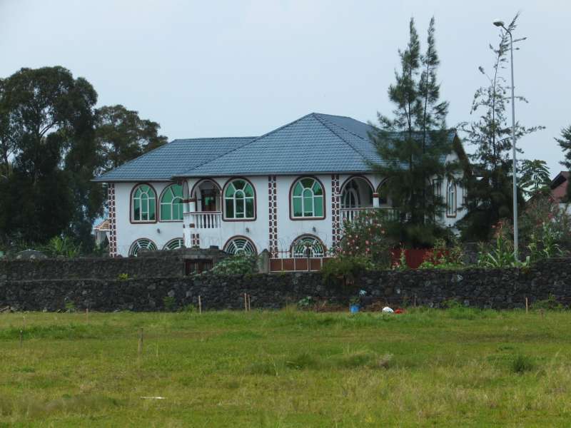
Kenya is fascinating as always. It is a country that is developing incredibly fast. Prices in some restaurants are as high or higher as in Germany, but the quality is also mostly as good. The traffic jams in the mornings and afternoons are terrible though. The streets of Nairobi have not kept up with the increasing number of cars that are bought and driven by the new middle class.
Every day we continued our flight preparations. The biggest scare was when we were told that there is no Avgas (aeroplane petrol) in Kigali. But, fortunately, it turned out that there is a small company there, Akagera Aviation, that sells you a full 200 l barrel, albeit for a very high price, and they hand-pump it into your plane. According to our planning, that was just about the volume we need, so the problem was solved.
On Thursday, 2013-01-24 in the late afternoon, we filed the flight plan and started the procedure to exit Kenya. Our plan was to perform the last bureaucratic tasks the next morning at 6:00, jump into the plane at 6:30, taxi to customs and immigration, do the last things there, like paying departure tax and signing customs forms, and take off at 7:00. It was highly likely that something would delay us, but if we would not even try, we would take off even later. In fact, we took of at 8:00, more or less as I had expected.
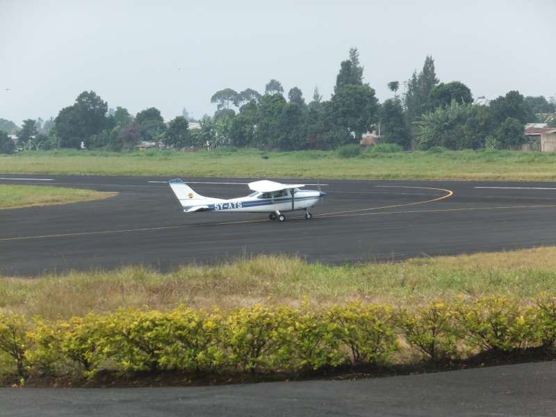
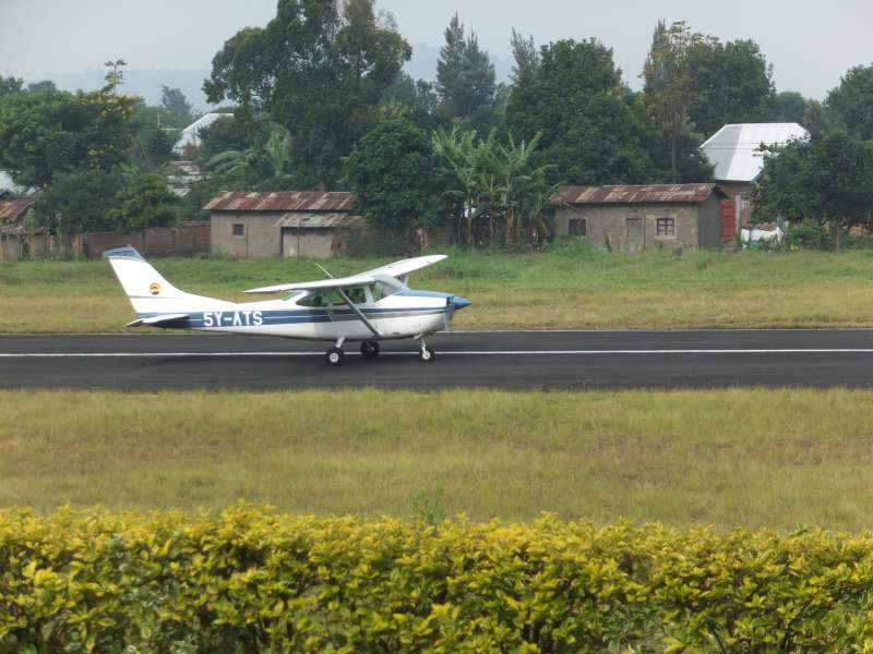
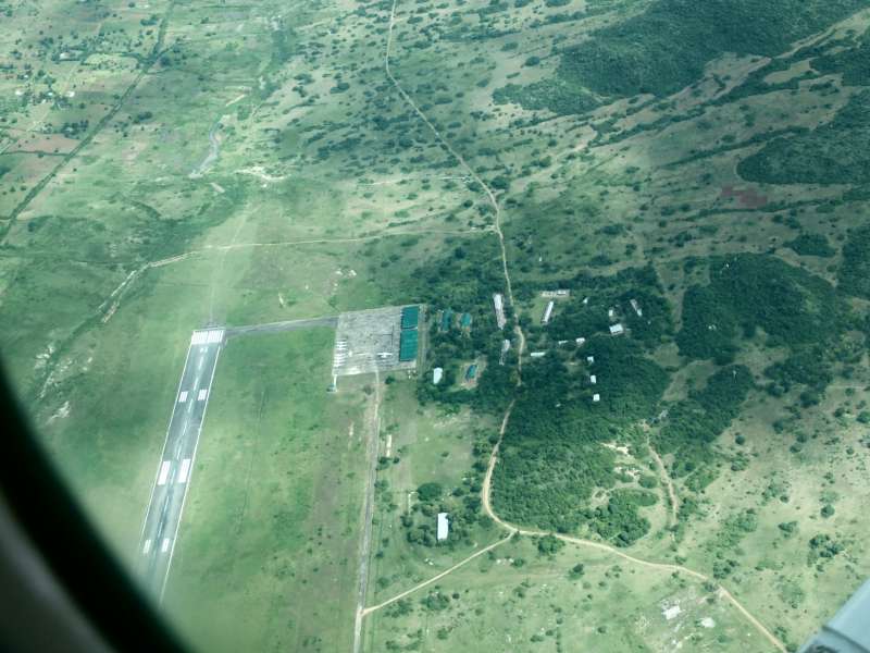
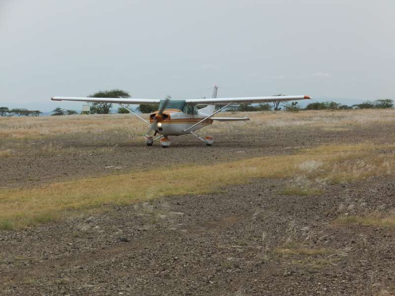
Checkout and training flights around Nairobi Wilson Airport
This was the day of the long flight, the main purpose of our visit. We woke up not long after 5:00 and packed everything. At 6:00 the Aero Club was already open, and the first of the people we needed to finish the last bits of bureaucracy appeared. For example, we had to obtain a fresh weather forecast for Kenya, Tanzania, and Rwanda.
The weather forecast looked good, as expected in the dry season, which was actually the reason why we chose January for this trip.
We checked the aeroplane, a Cessna 182. This is a four-seater with a 6-cylinder, 235 hp engine and long-range tanks for almost 300 l of avgas (petrol for piston-engine aeroplanes), yielding a maximum range of more than 1,500 km under ideal conditions.
With the help of Wellington, the guy who had helped me most to obtain the clearances for Tanzania and Rwanda, we loaded our luggage into the plane. Then I did a thorough pre-flight check.

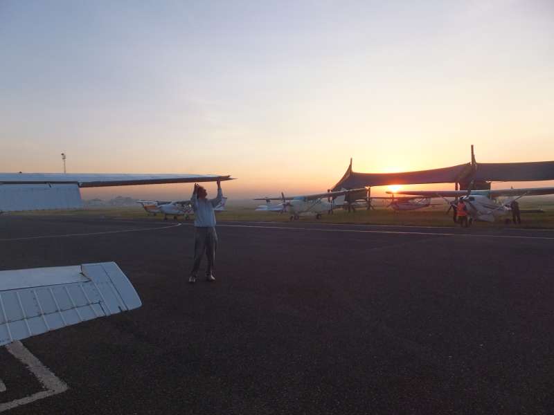
Wilson Airport at sunrise; Wellington and I; checking the plane
Wilson Airport requires us to taxi to the Customs and Immigration building (one of the crazy things in Africa), so we fired up the engine and rolled there to be checked and to fill yet another two forms at the immigration counter, pay a final visit to the toilet ("Tanks full, bladders empty", my instructor used to say), and around 8:00 we were ready to taxi to the runway for takeoff.
An international flight requires some extra details. For example, we got an individual transponder code, in this case 0711, so the radar operators can recognize our flight among the many others in East Africa.
After the final checks of the aeroplane we received our clearance for takeoff and accelerated down runway 14 of Wilson Airport until we lifted off and turned right towards the Ngong Hills.
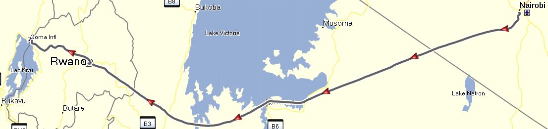
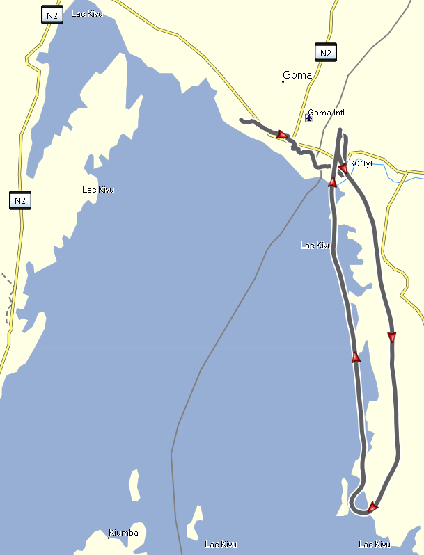
Nairobi – overflying Mwanza – Kigali – Gisenyi
After takeoff there are another few tasks to perform. First the 10° takeoff flaps are retracted, the elevator is retrimmed for best climb performance, the power is reduced to maximum continuous power, and I call the tower to tell them that we are leaving the circuit and set course for Mwanza in northern Tanzania.
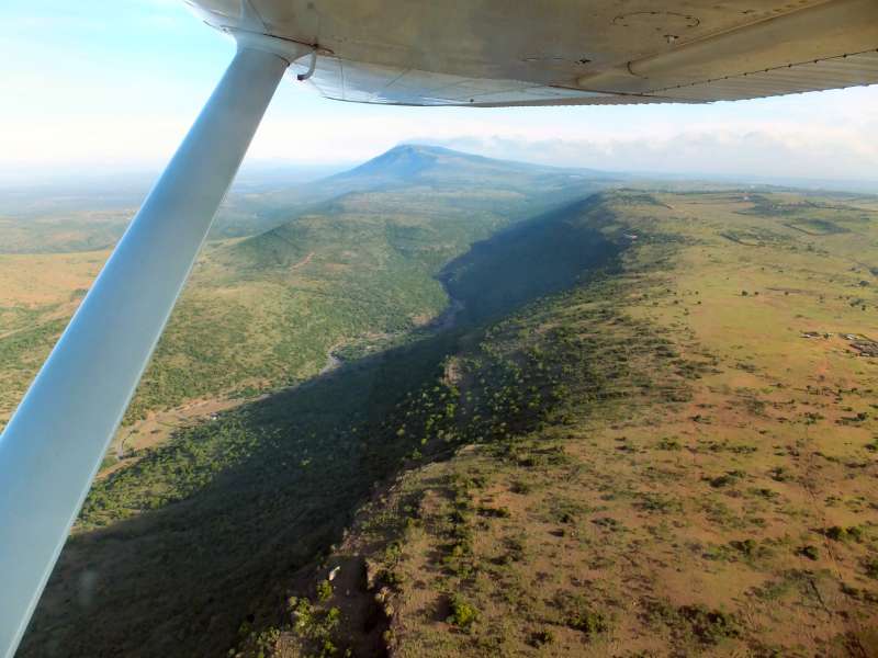

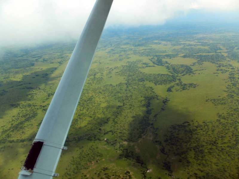
From the plains around Nairobi into the Great Rift Valley. The first two photos
show the Ngong Hills in the background, which mark the edge of the Rift Valley.
Takeoff time was 5:11 UTC. Pilots communicate times only in Greenwich Mean Time, to avoid any mistakes when crossing time zones. In fact, we did fly into another time zone. Rwanda differs from Kenya and Tanzania by one hour. 5:11 UTC is 8:11 local Kenyan time, but 7:11 in Rwanda.
We had first estimated reaching the Tanzanian border at 6:00 UTC, but we quickly found that we had a nice tailwind. So we reduced engine power a little to save fuel, but still had to revise our estimate to 5:55 UTC.
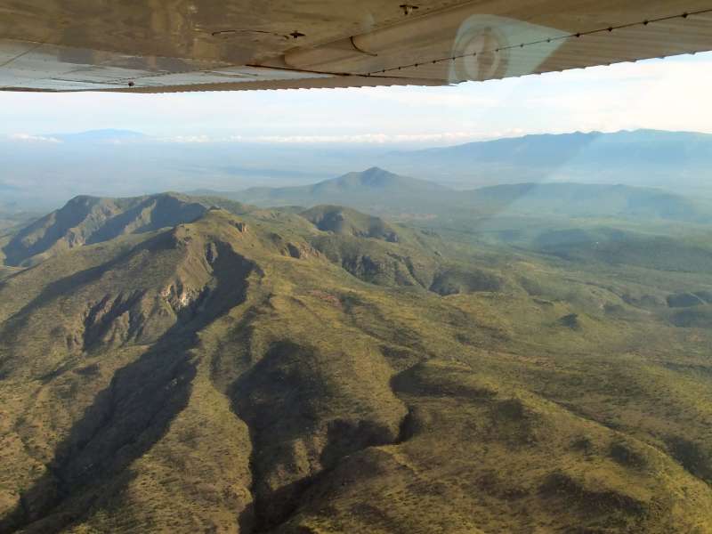
When we reached the Nairobi Control Zone boundary, we said goodbye to the Wilson Tower controller and now talked to the Nairobi Area Control Center, which covers the entire country. 45 min later we reached Tanzania and now flew south of Masai Mara over the northern Serengeti.
Flying over the Serengeti Plains
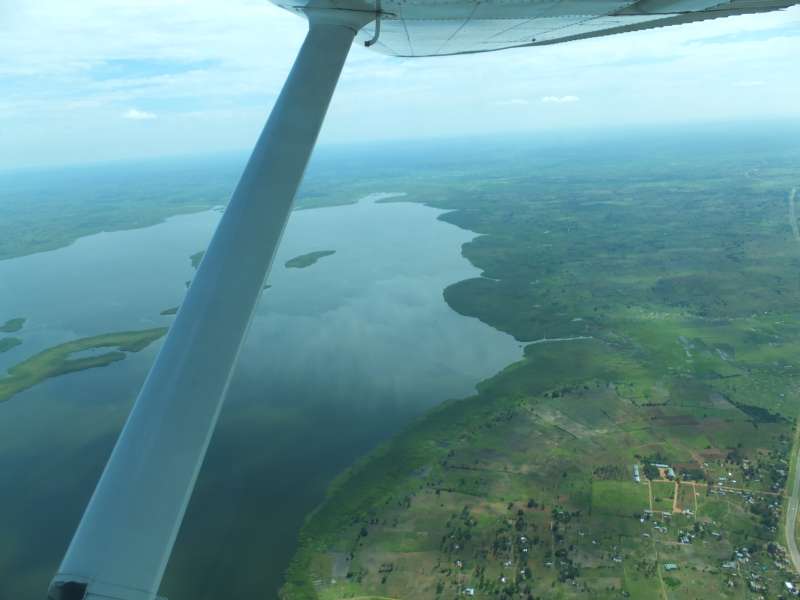
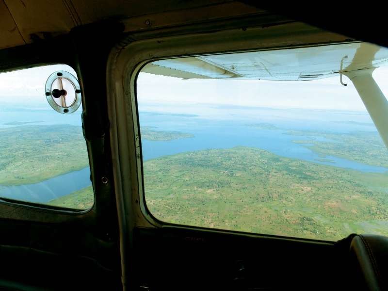
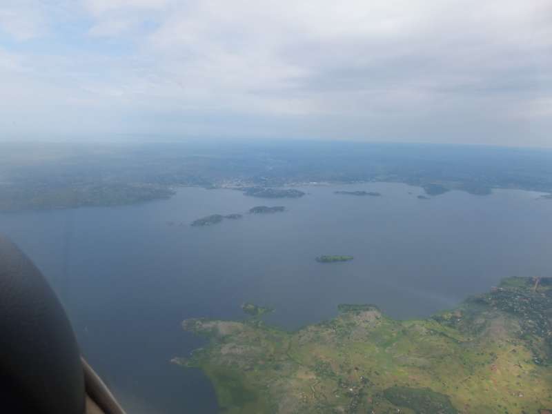
We enjoyed looking down at the Serengeti Plains, but could not make radio contact with Dar es Salaam Control, which covers Tanzania. Since lack of radio contact is not unusual in Africa, we transmitted our intentions blind, which is the common procedure, and happily flew on towards Mwanza on the southern shore of Lake Victoria.
After almost another hour of flying Lake Victoria appeared on the horizon. The lake is huge and gives the impression of an ocean. We kept looking down at the sparsely settled lake shore, until we came closer to Mwanza. The shortest way that avoids any long flight over open water leads directly over Mwanza Airport, which has a control zone with a radius of 30 nautical miles, which is unusually large, but common in parts of East Africa.
Why did we not take the shorter, entirely straight route across Lake Victoria? The simple reason is that we have only one engine. When it fails over land, we glide down and land on an airfield, on a road, or in the bush, which is well survivable.
A water landing is also well survivable, but we would lose the plane, which would sink within minutes, and we would probably die in the lake, unless a boat happened to be near, by very lucky coincidence. Swimming 100 km to the shore would be difficult, and avoiding the crocodiles near the shore might be similarly difficult. Besides, dying from being torn apart by crocodiles is not exactly my favorite way to die.
Therefore we flew the southern detour via Mwanza and stayed withing gliding distance of the shore at all times, meaning that we could always reach the shore in case of an engine failure.
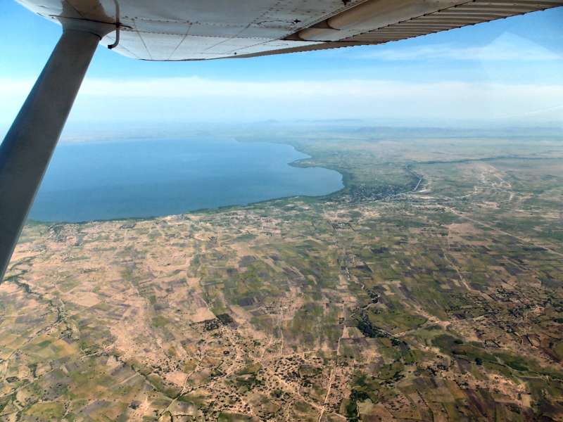
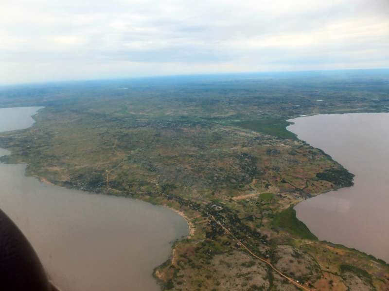
The southern shore of Lake Victoria
We called Mwanza Tower and asked for permission to fly through their control zone and over their airport. The permission was granted, and we continued along the shore.
100 km (60 nm) later, after overflying Mwanza at 7:10 UTC, we left the control zone and retried Dar Centre again. This time it worked. I think they must have a transmitter right at Mwanza. We communicated our flight data. Not long thereafter we lost contact again. Perhaps the transmitter in our plane was not particularly strong.
Most of the land in northern Tanzania looked like grassland to us. Now, in the dry season, the grass looked yellow to light brown. Only the Serengeti still looked green, perhaps because of its many rivers and creeks.
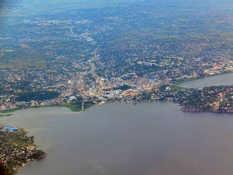
We reached Rwandan airspace at 8:15 UTC, called Kigali Approach, and were, to my surprise, directed to call again when we were on final approach, i.e. a few minutes before touchdown. This meant that there was no other traffic.
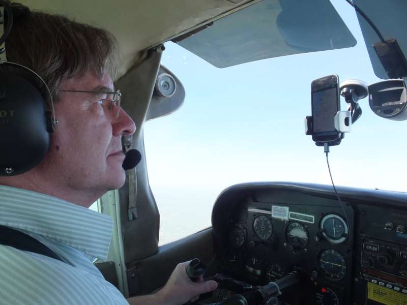
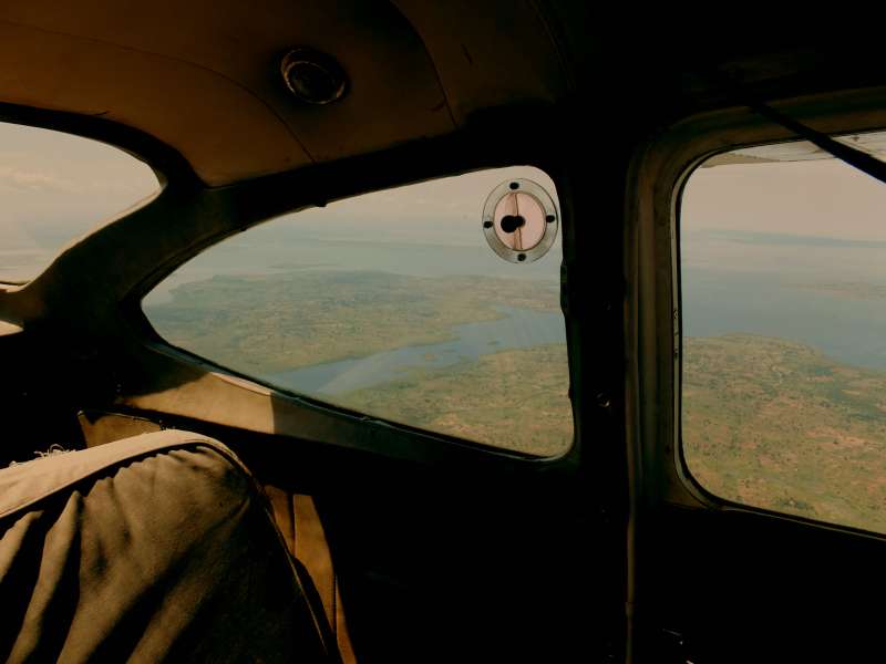
The approach to Kigali was very interesting, because the sky was hazy, and we could not see much farther than about 10 km at best. This means that our approach was essentially done on instruments, in this case my smartphone, which was attached to the windshield and equipped with an excellent navigation and mapping program. It showed me the exact direction and the time to the airport to the second, so the only thing I still had to do in my head was to calculate the rate of descent and the desired altitude at any time of the approach. I planned for a descent rate of 300 ft/min and approached the airport without seeing it.
We flew for quite some time over densely populated areas around Kigali, a hilly area with little criss-crossing valleys. Since we don't do this often, it was a strange feeling to fly on and on, descending lower and lower, without seeing the airport we were approaching. But suddenly, just 3 min before landing, the airport showed up before us at the exact right position and angle for landing. Our navigation had been perfect.
We kept flying over the huge, 3.5 km long runway to avoid having to roll along it for an inordinate time, then, at 8:40 UTC, touched down not too far before the turnoff onto the apron, where a few big airliners were parked. Our plane was the only small one and looked tiny, next to a big plane that was parked there.
Immediately a big passenger bus came to our plane to take us to the arrivals hall. We secured the aeroplane, hopped on the bus, and were taken to arrivals, where we had to fill the usual immigration forms.
I also got a phone call from the lady, with whom we had arranged the refuelling. She must have noticed our small plane. She came over to arrivals, welcomed us, and we all went back to our plane to fill the tanks. Two workers rolled a 200 l barrel to our plane and used a hand pump to fill up. I climbed on the plane's wing to unlock the tank lid, hold the hose into the tank, and shout when the tank filled up to prevent overflowing.
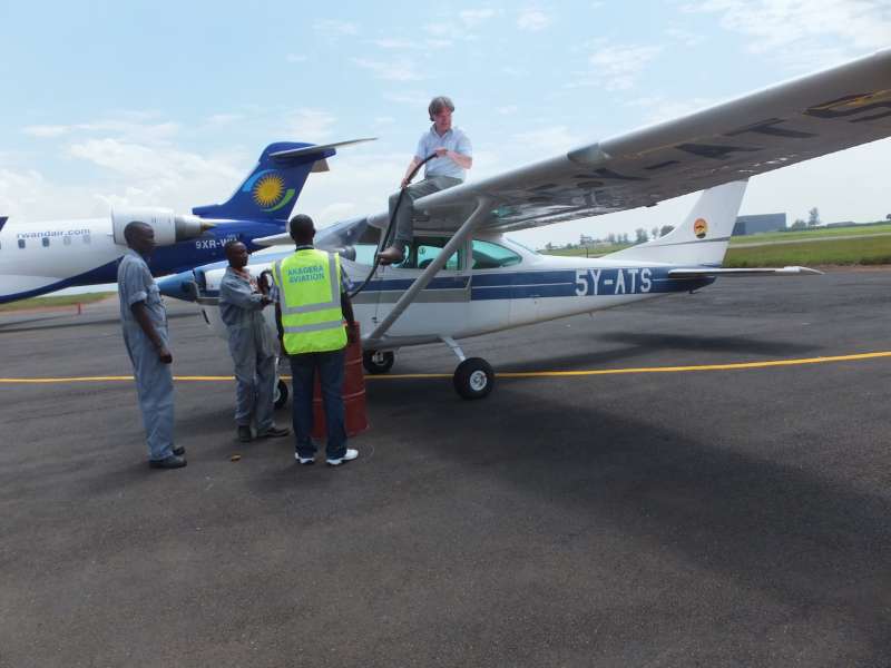
Filling the tank on Kigali International Airport
We filled only one tank and agreed to fill the rest when we would return from Gisenyi on Wednesday. All the petrol would not have fit anyway, and we did not want full tanks, because we still wanted to do a small sightseeing flight around Gisenyi with our hosts, for which we did not want the plane to be heavier than necessary.
After refuelling we filed a flight plan for Gisenyi and took off at 11:07 UTC. The controller reminded us not to come close to city of Kigali to prevent noise pollution, so we flew around the city in a wide arc, then set course for Gisenyi.
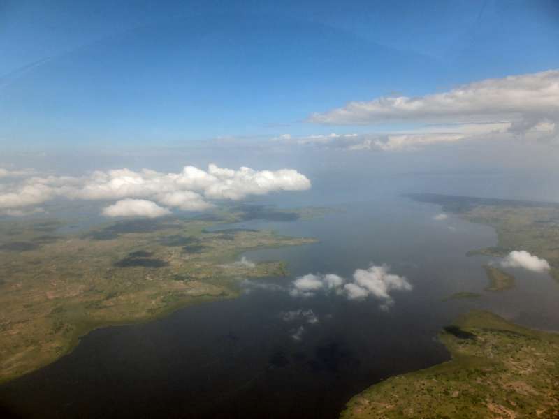
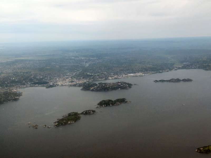
After leaving the Kigali Control Zone and coming closer to the Goma Control Zone, which covers both Goma and Giseny, we called Goma Tower, but received no reply. We reduced our speed and climbed higher in the hope to get a connection, but we remained unsuccessful. So we continued towards Goma and kept calling, when we heard another plane talking to Goma Tower. We asked them to relay our message and were asked by Goma Tower to report final approach to Gisenyi. At that time we could already hear Goma Tower, but Goma Tower still could not hear us, possibly because of the high mountain range in between.
We descended towards Lake Kivu, zig-zagging around some clouds, then first saw the big Goma airport. Cross-checking with the GPS, we got the direction towards Gisenyi airport, which, coming from the south, was just to the right of it, some two kilometers to the east. In between is the border between Rwanda and the Congo.
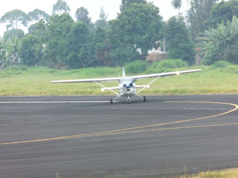
We turned final for Gisenyi runway 01 and called Goma Tower, as requested. Now Goma handed us over to Gisenyi Tower, and Gisenyi cleared us for landing.
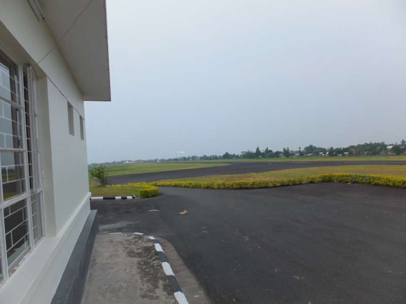
We landed at 11:46 UTC, just one minute after our ETA (Estimated Time of Arrival), in the early afternoon, unloaded our luggage, locked and secured the plane, and walked over to the small airport building. We were expecting our hosts there, who had already announced that they would collect us.
On the ground on Gisenyi Airport
But nobody was there. So we sat down and waited, while checking our mobile phones. As it turned out, the phone system had been down for hours, so our SMS text messages had either not been sent or had not been delivered. Our friends had no idea that we were already there. When I tried to call them, I heard only a taped message that the number was not reachable.
Fortunately a short time later I received a telephone call from Georg, our host, who had now received the messages after the phone system had come back to life. He said he would meet us at the Grande Barrière, the major border crossing point, and help us to cross the border into the Congo.
When we asked for a taxi, a woman came forward and directed us to her car, an SUV without taxi markings, and took us into the town. I tried to get some Rwandese money from an ATM, but my first little problem was that I did not even know the name of the Rwandese currency. All attempts to ask our "taxi" driver for that name failed, because she could only understand French, but our French is somewhere between minimal and nonexistent. All attempts to convey a meta-language concept, like the name of the currency, failed.
The ATM we eventually found accepted my credit card and asked me how much money I wanted, but then said that the transaction cannot be completed. So much for modern technology. We gave up on the money, but at least found out that the currency is named Rwandese Franc. As it turned out, we never needed any Rwandese Franc. Our taxi driver gladly accepted US dollars and explained to us that the taxi prices on the other side of the border are only a quarter of hers and we should not think that we had overpaid her.
We drove on to the Grande Barrière. Our driver said that she cannot drive up to the actual border point and stopped in a little courtyard. Then she helped us carry our luggage to the border.
When we reached the border, Georg appeared. After a happy greeting he led us to the first counter, where we had to fill the Rwandan immigration form for leaving the country. Georg's wife Judith also appeared and greeted us with enthusiasm, partly because we were their first visitors after their two years in Goma.
Then we crossed the border and came to the next counter, where we swapped the visa applications, which our hosts had already prepared, for visa stamps in our passports. Unfortunately, Mausi's entry in the visa book was the last one on the current page, so the female officer opened the next page and pulled out a ruler to draw the vertical lines for the various data entry fields. After doing that with unbelievable, un-African precision, it was my turn to get recorded.
There had always been some uncertainty whether anything would go wrong and we would not get our visa, so we were relieved to finally receive the stamps and walk into the Congo. Our hosts had parked their Yamaha Enduro motorcycles at the border. We loaded our luggage onto the motorbikes and drove off in northwesterly direction, essentially along the lake shore.
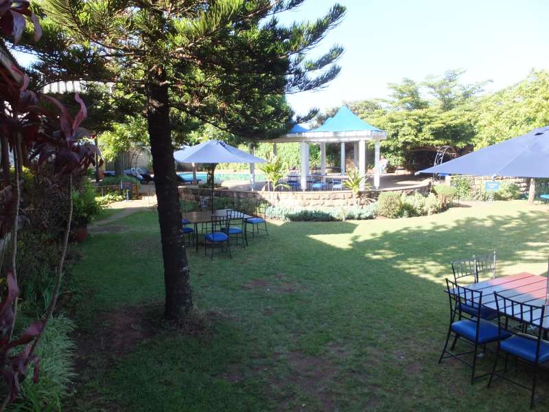
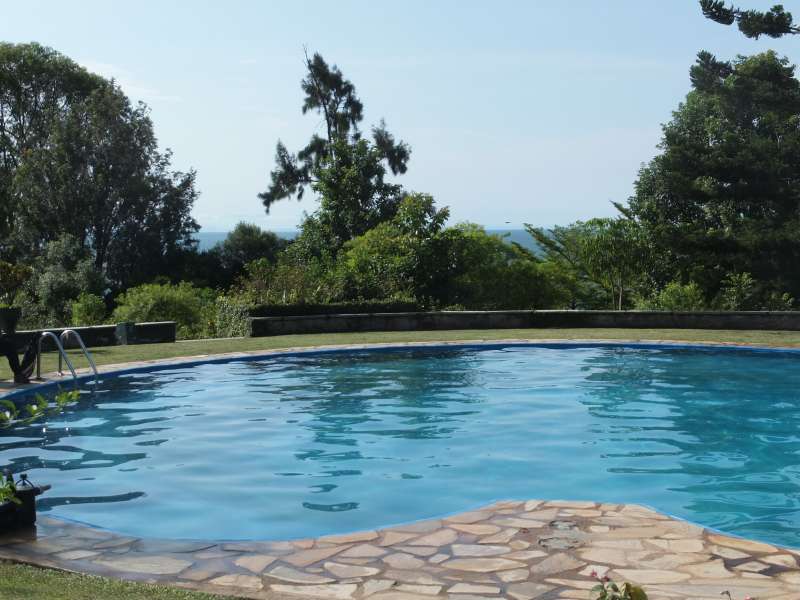
After a short while the paved road turned into a dirt road, and we were told that there are no further paved roads in Goma. Our ride took about 20 minutes, until we reached the beautiful garden of the Hotel, where Judith and Georg live.
We settled into our nice room with a view overlooking Lake Kivu, walked over to Judith and Georg, who had invited us for dinner, and had a long chat covering all the essentials and the situation in the eastern Congo (see appendix). Finally we went to bed to sleep for a long time after this demanding day.
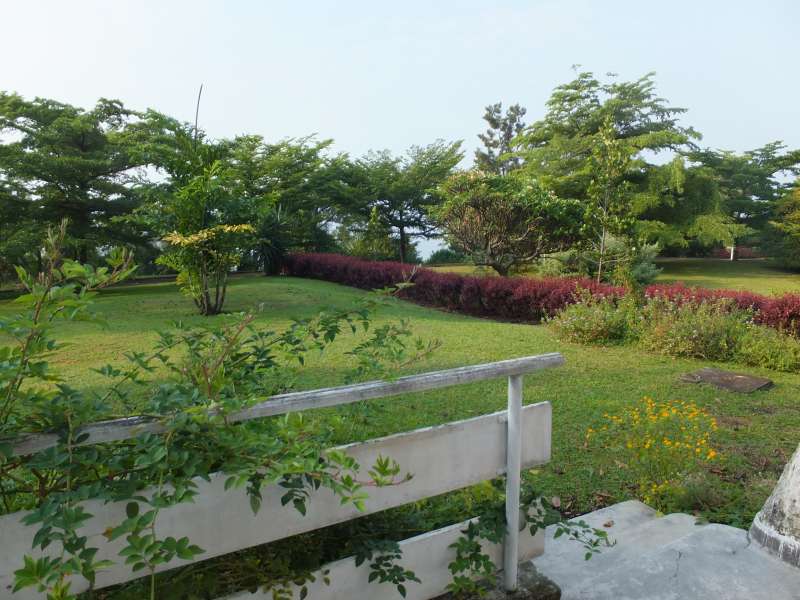
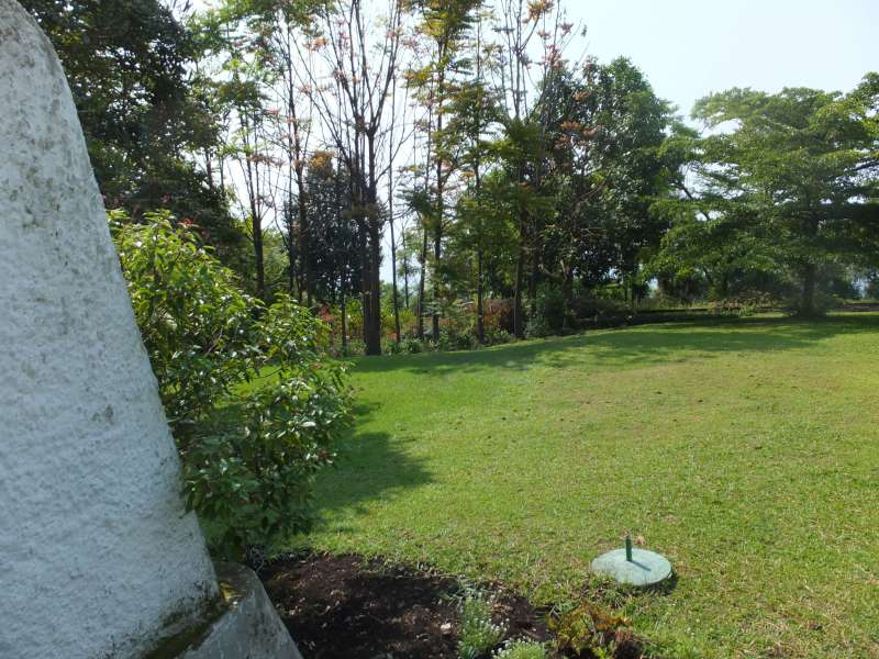
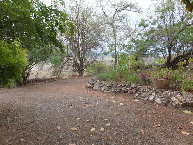
After a good night's rest we got up and strolled through the hotel compound and took a few photos, showing the hotel garden. On some of them you can see Lake Kivu in the background.
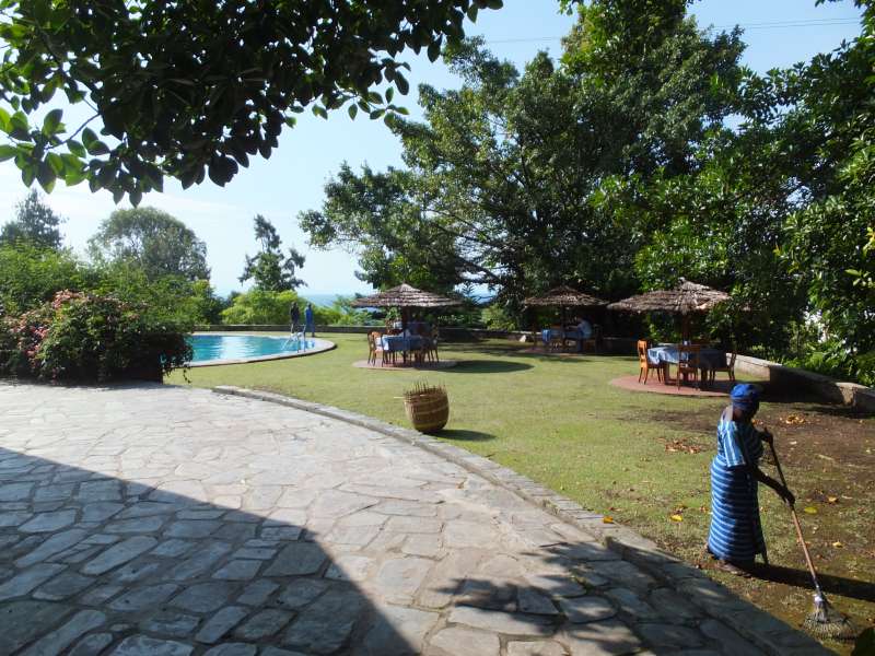
Das Hotel in Goma
We met with our hosts for a small breakfast and chatted about many things, particularly again the political situation in Goma.
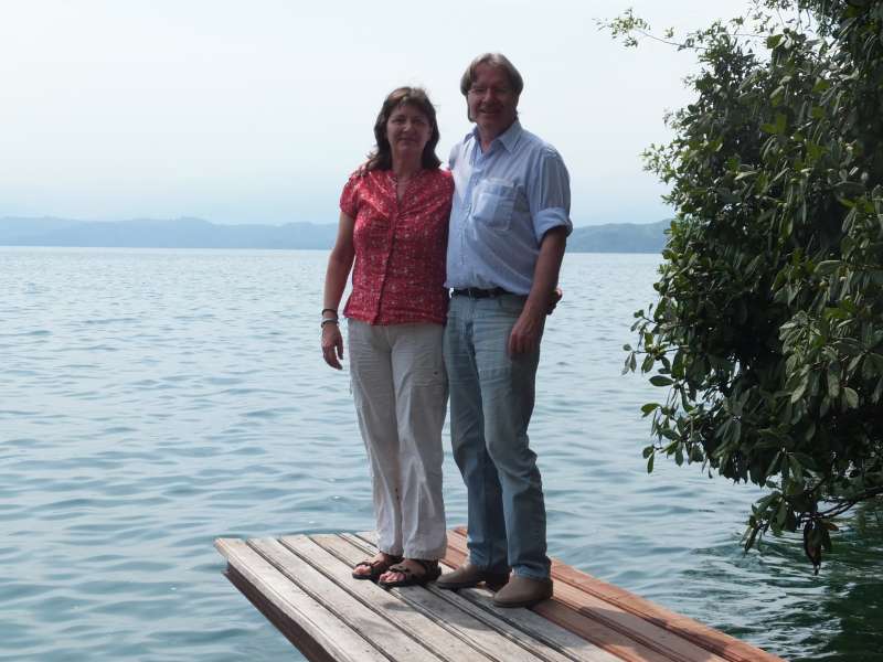
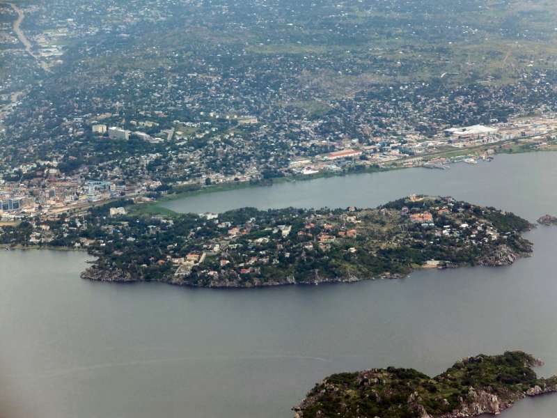
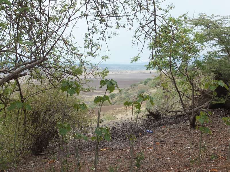
Lake Kivu
In the afternoon we took to the motorcycles to ride to one of the several very nice restaurants in Goma, the "Lac Kivu Lodge", which belongs to another hotel. We sat on a terrace, overlooking Lake Kivu, which is four times as large as the largest lake in Germany, and had a very good dinner. To sit and eat in such a situation in one of the poorest countries of the world feels unreal.

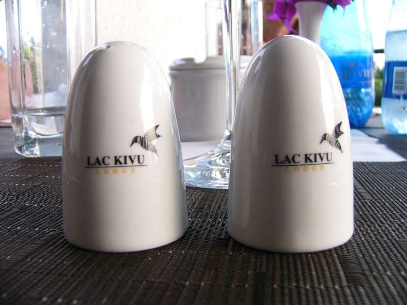
Early dinner in the Lac Kivu Lodge
In fact, the Congo should be rich because of its valuable minerals, but the uncertain political situation and the pervasive corruption waste this wealth and keep the people poor.
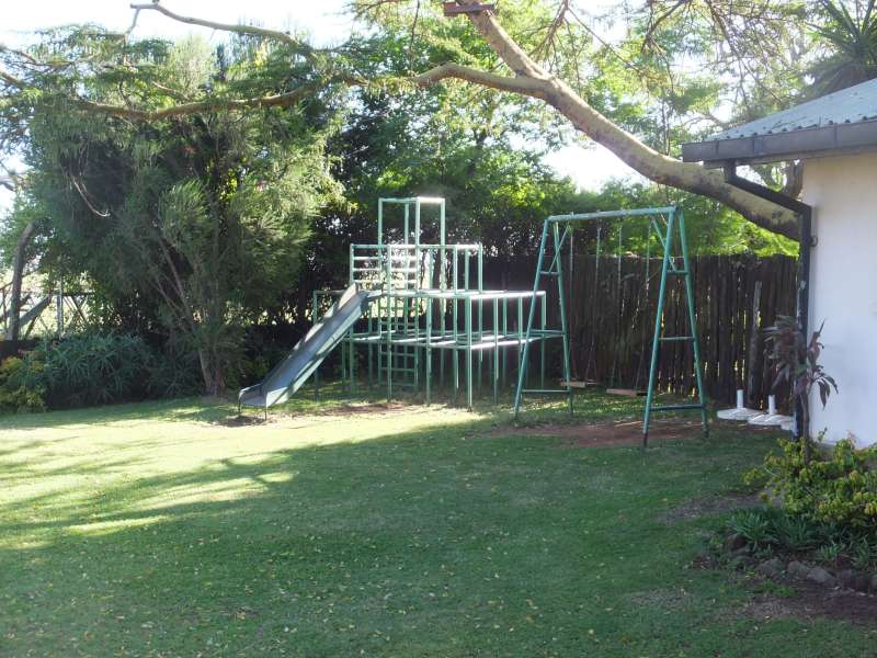
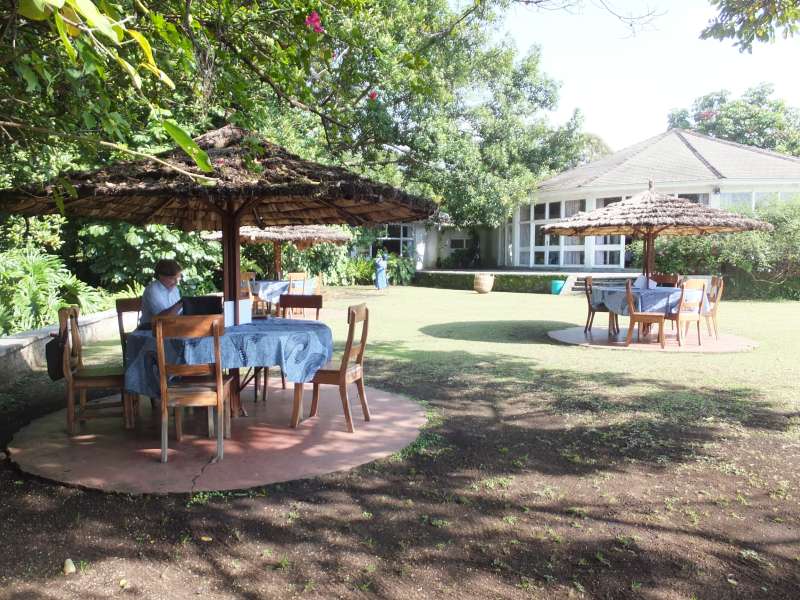
In the morning we took a few more photos of the beautiful hotel compound.
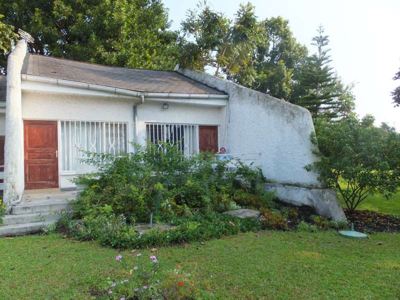
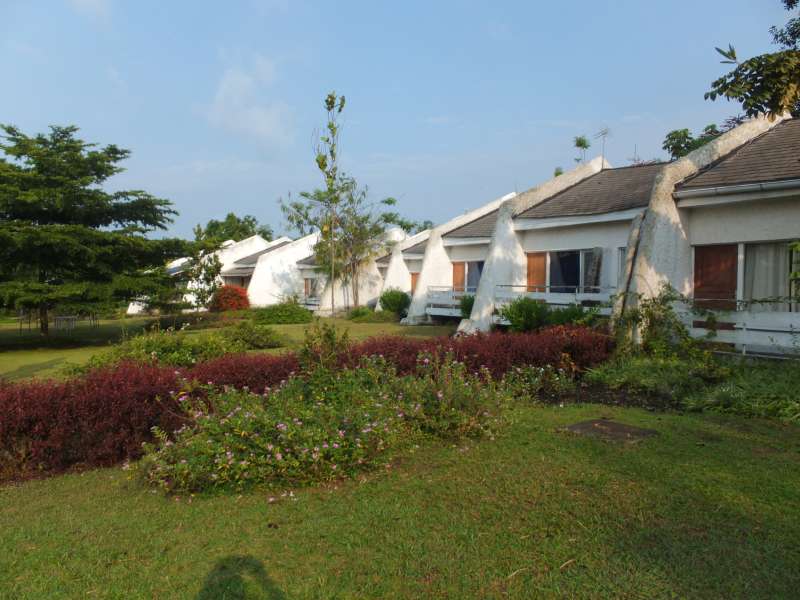
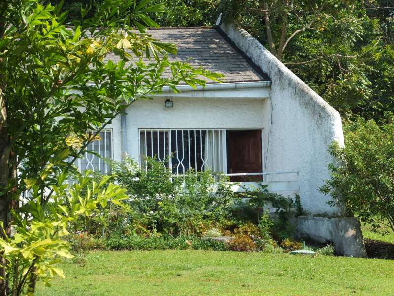
More photos of the hotel compound
Eventually our hosts came, after their morning jog.
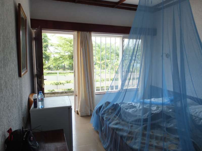
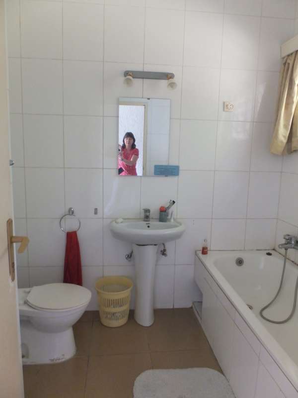
Our hotel room and bathroom
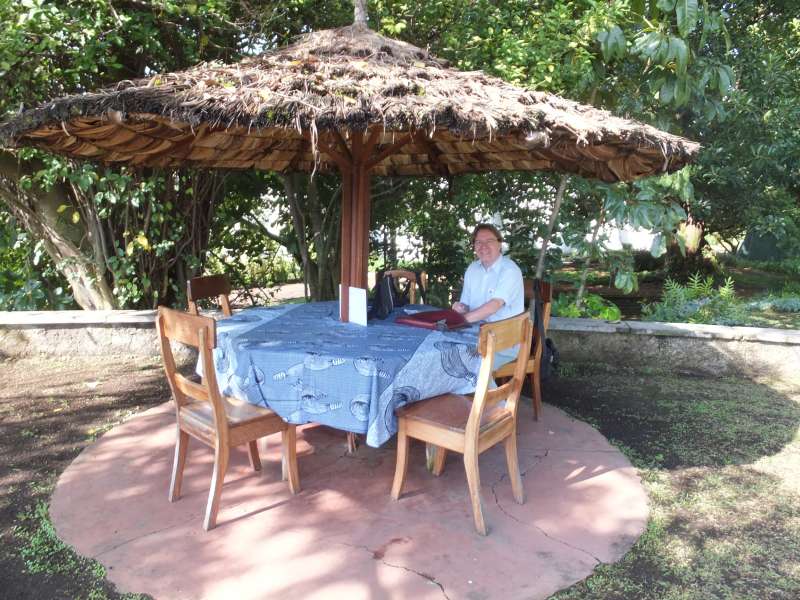
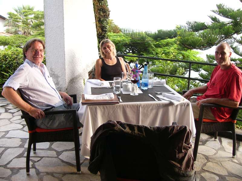
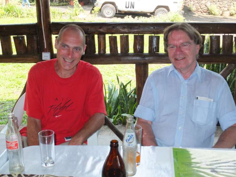
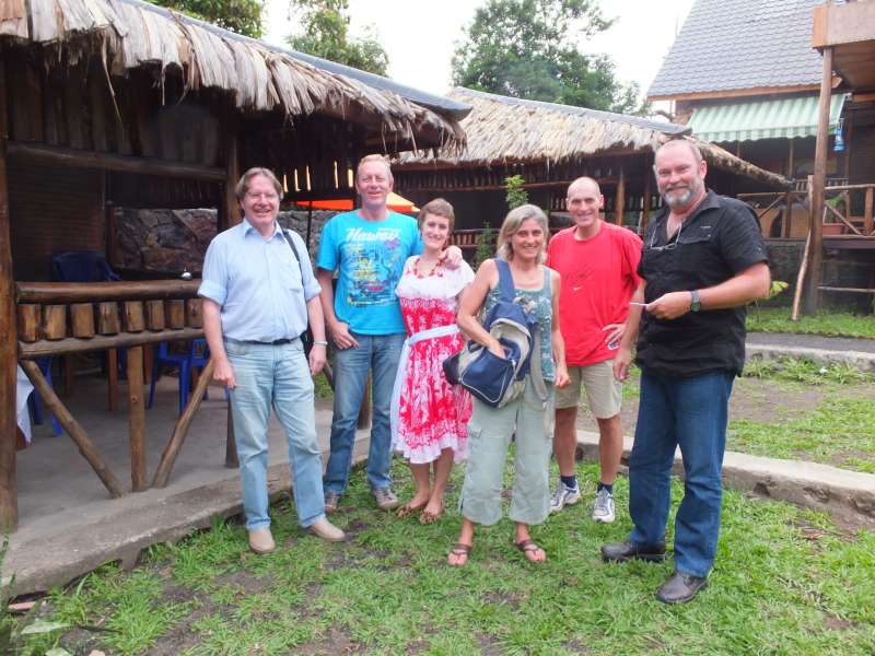
We walked over to the nearby home of friends of our hosts, Mania and Dries from South Africa. We reached their wonderful villa on the lake shore and had a drink with them. Then they took us to a new restaurant, the "Cotton Club", which everyone wanted to check out. This was also the first time we used a car, rather than motorcycles, in Goma.
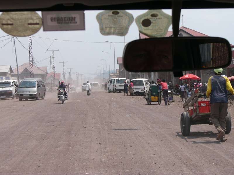


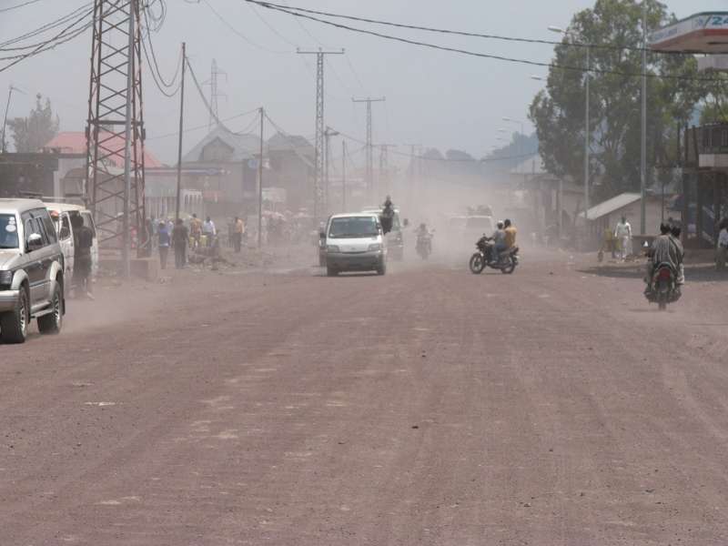
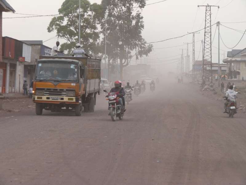
Driving through the dusty streets of Goma

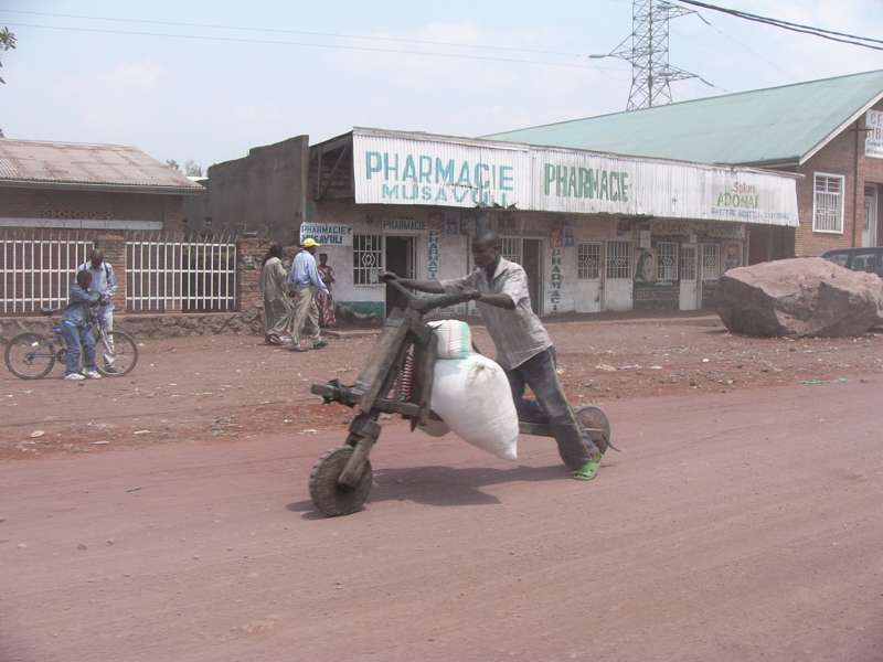
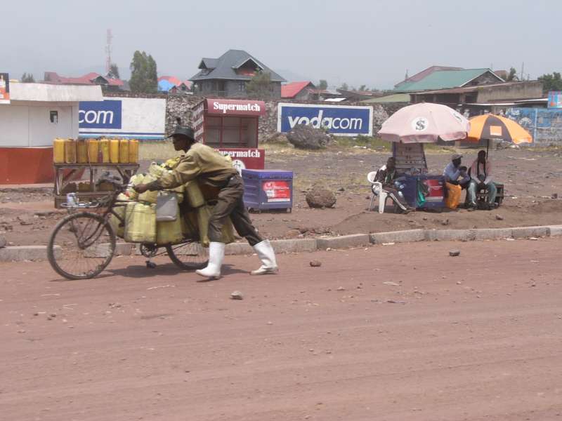
Means of transport
We drove through the dusty dirt roads of the city of Goma and reached the "Cotton Club", which turned out to be a very good, partly open-air, bar and restaurant with good to excellent food.


The Cotton Club
After lunch we drove back to the villa and spent the afternoon there, talking about jobs and Goma, the eastern Congo and Rwanda in general, and about the strange life here under the constant threat of the next rebel attack.
Driving back
Finally we walked the short distance from their villa to our temporary home in our hotel.
From our breakfast table we watched a
Palm-nut Vulture (Gypohierax
angolensis, also called Vulturine Fish Eagle or, in German, Palmgeier
or Geierseeadler) in the hotel garden.
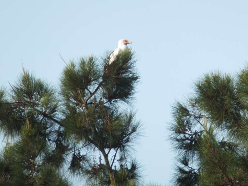
Palm-nut vulture in the hotel garden
The highlight today was our visit to Radio Tayina 88.2 MHz in Goma. Because Judith was already in town with her bicycle (not her motorcycle), the remaining three of us walked out of the hotel after a good hotel breakfast and looked for motorcycle taxis, usually called mototaxis here, typically young men on motorcycles, who take paying passengers. This is one of the major means of "public" transport in Goma. I have not seen any "normal" taxi cabs here so far, but was assured that there are some.
The motorcycles are mostly of the same or a similar type to that which Judith and Georg ride, the Yamaha Enduro with a four-stroke, single-cylinder, 200 cm² engine. Because of the bad roads they usually drive slowly, so our fear of dying on the road remained within limits.
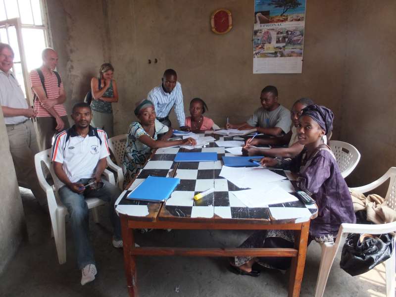
I had promised to hold a lecture about designing a simple web site, for example one based on an easy-to-manage Content Management System like Wordpress. The radio station, also interested, had offered a room for the lecture.
People from several different small organizations, concerned mostly with nature conservation and improving the city of Goma, assembled, and I shared some of my knowledge about how to create web sites. Including questions, it took about two hours, and, as far as I could tell, people perceived the lecture as useful. Of course I missed the usual amenities, like a computer with an Internet connection and a projector, so the lecture remained somewhat theoretical, but that was all the circumstances allowed.
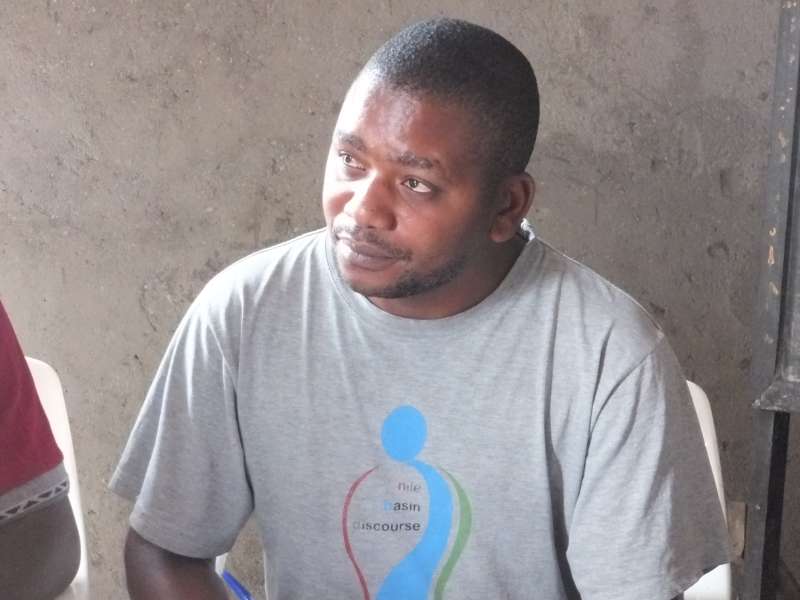
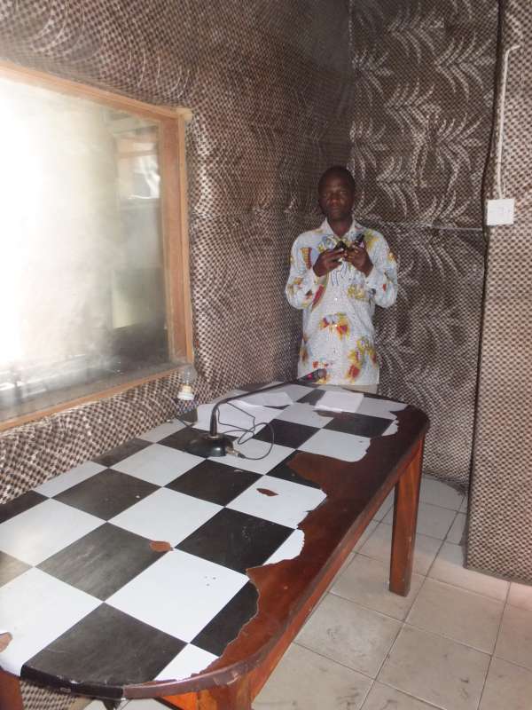
Preparing for the lecture; the director of Radio Tayina
Afterwards we were allowed to tour the radio station, which was very interesting for me. Radio Tayina runs a 2 kW transmitter on the frequency of 88.2 MHz. They have 15 editorial journalists, of whom we met 7, they have at least one lady running a sound processing computer, and the director, Jaques.
They have an editors' room, a sound-proofed speaker chamber with the microphone, and a sound control room with a view through a glass window into the microphone room. Many of the transmissions are done live. We noticed that the journalists did not even have a single computer there. We can only guess that journalistic research must be difficult under these conditions.
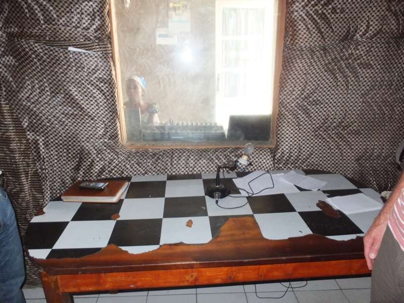
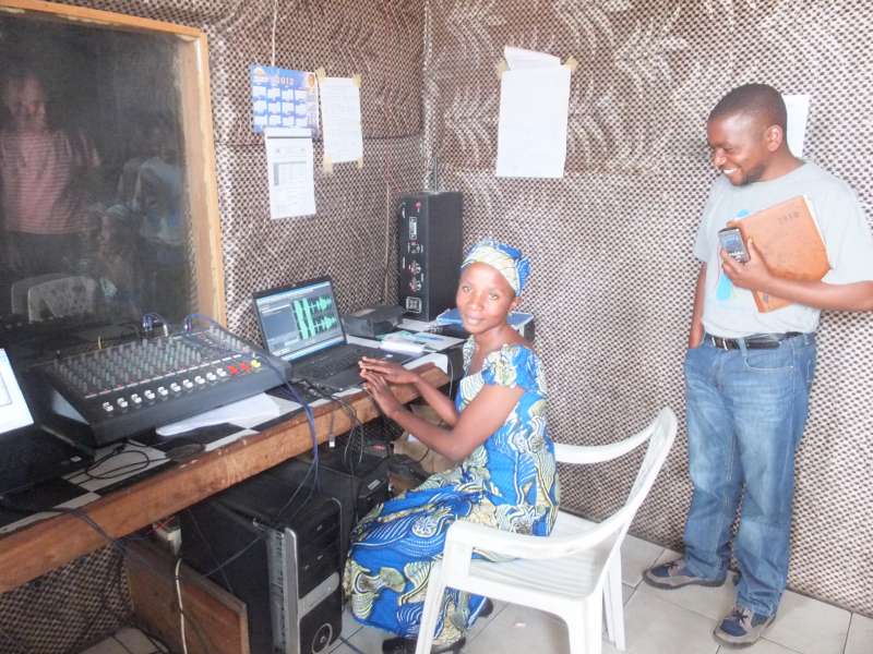
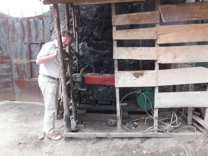
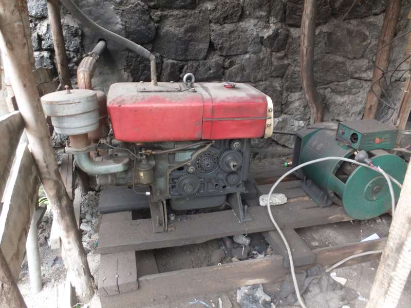
Radio Tayina journalists room, microphone room, sound studio, generator
We walked back and used mototaxis to get back to our hotel.
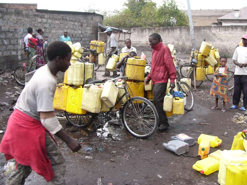
City street; water distribution
In the evening we had dinner, this time in the hotel, which was reasonably good, and we worked a bit on our smartphones, sharing experiences.
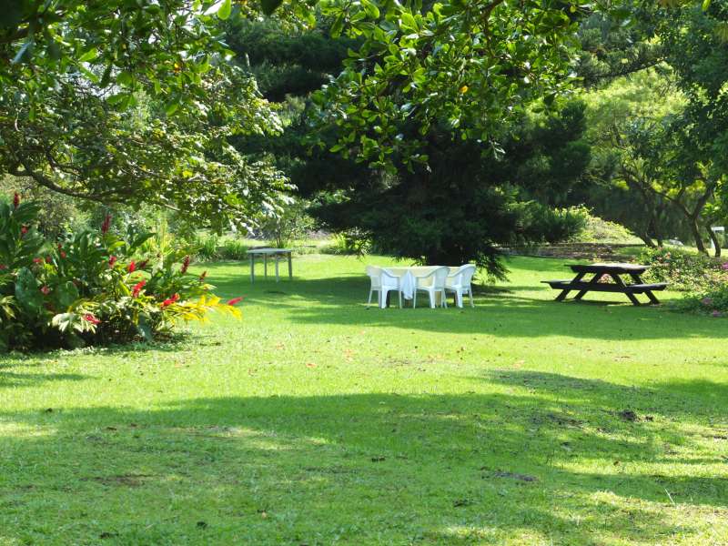
We enjoyed the morning on the terrace of our hosts. A banana plant grows directly in front of it.

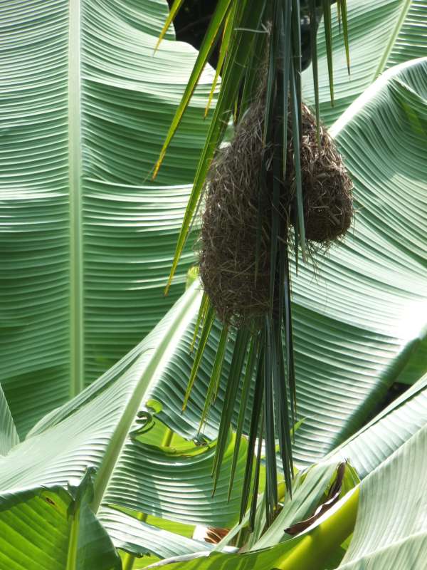
Hotel garden with bananas and weaver birds' nests
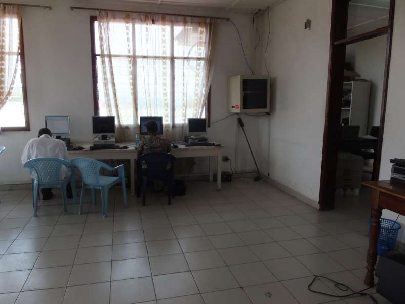
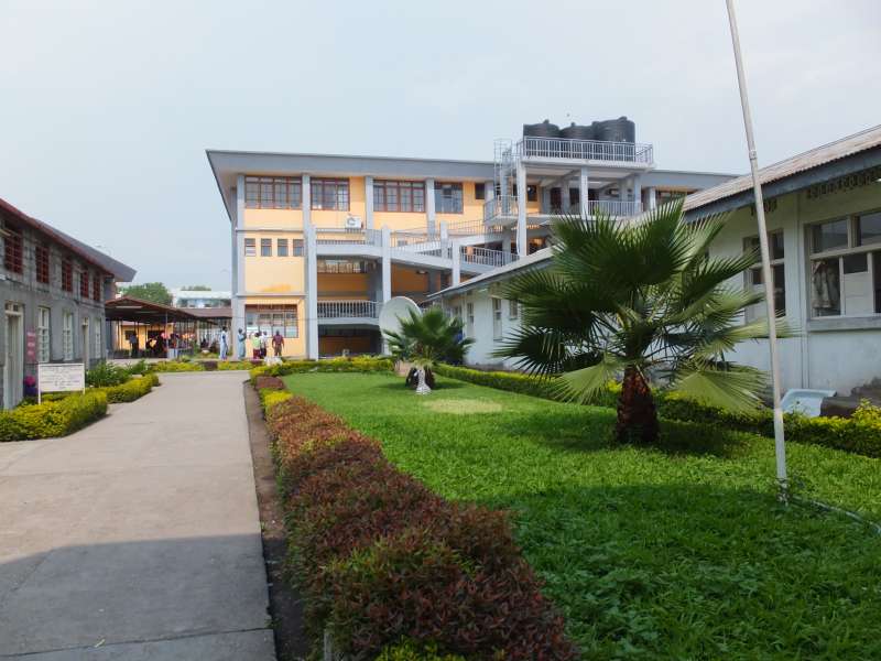
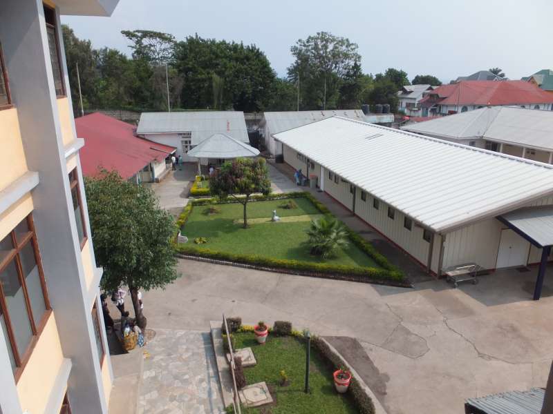
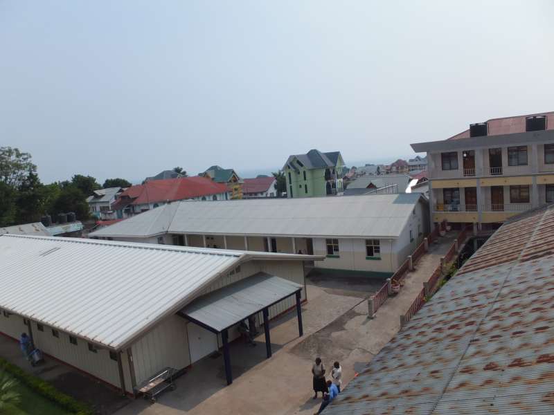
After breakfast in the hotel with some wonderful fruit salad we walked over to the nearby university campus, the ULPGL, where Georg works, and he showed us many of the rooms, including his office and the library. To me it is good to see that the students get a chance to receive good education, albeit limited here by a lack of infrastructure, like computers and internet connections.
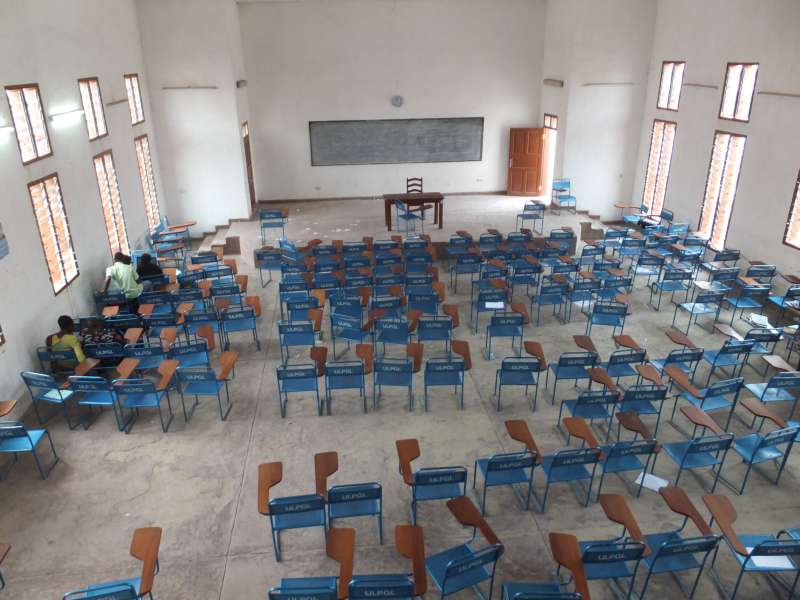
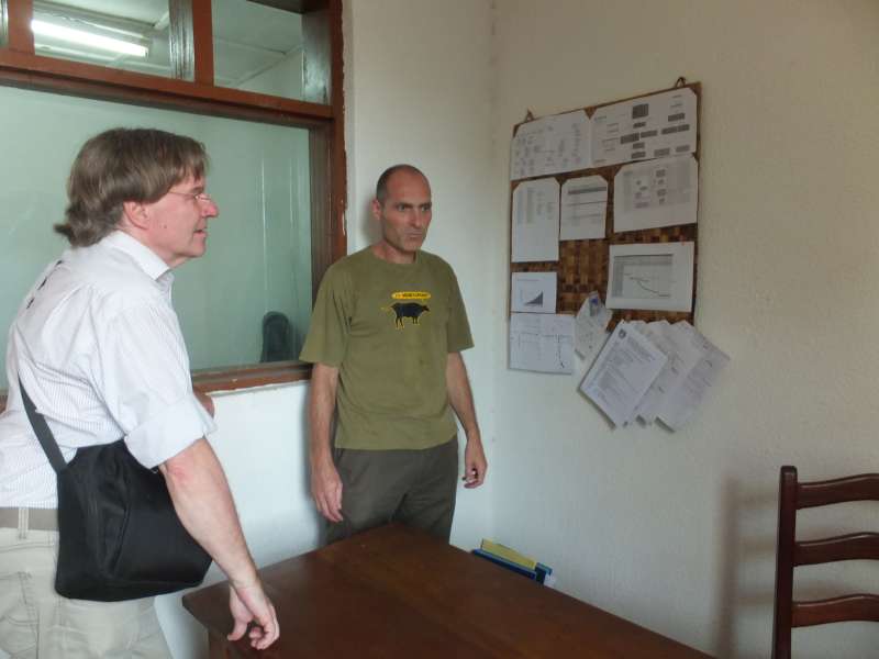

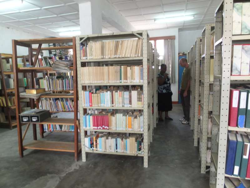
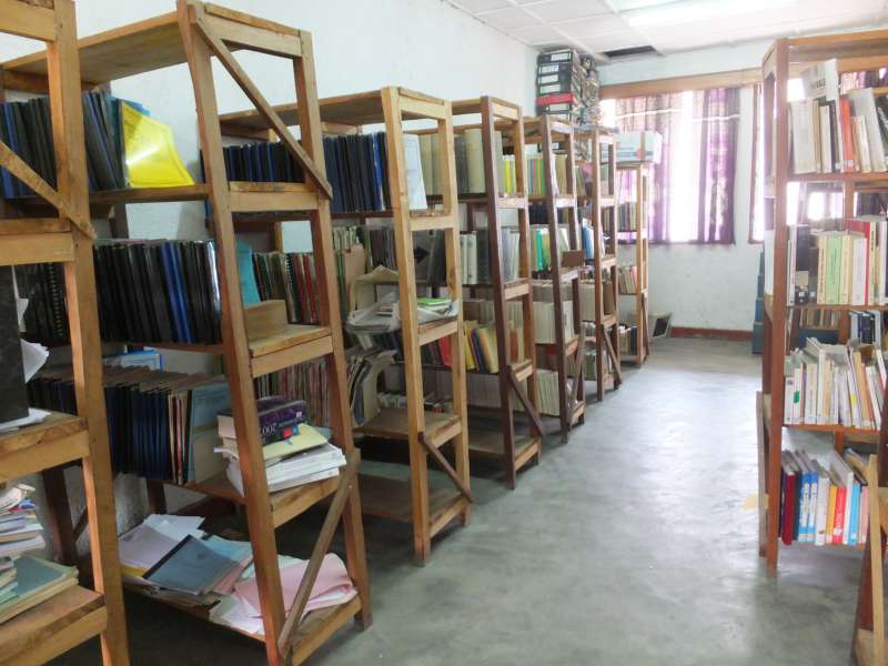
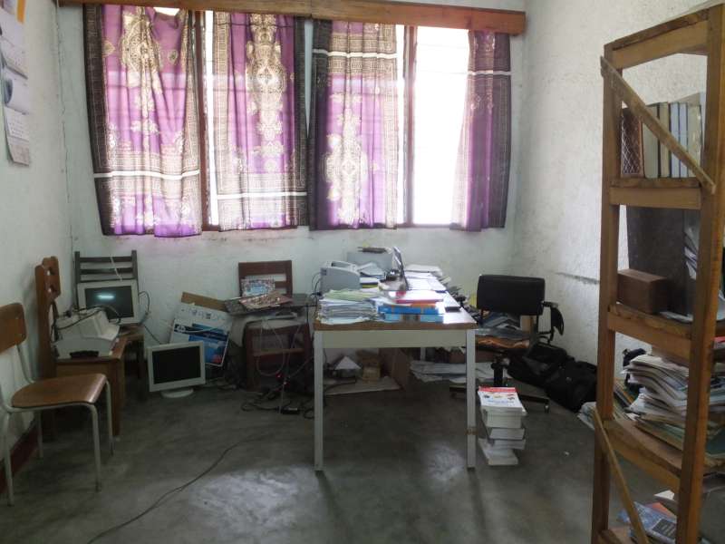
Goma University (ULPGL); Georg's office; the library
The buildings looked good to me, apart from some quality lapses on the floor and staircase surfaces. Certainly these buildings offer an environment suitable for teaching.
After seeing the university we walked back through the hotel compound and then towards the town to meet Judith. Mototaxis were quickly found, and we rode into the city to pay a visit to the aid organisation where she works.

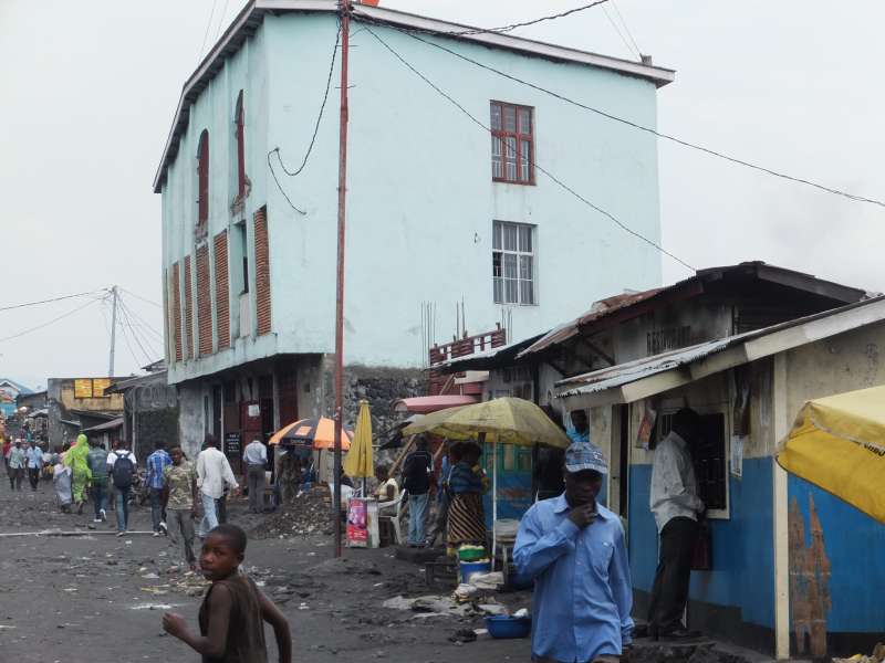
Views of Goma
Judith had already told us many things about her work, and now we could see it with our own eyes.


The compound of a local aid organisation
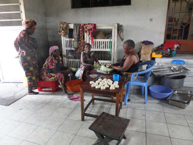
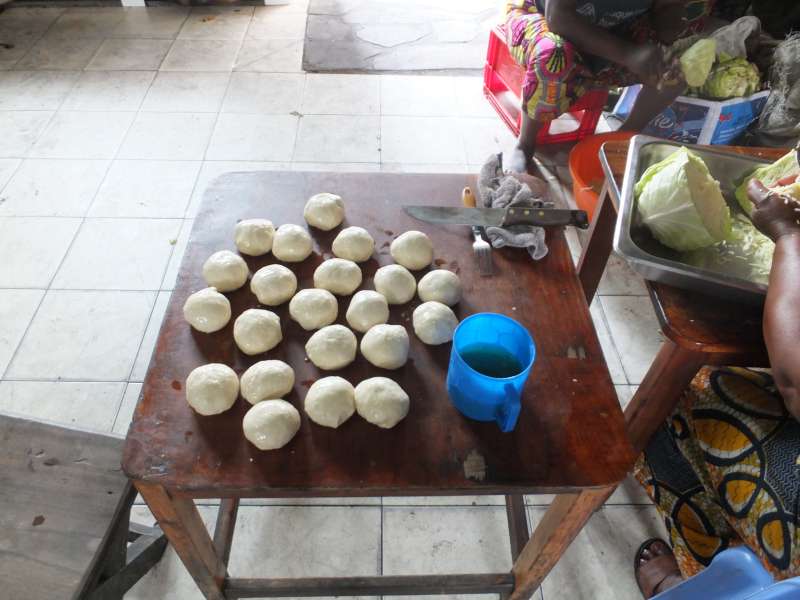
Some women work in a sewing workshop and try to sell their wares.

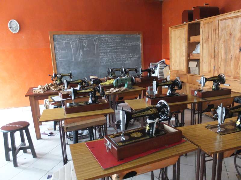
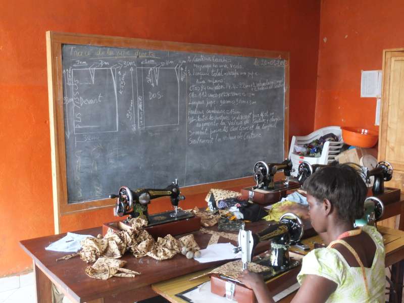
Sewing workshop
Finally we left and headed back.
We returned to our hotel and took showers to wash off the dust. Our hosts started a fire in the fireplace on their terrace and served us a nice dinner.
There were many little things, too many to describe, that made our visit worthwhile. What I can write here is only a crude attempt at conveying what life is like in Goma. If you really want to know it in detail, you have to go there and see and experience it for yourself.
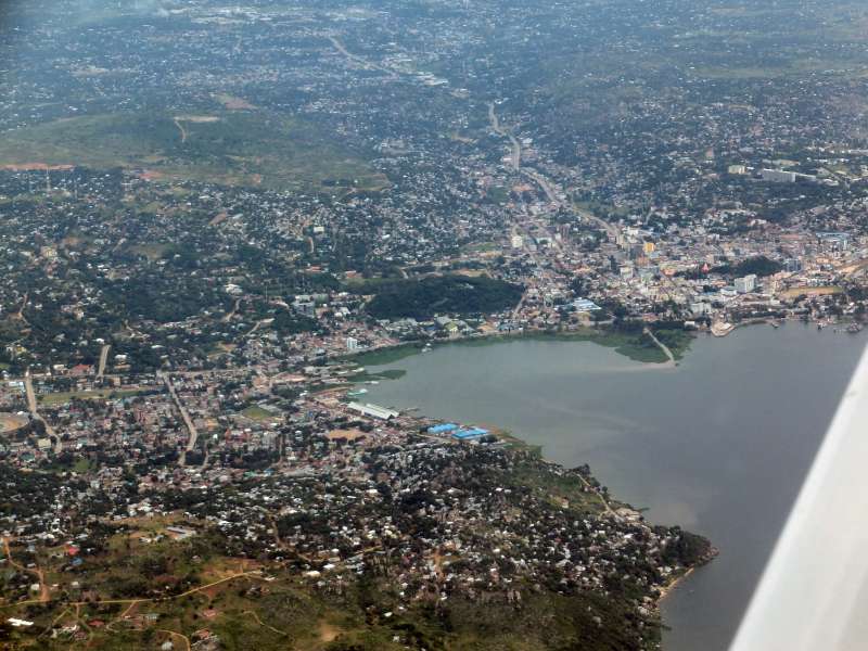
At sunrise we left our hotel and boarded the hotel bus, which the hotel had nicely offered to us, and were taken to the border. Judith and Georg came with us, because they wanted to help us get back into Gisenyi, Rwanda, and because we had promised them a small sightseeing flight before we leave. Since our visa were good only for one entry and exit to and from the Congo, the obvious solution was to do the flight just before we left.
View over Goma
Before crossing the Grande Barrière into Rwanda, we learned about another curiosity. Plastic bags are prohibited in Rwanda. When the customs people find one in your luggage, they confiscate and later destroy it.
When we had come into Rwanda the first time, our luggage was not inspected, so we were lucky that time. But now we emptied and removed all plastic bags and hid some of them in our luggage. But our bags were again not searched, so we kept our plastic bags again. While I agree that plastic bags have their problems, I thought that taking them away from travelers in transit is only another proof that the world is a madhouse.
We took off for our little sightseeing flight and flew along the shore of Lake Kivu for a while.
Takeoff for the sightseeing flight
The weather was still very hazy, so we could not see very far, but the view down from the plane of the country and the shore of Lake Kivu below was good. Georg steered the plane for a little while, so he got the feeling for what flying is like. We flew south along the Rwandan shore of Lake Kivu, then turned back and approached Gisenyi Airport over the lake, parallel to the shore.
Sightseeing flight along the Rwandan shore of Lake Kivu
Returning from the sightseeing flight
We had to say goodbye to our friends, and I felt that I would actually have liked to stay longer. But our friends have to do their jobs and cannot take time off forever, and our vacations are also limited, so after these very nice and interesting days we had to leave.
We loaded our luggage, that had stayed on the ground, into the plane, fired up the still warm engine once more, and took off.
Already before takeoff Gisenyi Tower handed us over to Goma Tower, from which we got our takeoff clearance. I think this is a very nice example of good cooperation across borders. Goma has a circular control zone that stretches deep into Rwanda. Since Goma has a lot more air traffic than Gisenyi, mostly United Nations and various aid NGOs, it makes sense that Goma controls all air traffic in the area.
The weather was still very hazy, and we could not see very far, but we did not have to use our route of last resort along the northern road to Kigali. We crossed the mountains, flying through a high valley and ended up doing a GPS-assisted approach to Kigali again, without seeing the airport.
Finally the airport popped up from the mist just to our right, and we turned sharply into the final approach to runway 28 (turning back into a western direction).
After landing we requested to taxi directly to the Akagera Aviation hangar, the company from which we had bought the 200 l barrel with aircraft fuel, and poured the rest into our tanks. Then we had to add some more, because we wanted to have full tanks for the long way back, although under ideal conditions we would need not much more than half-full tanks.
Unfortunately the procedure of refueling, going through customs and immigration and through the security checks, took much longer than we had hoped. We could take off only around 12:30 local time, so we could not expect to reach Nairobi before 17:30, since we also lose one hour to the time zone difference. This meant that we had only one hour of daylight reserve, which is about the minimum with which I would start on such a flight.
Finally we took off and slowly climbed up to clear the mountainous region in southeastern Rwanda. Then we descended to 7,500 ft to reduce the effect of the prevailing headwind.
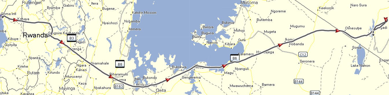
Gisenyi – Kigali – overflying Mwanza – Magadi
After a while we reached the southern shore of Lake Victoria again.


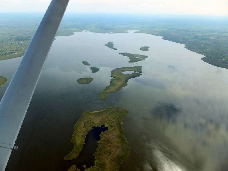

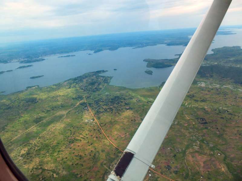
Flying along Lake Victoria
After not quite two hours we passed over Mwanza again and set course for Nairobi, all the time looking at the beautiful, currently green pastures of the Serengeti.
Mwanza; Mwanza airport
After Mwanza we kept flying along Lake Victoria.
On average, we flew at an altitude of about 1,000 m above the ground below us, i.e. the highlands of East Africa, particularly the Serengeti Plains.

Typical wildlife lodge; Serengeti Plains
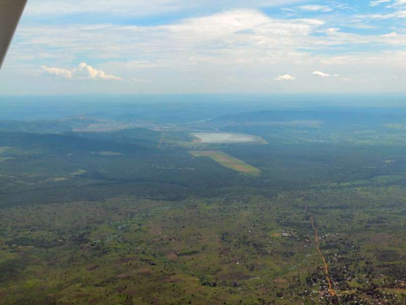
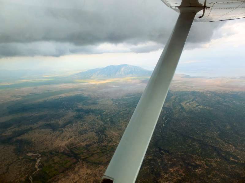
Eventually we reached Kenya and looked at a dark-grey wall of rain clouds to the north of us, i.e. on our left side. The weather got worse. We continued straight towards Nairobi, entered the Great Rift Valley and flew past Shompole airfield, which had a rain shower directly above. A short distance later we overflew Magadi, a place with a salt lake and a soda ash factory, one of the warmest places in Kenya.
The area controller had already talked to us, and I had told him that we were trying to reach Nairobi, but that we would land in Magadi if we could not make it. Deep in the Rift Valley we lost radio contact, as expected, and continued straight towards Nairobi.
I could see that a route along the Tanzanian border was sunny, and we could have tried to fly all around the bad weather, but with only one hour of daylight reserve that option was out of the question, particularly since there was no guarantee that we would be able to reach Nairobi that way.
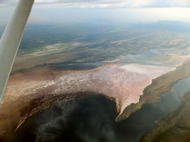
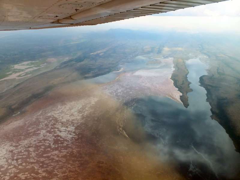
We overflew Magadi, which was our airfield of last resort, and saw a peculiar sand storm below, next to the airfield. But since we did not want to land there, we did not pay much attention.
Overflying Magadi in deteriorating weather
We just pressed on and flew into a gap between two dark-gray rain areas, but the situation only got worse and the visibility became even poorer. I would not even have flown that far, if I had not had the safe alternative of Magadi nearby. It became obvious that we could not reach Nairobi safely, and we turned back.
When we approached Magadi for the second time, we saw that most peculiar sand storm again, forming a long, rolling cloud. Meanwhile it had passed over the runway and was now on the other side. It would not concern us any more, but it looked truly peculiar.
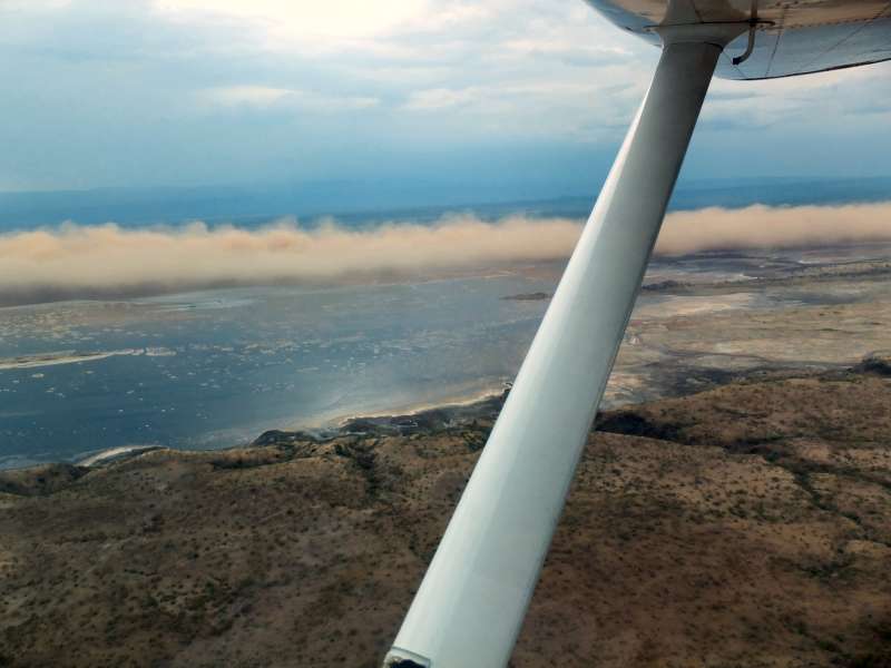

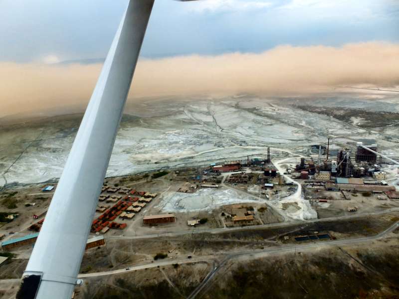
Magadi soda ash factory and sand storm
We flew over Magadi airstrip from north to south at low altitude and looked for any obstacles on the runway. Magadi has a long and wide gravel runway, which could be used with some special measures to avoid stone damage to the plane.
When I turned left for the final approach, I noticed that we were now drifting to the right, meaning that we had flown over the airfield in downwind direction, which would be very unsuitable for the landing. So I did a teardrop turn and approached Magadi again in the opposite direction, this time from the south.
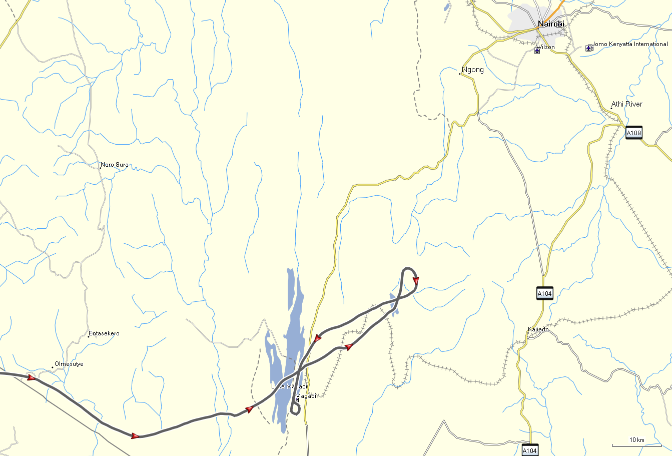
Our hapless entry into Kenya,
attempt to fly towards Nairobi,
and eventual return to Magadi
Landing on a gravel airfield in Africa usually means that I am looking for the best part of the field to land on. I use full landing flaps to reduce the speed as much as possible before touching down. Then, after touchdown, I immediately raise the landing flaps, to increase the load on the wheels, and brake. As the electrically operated flaps come up, I can brake harder and quickly reduce the speed to avoid stone damage.
As it turned out, the wind was quite strong and straight down the runway, so I could bring the plane to a halt in only about 100 m from the point of touchdown. Then we slowly rolled along the runway, looking for the best place to park.
As we secured the plane, another plane flew a very low pass over the runway, also in the wrong direction, similar to our first pass, and it looked as if they were attempting to land. But before actually touching down the pilot increased power and flew away.
I feared that this might be a student pilot in distress and worried about that plane, until I later met the pilot, who had eventually also landed in Magadi. It turned out to be an experienced flying instructor with a student pilot, so my worries were unfounded.
After we had secured our aeroplane, we pondered the question of how to get to Magadi town. From the air it looked close, but in fact, the airfield was several kilometers away from the town. We almost began to walk, when a car passed nearby and stopped. We asked them to take us to town, and they agreed and told us that walking would not have been a very good idea because it was quite far and because of hyaenas in the area.
Our helpers told us that there is a nice private club, the "Sports Club", in Magadi, and that they would help us to get a room, although we were not members.
And so it happened. In fact, we did not just get a room, but rather a complete house that was so big that I later had problems, while exploring the house's many rooms, finding our air-conditioned bedroom again.
Our helpers had promised to come back and drive us back from the house to the club restaurant, and so they did a short while later. We invited them for dinner, to which they reluctantly agreed, and chatted with them about Magadi and about Germany. When I later offered the driver a tip, he refused to take it. I made a mental note that, should I ever meet a person in need, I should help in a similar, totally selfless way.
In the restaurant we saw the pilot of the other plane that had meanwhile landed in Magadi too. He told me that he had tried to get back into Nairobi after his Magadi pass, but could not get through either. He was instrument-rated, so he could have flown through the clouds, but the aeroplane, a Cessna 172, was not instrument-equipped. There are certain rules for instrument flight. For example, several instruments, including the artificial horizon and the altimeter, need a redundant duplicate, in case one fails.
He also recommended that I report to the Magadi police station, because I was now violating the rules when coming from abroad and landing on an airfield without customs and immigration facilities. So we did, and the police officer wrote a brief report into his big book.
Again our helpers took us to the police station in their car, waited there, explained the case to the officer, and tried to negotiate a reasonable price for the security people, whom he recommended to call in to guard the aeroplane.
The security manager of the soda ash factory came and offered us the choice of three or four night guards for the aeroplane. Since no guard at all would have been our favorite choice (nobody steals aeroplanes here), we chose three, and later learned that the fourth was given to the other aeroplane, although both planes were parked next to each other on the airfield. Oh well!
We went to bed early and had a good night's sleep in our otherwise pretty much empty house.
When we woke up, it was already 8:30, only a half hour before the time when our helpers wanted to collect us and drive us back to the club restaurant. So we got up, packed our things, and just as we were finished and had moved our bags outside, the car came and took us back to the club, where we had a nice breakfast.
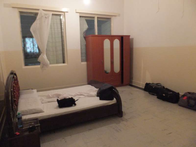
Our bedroom in Magadi
The pilot of the other plane was also there and called Wilson Tower for the current weather, which was still not good enough for a very easy flight to Nairobi. So we took our time with the breakfast and kept waiting for the sun.


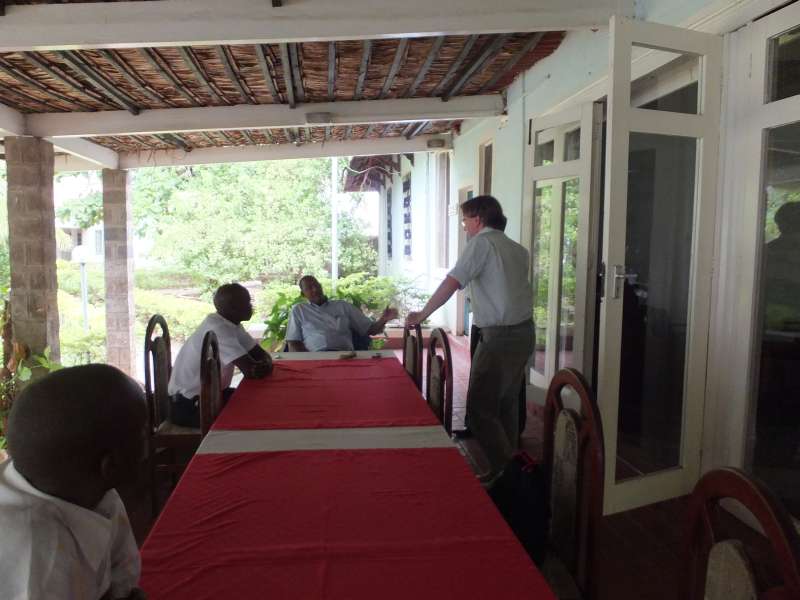
The club in Magadi; breakfast buffet; talking with the flying instructor and his
student
Eventually we got a good signal and were driven to the airfield. The other plane took off first.

Club; Magadi airfield; the other plane takes off first
We checked the plane and then also took off.
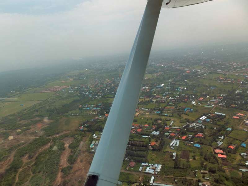
From the air the weather looked clearly better than yesterday, but it was still very hazy, just like in Rwanda. We were beginning to worry again, but kept on flying towards Nairobi with the assistance of our GPS-equipped smartphone and its excellent mapping software. It turned out that there was no problem, except for the haze, but we could simply ignore that and fly more or less by GPS straight into the Nairobi Control Zone and on to the approach to runway 07 on Wilson Airport.
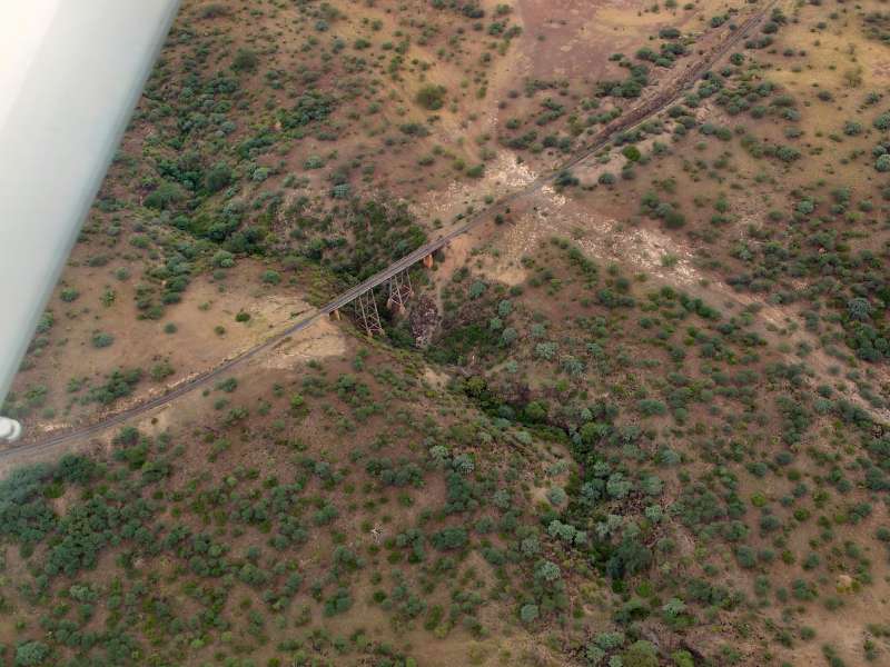

Flight from Magadi to Nairobi Wilson Airport; Magadi Road bridge; shopping mall;
building a road; race track
The landing was uneventful. Now we were worrying about customs and immigration, where we expected difficult questions because of our rule violation. As it turned out, however, the immigration officer was in an extraordinarily good mood and instead only wanted to show us the little duty-free shop, and there he particularly recommended the "Amarula" liquor. Then he returned to his office.
To be nice, we bought a bottle and took it back to him, which made him even happier. I was not sure whether this was already the entire procedure and asked him what we would have to do now. He said, we were free to go now, but we should still ask the officer on duty outside on the airfield. We did that and asked the young man, who did not want to inspect our airplane and also let us go. So that was much easier than we had expected.
We rolled back to the Aero Club of East Africa, handed the aeroplane over to the ground crew there, removed our luggage from the plane, and did all the officially required writing of the logbooks.
Office on Wilson Airport
Eventually, after a little lunch and a drive to the nearby Uchumi supermarket to plunder its ATM to pay for the plane, we got ready to go. We jumped into our car and drove off in the direction of Nakuru, which we hoped to reach before it got totally dark.
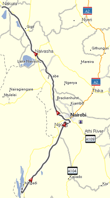
Lower part: flight from Magadi to Nairobi Wilson Airport.
Upper part: driving from Nairobi to Nakuru.
Leaving Nairobi is not easy these days, particularly not in the morning and afternoon rush hours, into which we had meanwhile slipped. We chose the middle way and drove out neither along the main road, which is almost always full of cars, nor the long way all around Nairobi on the southern and western side via Langata. Instead we used our old favorite, Ngong Road to Dagoretti Corner, then straight north towards the highway to Nakuru.
That did not help us much, because we still got stuck in traffic. It took us an hour to get out of Nairobi, but nowadays that counts as a good result.
After negotiating the potholes on the four-lane freeway-like road towards Nakuru, we drove happily across the highlands and continued on the now good two-lane highway to Nakuru, where we arrived not long after dark.
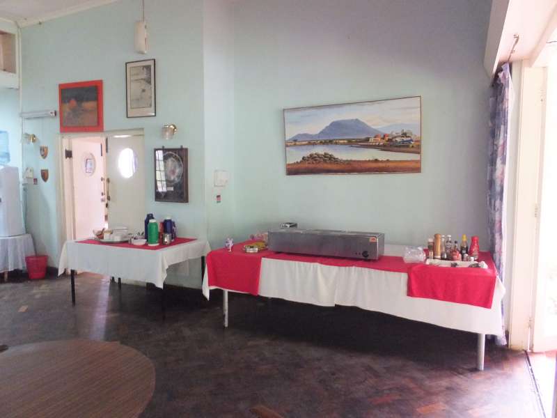
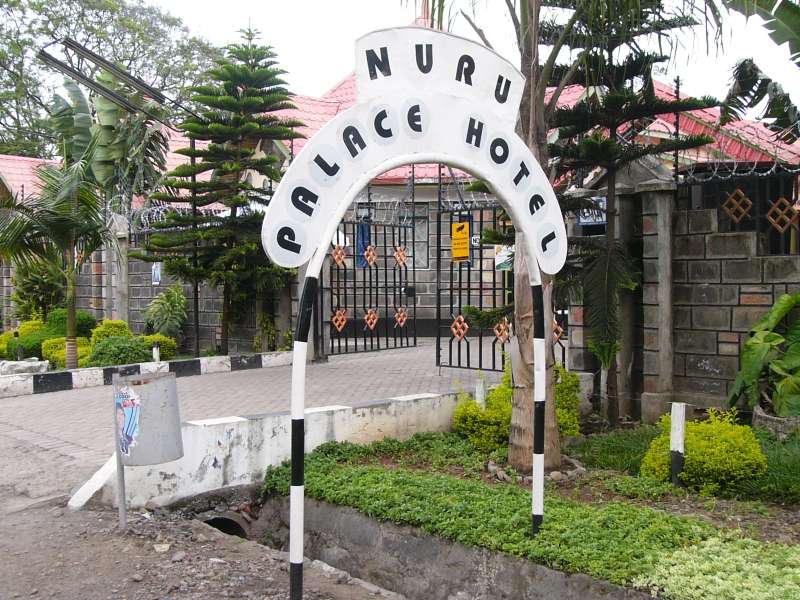
We had chosen the Nuru Palace Hotel again, which is cheap, good enough, and run by some fundamental Christians. Therefore they sell no alcoholic drinks, so no beer, no wine. I will not complain.
After we had dinner in the hotel restaurant our friend Sue arrived, and I swapped her smartphone, which had developed a tendency to stop working long before its battery was actually empty. We transferred the entire contents from her old phone to the new one I had brought, then chatted about some usage aspects of our phones. Finally we went to bed to be ready for an early-morning game drive around Lake Nakuru tomorrow.
We got up early, took a little breakfast in the restaurant, and drove down towards the lake.
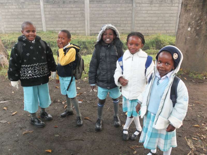
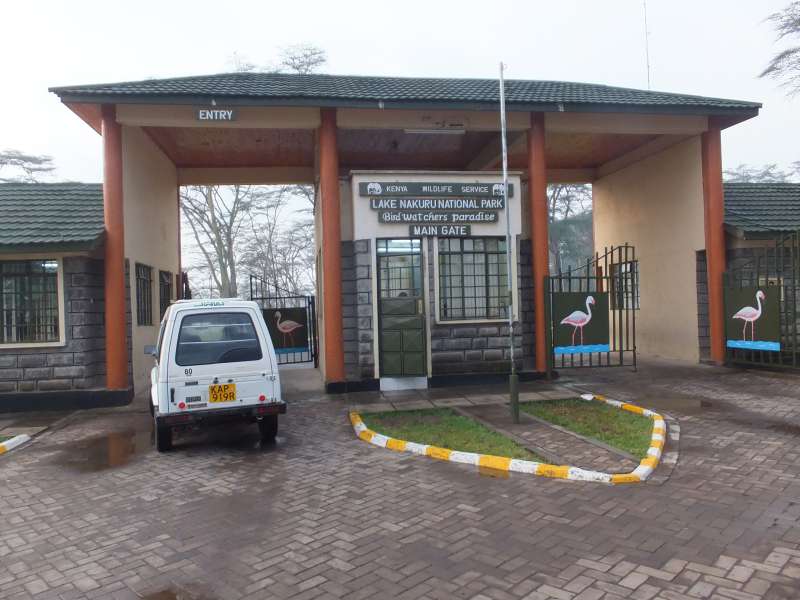
School children in Nakuru; Lake Nakuru National Park entrance
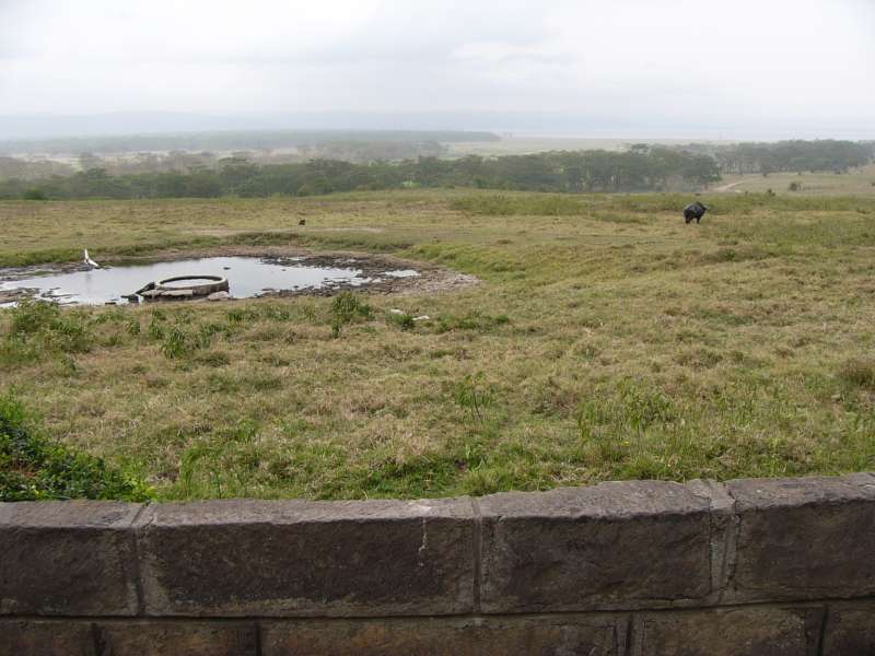
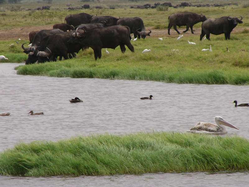
After paying the ever-rising entrance fee to Lake Nakuru National Park, we slowly drove along the lake shore, taking many photos of the incredible variety of waterbirds that live in and around the lake.
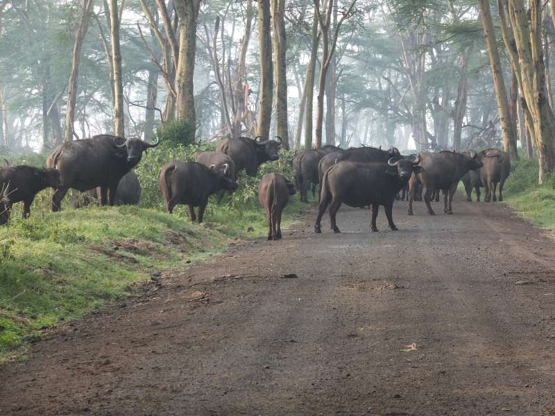
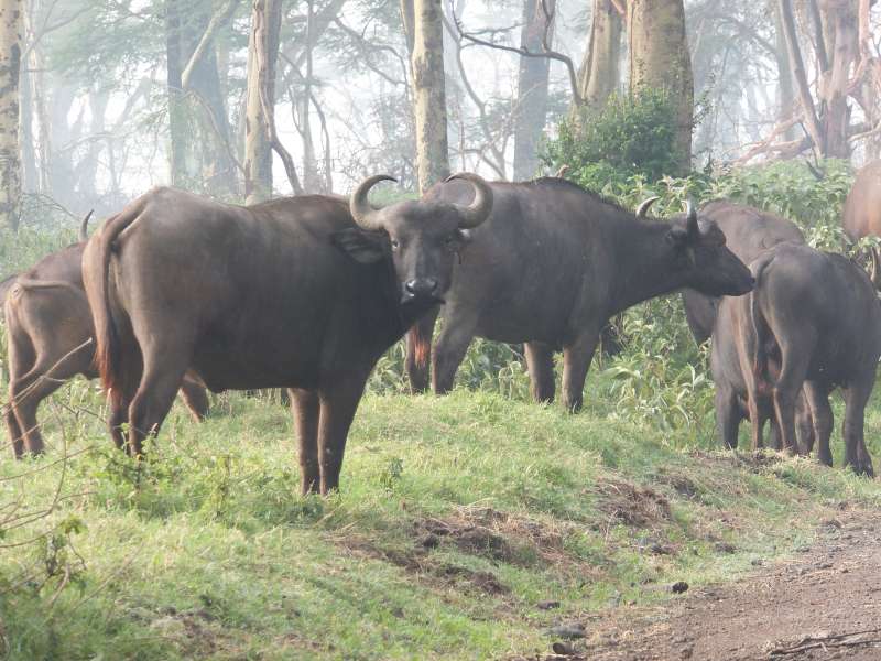
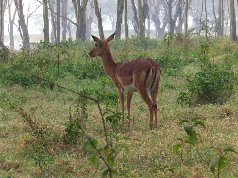
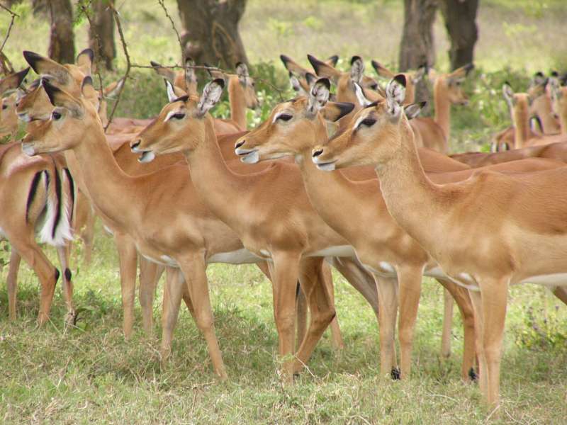
Buffalos blocking the road; Impala
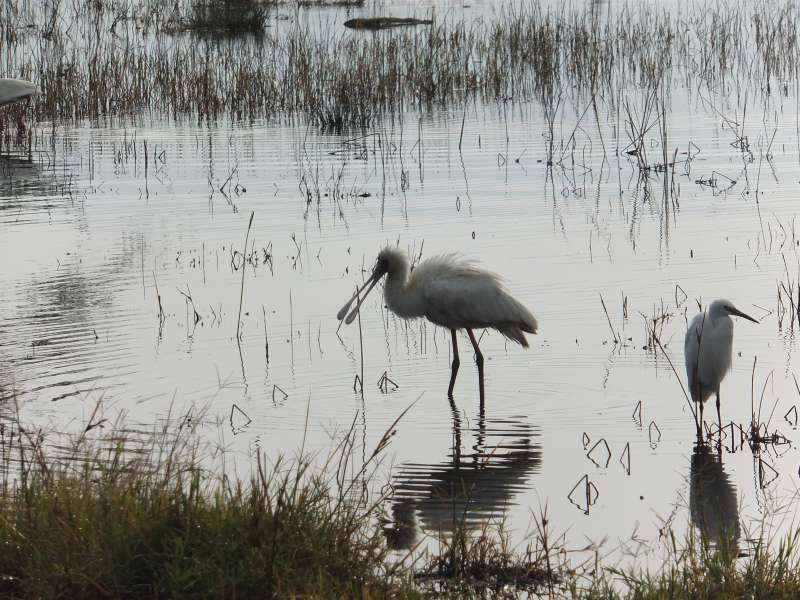
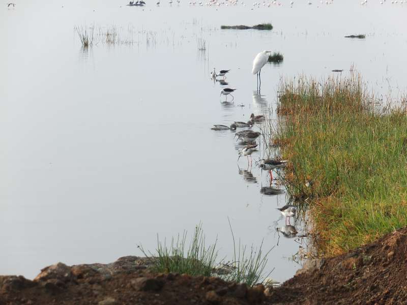

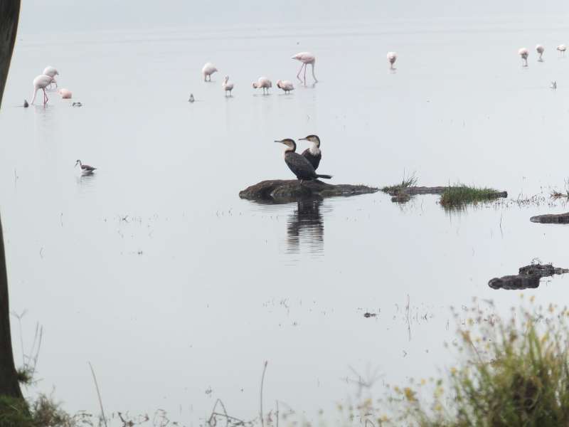
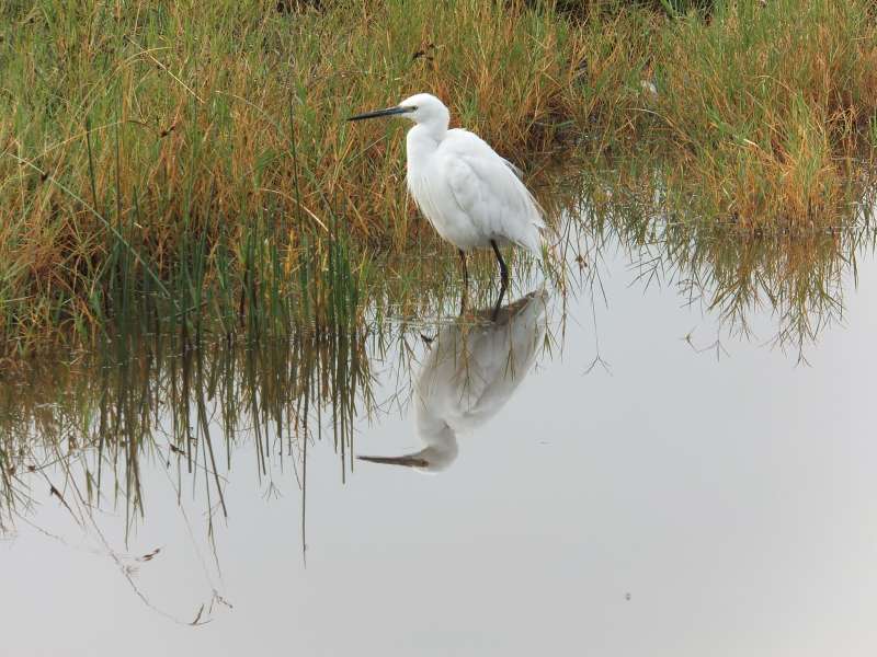
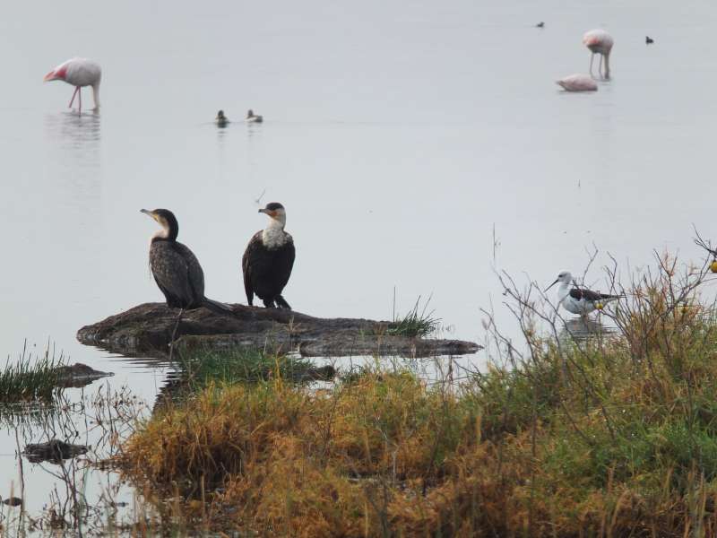
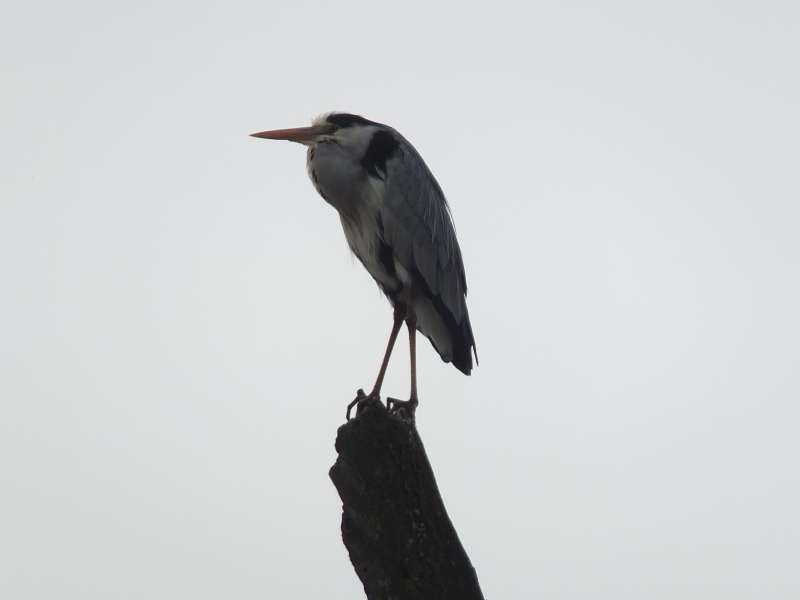

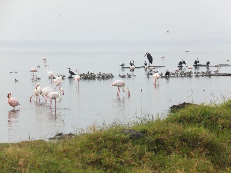
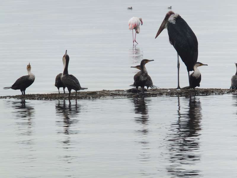
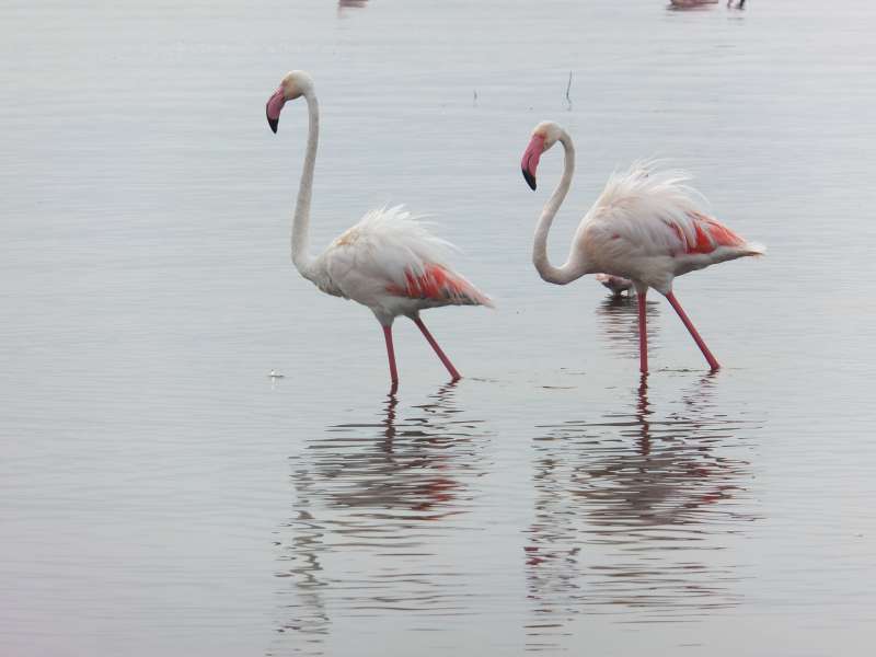
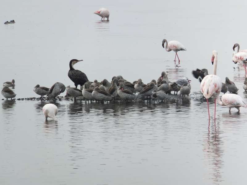
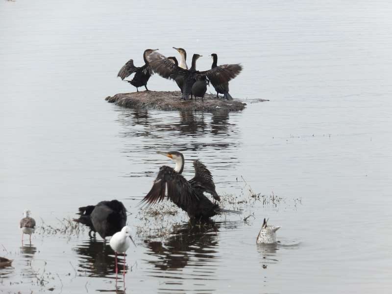

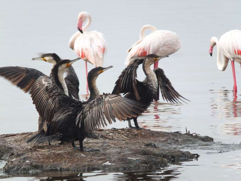
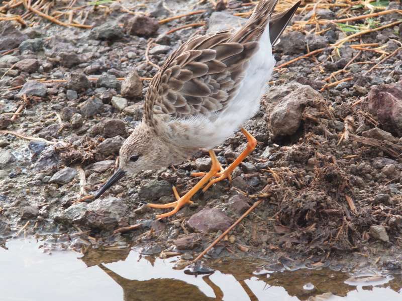

Lake Nakuru water birds
The water level was very high. Most tracks near the lake shore were flooded, and we had to drive a detour over a high ridge on the western side of the lake. At the lookout platform at the top we saw a family of rock hyrax warming up in the morning sun.


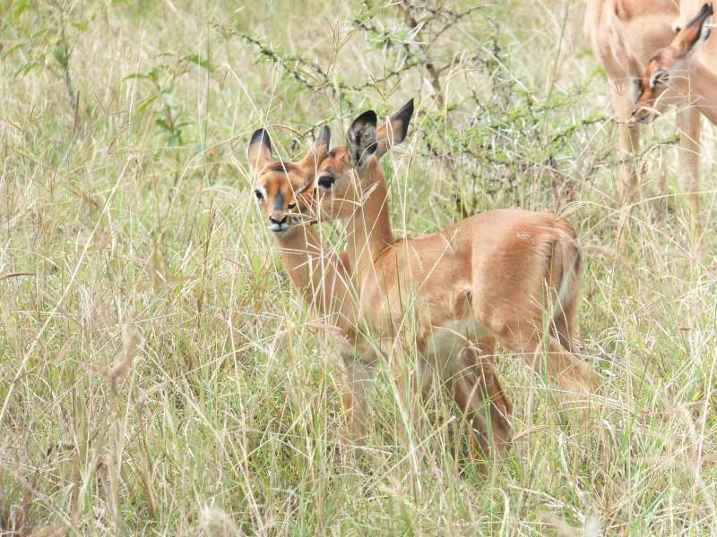
Zebra; rock hyrax; two Impala babies
We had first tried to drive along the lake shore, but the track was blocked, and we got stuck trying to negotiate a detour. A passing minibus pulled us back, which saved us a lot of work trying to free the car from an unexpectedly difficult position. I guess it might have taken us two hours to free the car on our own.
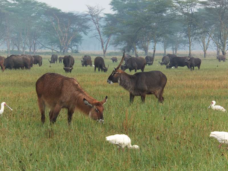
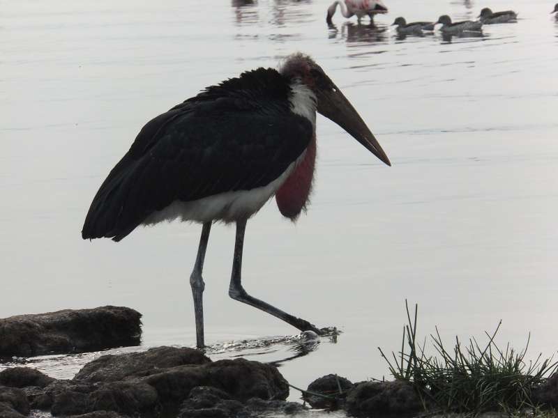
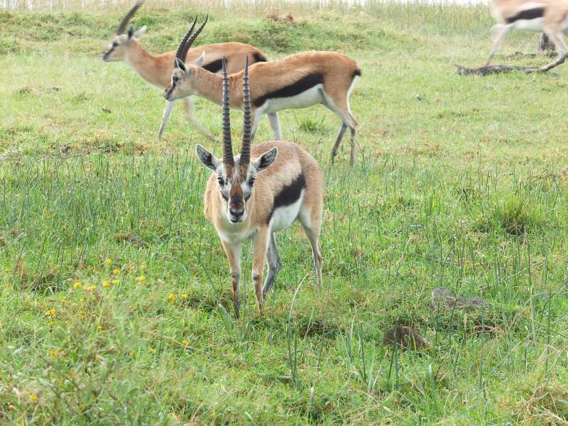
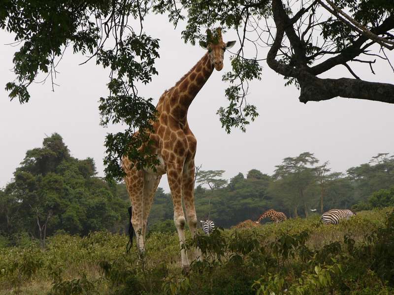
We drove through the entire park, up to Makalia Falls at the southern end. The falls had a lot of brown water, indicating that some soil was being carried downstream. On our way we saw very many buffalos, one group of Rothchild giraffes, gazelles and antelopes, warthogs, and many exotic birds, and also a large flock of white storks, which migrate here from Europe.
Makalia Falls also has a camp site, even with showers and toilets. We did not test though whether the showers actually worked.
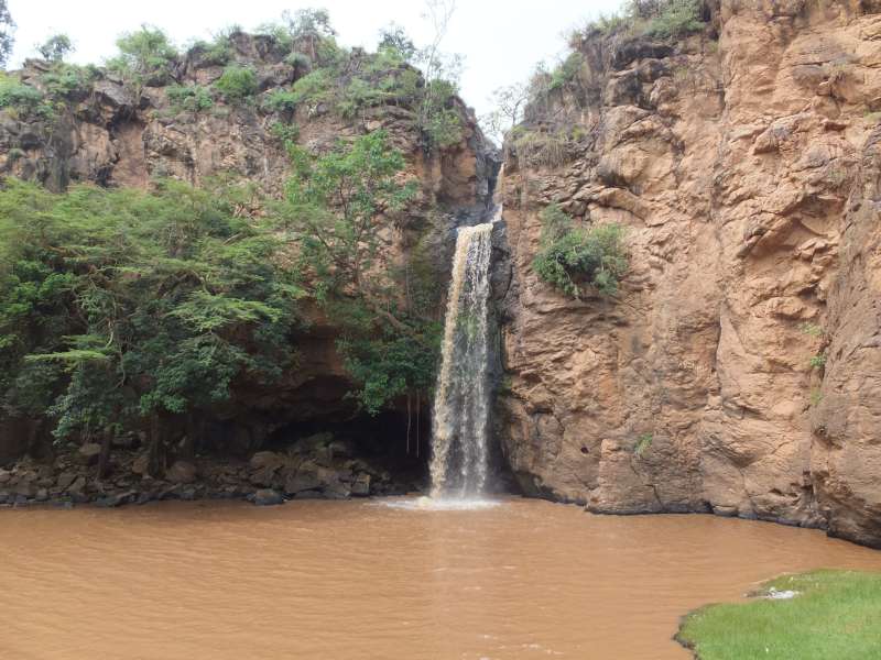
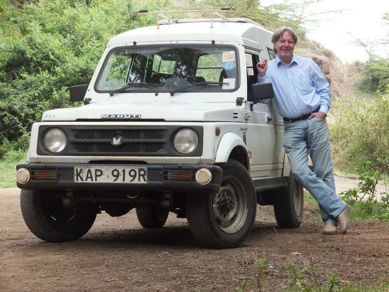
Makalia Falls; our car
We drove back on the eastern side.

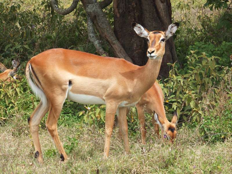
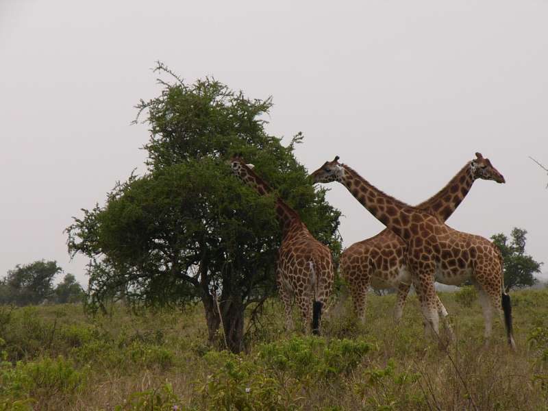
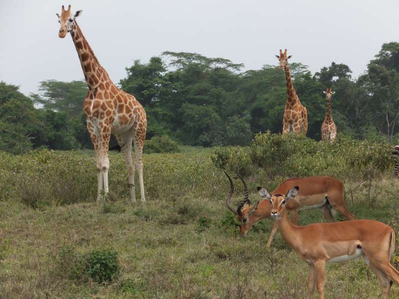
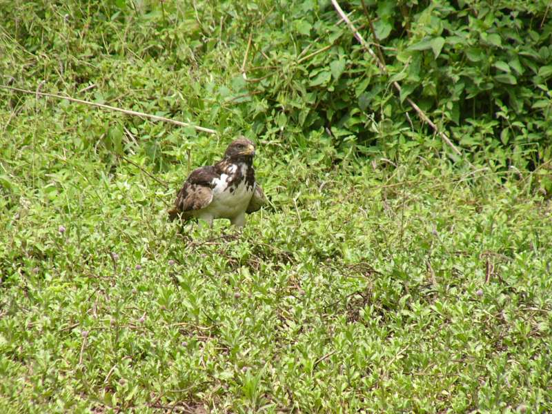
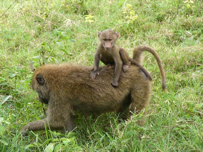
Rothschild giraffe; Impala; bird of prey; baboon
We reached Lake Nakuru Lodge at a good time for lunch. The food was good. The lodge now has two apparently separate restaurant operations, the one we knew from previous years, which offered a buffet, and another one in the garden, serving food from a menu for a much lower price.
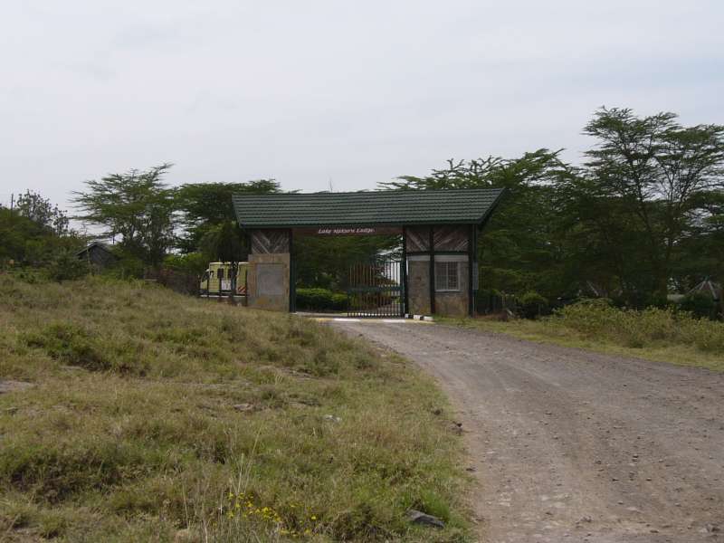
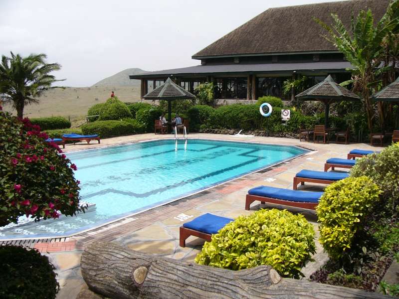

Lake Nakuru Lodge
Since the lake shore drives were flooded, and a river runs through the entire park, we had to go back all the way to Makalia Falls, if we wanted to stay on that side of the park. We used different tracks where we could, and saw many more animals, particularly buffalos, which blocked our way several times. Since buffalos are known to attack cars when threatened, one does not drive into a buffalo herd that does not give way. So it is either turning back and finding another way or moving forward in little advances while having the headlights on and the engine running, until the buffalos think they have wasted enough time and slowly move away.
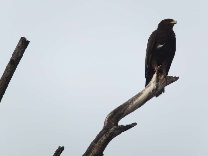
Apart from different eagle species we did not see any large predators. Lions are often well hidden, and our overall likelihood of seeing lions in the Lake Nakuru National Park is well below 50%, so this time was no surprise. I also do not remember ever having seen hyaenas here. Perhaps there are none.
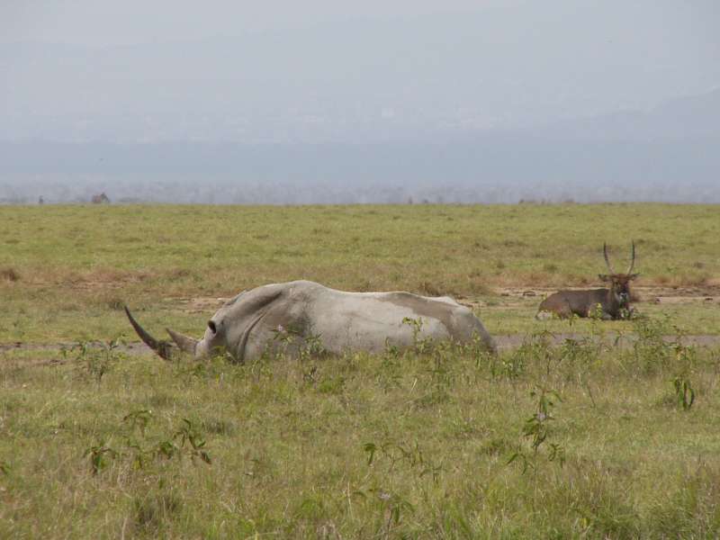
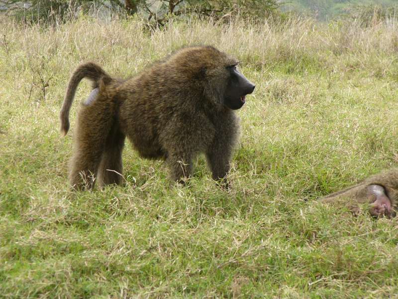
White rhino; buffalo; baboon mother with child; Impala
We continued to go back along the lake shore and reached the main gate about one hour before sunset and drove back to our hotel. I then continued to Sue's home for a last visit, and came back in time for dinner in the hotel restaurant.
![]()
Driving through Lake Nakuru National Park
Driving at night is a challenge, because there are many bicycles, almost always unlit, and many people everywhere, all of them totally convinced that I see them and will not bump into them, which may be a mistaken belief. But so far I have been able to avoid accidents by driving very slowly and carefully and by always looking in all directions.
Finally a day without too much time pressure! We could sleep long, have a leisurely breakfast in the hotel restaurant, and slowly get going towards Nairobi.
Nuru Palace Hotel entrance
The drive was easy and uneventful. The weather cleared up for the first time. We could look down into the Rift Valley from the road and actually see the satellite station, which had been totally obscured before by the prevailing haze.
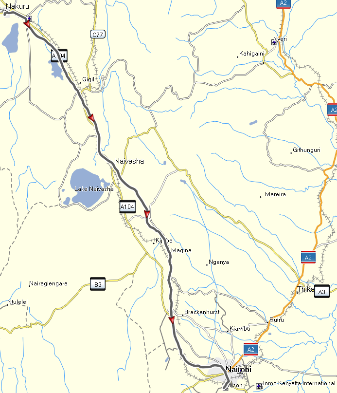
Driving back from Nakuru to Nairobi
We arrived in the Aero Club of East Africa in the early afternoon. I drove to Rasul's home to return our car and took a taxi back to the Aero Club. In the remaining time I tried to complete this travel report and ended the day with a nice dinner. We also checked into our flight via the Internet, changed our seat numbers, and printed our boarding cards.
We woke up before 5:00. The taxi we had ordered arrived well before the agreed time of 6:00, and we set off for the international airport before 6:00. As expected, more than 2 hours before the departure time of our Kenya Airways flight there was no line waiting, and we got through the security checks, customs and immigration very quickly.
Our Kenya Airways flight left on time.
Departure from Nairobi. Left: taxi ride to the airport. Right: takeoff and
climb.
We enjoyed the view of the river Nile in Egypt, the isle of Crete, and many other fascinating sights. When it was cloudy underneath, we watched some movies on the plane's entertainment system.
Our flight from Amsterdam was late to take off, but arrived in Munich in time due to a favorable tailwind. It seems that we were blessed with a favorable tailwind on all of our flights.
Goma has had a stressful recent history. On November 19, 2012 the M23 rebel group attacked and soon took Goma without a major fight. There was some initial resistance by UN and Congolese troops, but a few days later the Congolese army withdrew and left Goma to the rebels.
At that time the Goma prison was opened, and about 1,800 inmates were released, which has made the security situation in and around the city worse. People are afraid to leave their homes at night. Occasionally, gunshots can be heard at night.
On December 1, 2012, after receiving an offer of negotiation and presumably under influence from the Rwandan or Ugandan side, the M23 rebels left Goma, and the Congolese army returned. Throughout the occupation UN troops remained in Goma and acted within their mandate to protect the civilian population.
M23 has withdrawn only for a very short distance, parts of the group remaining just a few kilometers outside the city.
I know that some foreigners, who work in Goma, carry a bag with them from home to work and back that contains the most important necessities, needed in case of an unexpected rebel attack. They also carry their passports with them, so they can flee across the border to Gisenyi, Rwanda, without having to rush back home first.
The M23 group is made up of soldiers from a former rebel army that signed a peace deal with the government on March 23, 2009, and was integrated into Congo’s national army. But in the spring of 2012 hundreds of them mutinied, claiming that the government had failed to meet their demands under the 2009 agreement.
The figurehead of the group is believed to be Gen. Bosco Ntaganda, a former rebel and high-ranking army officer wanted by the International Criminal Court to answer charges that he committed war crimes and crimes against humanity.
The rebellion broke out as Congo and foreign governments called for the arrest of General Ntaganda. Since then, Rwanda and Uganda have been accused by a United Nations panel of experts of aiding the rebel movement, a charge that both countries deny.
Now, as of February 2013, the Congolese government is negotiating with M23 leaders in Kampala, Uganda, whose government is trying to mediate. The negotiations appear to be difficult and not nearing an end.
Approx. 2012-12
Liste non exhaustive des groupes armés opérationnels dans les provinces du Nord-Kivu et Sud-Kivu
I. GROUPES ARMES NATIONAUX AU NORD-KIVU ET AU SUD-KIVU
01) MAY MAY APCLS - Alliance des Patriotes pour un Congo Libre et Souverain, (Masisi, Walikale), Nord-Kivu, du Lieutenant-Général Janvier BUINGO Karairi
02) MAY MAY - FDC- Forces de défense congolaises, ex GUIDE (Walikale), Nord-Kivu, du colonel Luanda Butsi
03) MAY MAY-KIFUAFUA (Ufamandu) Sud-Kivu et (Ziralo), Nord-Kivu
04) MAY MAY-NDC- Nduma Defense du Congo, du colonel Sheka Ntabo Ntaberi, (Walikake), Nord-Kivu
05) MAY MAY-RAIA MUTOMBOKI (Shabunda et Mwenga), Sud-Kivu
06) MAY MAY KIRIKICHO, (Kalehe), Sud-Kivu, du colonel chef Kanyere Longangi
07) MAY-MAY SIMBA (Lubero) Nord-Kivu, du colonel Jean-Luc
08) MAY MAY SHETANI (Rutshuru, Chefferie de Bwito), Nord-Kivu, du colonel Shetani Muhima
09) MAY MAY JACKSON (Rutshuru et Lubero), Nord-Kivu, du colonel Paluku Jackson
10) UPCP/FPC - Union des Patriotes Congolais pour la Paix / Forces Populaires Congolaises, en sigle (ex PARECO), du Général de brigade Kakule Sikuli Vasaka alias Lafontaine, (Lubero), Nord-Kivu
11) M23 – Mouvement du 23 mars 2009 ex CNDP, (à Kitshanga) qui a fusionné avec l’ex PARECO-FAP, (à Ngungu, Masisi), l’ex PARECO-FODEPE (Masisi), l’ex PARECO-FORCE (Masisi), l’ex PARECO-MONGOL (Masisi), l’ex PARECO-NYEGANYEGA (Masisi), l’ex PARECO-RENGERA BUZIMA, (Masisi) tous ont adhéré au M23
12) PARECO-NYATURA (Masisi), Nord-Kivu
13) MAY MAY YAKUTUMBA (Fizi et Uvira), Sud-Kivu
14) MAY MAY FOLC - La Force œcuménique pour la libération du Congo, du colonel Bana Sultani Selly, alias "Kava wa Selly", alliée au M23 (Beni, dans la vallée du Semiliki), Nord-Kivu
15) MAY MAY MCC-Mouvement congolais pour le changement du colonel Bede Rusagara (Uvira), Sud-Kivu
16) ALEC - Alliance pour la libération de l’est du Congo, présidé d’abord par Akim Hakizimana Muhoza, puis par Tommy Tambwe résident au Rwanda; allié au MCC et au M23 (Uvira, plaine de la Ruzizi) Sus-Kivu
II. GROUPES ARMES ETRANGERS AU NORD-KIVU ET AU SUD-KIVU
1) FDLR - Forces démocratiques pour la Libération du Rwanda: Le colonel Pacifique Ntawhunguka, alias "Omega", reste à la tête du secteur du Nord-Kivu et le lieutenant-colonel Hamada Habimana a pris le commandement du Sud-Kivu. Chacun des six sous-secteurs des FDLR compte de 250 à 400 soldats
2) FDLR/FOCA - Forces démocratiques pour la Libération du Rwanda-Foca, (Walikake) Nord-Kivu
3) FDLR–RASTA -Forces démocratiques pour la Libération du Rwanda-Rasta, (Walikake et Masisi) Nord-Kivu
4) FDLR-RUDI -Forces démocratiques pour la Libération du Rwanda-Rudi, (Walikake, Masisi et Tshuru) Nord-Kivu
5) ADF-NALU (Ouganda) basé dans les montagnes de Beni (Ruwenzori)
6) FPM-Front du peuple murundi, groupe burundais, Sud-Kivu
7) FNL-Forces nationales de libération, burundais au Sud-Kivu
8) FDA-Forces démocratiques alliées sous le contrôle de l’Ouganda, en coopération avec le groupe terroriste Al-Chabab en Afrique de l’Est, (Beni) Nord-Kivu
9) FPM-ADN-Front du Peuple Murundi – Alliance divine pour la nation, burundais au Sud-Kivu
III. GROUPES ARMES EN PROVINCE ORIENTALE
1) FRPI-Les Forces de résistance patriotiques en Ituri, du général de brigade Justin Banaloki, alias "Cobra Matata", constituent le groupe rebelle le plus fort de l’Ituri, province Orientale
2) COGAI-Coalition des groupes armés de l’Ituri, créée en mai 2012, présidé par Justin Banaloki, alias "Cobra Matata" (province Orientale, district de l’Ituri)
3) MRPC-Mouvement de résistance populaire du Congo, allié du M23, créé en août 2012 par des membres de l’ethnie hema, du lieutenant-colonel Rutsholi, (province Orientale, district de l’Ituri)
4) UPC-Union des patriotes congolais, (province Orientale, district de l’Ituri)
5) MAY MAY MORGAN, du major Morgan, (province Orientale, territoire de Mambassa, district de l’Ituri)
IV. GROUPE ARME EN PROVINCE DU KASAI ORIENTAL
1) MRE-Mouvement pour la revendication des élections, du colonel John Tshibangu, province du Kasai Oriental
If in this text you find any typos, orthographic errors (even small ones), ungrammatical sentences, wrong or illogical information (like wrong names of birds), if you want me to write more details about something in particular, or if you want one of the photos in full resolution (usually 1,600 x 1,200 pixels), please click on the email sign below and write to me. Many thanks!
Copyright © 2013-2023 Hans-Georg Michna.
Private homepage – Hans-Georg Michna
Kenya travel reports: 1999, 2000, 2002, 2003, 2004, 2005, 2006, 2007, 2008, 2009, 2010, 2011, 2012, 2013-Goma, 2013, 2014, 2015, 2016, 2017, 2018, 2019
Kenya Safari Travel Plan, Kenya 1980-2000 photos

hits since 2013-01-15
Free PHP scripts by PHPJunkYard.com